
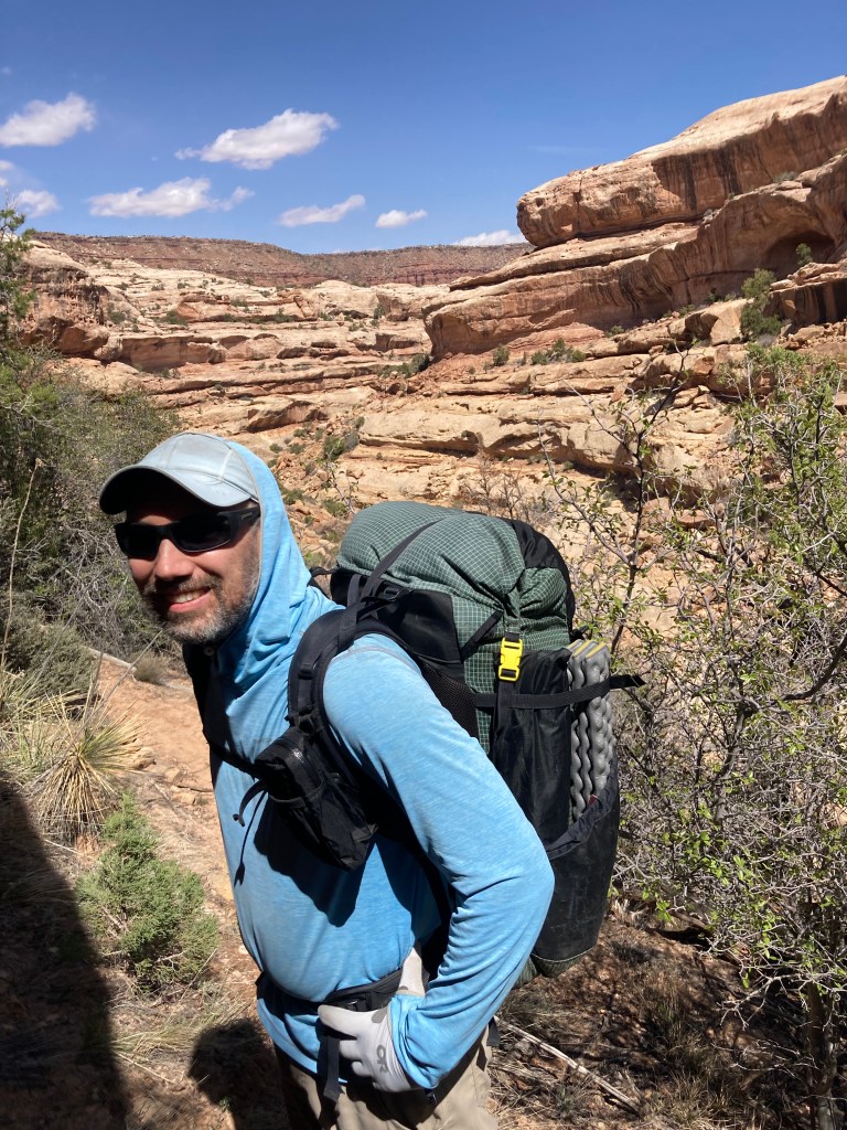
I clung to a protruding rock outcropping blocking my passage along a narrow ledge on the lip of a cliff over a deep canyon. I stood pinned to the rock wall, my back to the cliff. With my left foot I kicked away some gravel on the ledge, hoping to improve my future stability—one less thing to disrupt traction, I thought. I watched the rubble tumble down into the abyss. I could not hear it reach the ground. To pass, I needed to plant my left foot on the other side of the outcropping, push off with my right foot to swing myself around it, counterintuitively leaning out to the cliff with my heavy backpack behind me, before reweighting on my left foot and returning to the safety of the wall without ricocheting off it. I felt around desperately for a handhold, but the outcropping did not oblige. Spreading my hands on the rock gave me some friction, but not enough to alone hold me. Technically, this obstruction was not difficult to pass. I must have made similar moves on other parts of the trail without thought many times. The difference this time was the cliff—so steep, I could not see the bottom. Intellectually, I realized this was not as dangerous as it felt. I gave myself better odds than surviving a car trip on I-95 from Washington to Philadelphia. Yet that drop was so visible . . . Also, I had a backpack laden with five days of food and sufficient heavy water for a desert trek. I wanted to make sure the unusual weight did not handicap me. I did not know it at the time, but Jen (Shuttle) was having a similar experience in a nearby canyon.
Andrew (Camel) and Logan patiently waited for me on the ledge on the other side. They completed the maneuver with much less deliberation. Because my Spider-Man senses lets me read minds (other’s thoughts are visible to me in text boxes over their heads), I could read Logan’s thoughts. (My trail name is “Spider-Man”). His text box read sarcastically: “Wow, this is one lame Spider-Man . . . How did he pull that trail name? Was ‘Timid Chicken’ taken?”
I ignored Logan’s thoughts and steeled myself. Without looking down, I put my weight on my left foot, palmed the protrusion like a basketball, and pushing with my right foot I swung.
# # #
We never intended to be on that ledge. When Camel posted his then-next epic trek to southern Utah, he advertised the narrow slot canyon of Paria. I expected danger of flash flooding, not falling into a canyon. We could mitigate the flood danger by checking watershed weather reports to confirm 0% chances of rain. Unfortunately, Camel lost the permit lottery for Paria and proposed a “Plan B” trek through the Escalente National Monument. Similar to Paria, this backup plan had us walking through a canyon, sloshing back and forth across the ankle-deep Escalente River. Eight of us DCULers eagerly approved the new plan and bought plane tickets to Las Vegas.
Most DCUL adventures are fully charted in advance. For example, for the upcoming Standing Stone Trail hike in central Pennsylvania, Kyle (Water Dog) posted a complete .gps map with the route in bold color and pinpoints for camping spots and water opportunities. However, for this Utah trip, across the US in the desert for a 10-day trek, Camel’s plan was “we’ll hike somewhere in the Escalente Monument—I’ve got some ideas, but it will depend on the weather.” Knowing Camel frequently hikes in southern Utah, I accepted his reason for the flexible itinerary. I purchased a map of the Escalente area and started reading about it on the internet. Most backpacking routes there followed “washes,” which are dried riverbeds left over from ancient rivers or more recent flash floods. When I asked about us hiking in the nearby mountains, Camel replied that his plan was to avoid them so as to have no issues with snow or ice on this early Spring trip. So, I prepared for canyon-bottom walks with frequent water crossings when we came to the Escalente River. Camel told us to prepare for constantly wet feet in cold water along that river. However, he promised quick drying in the arid desert.
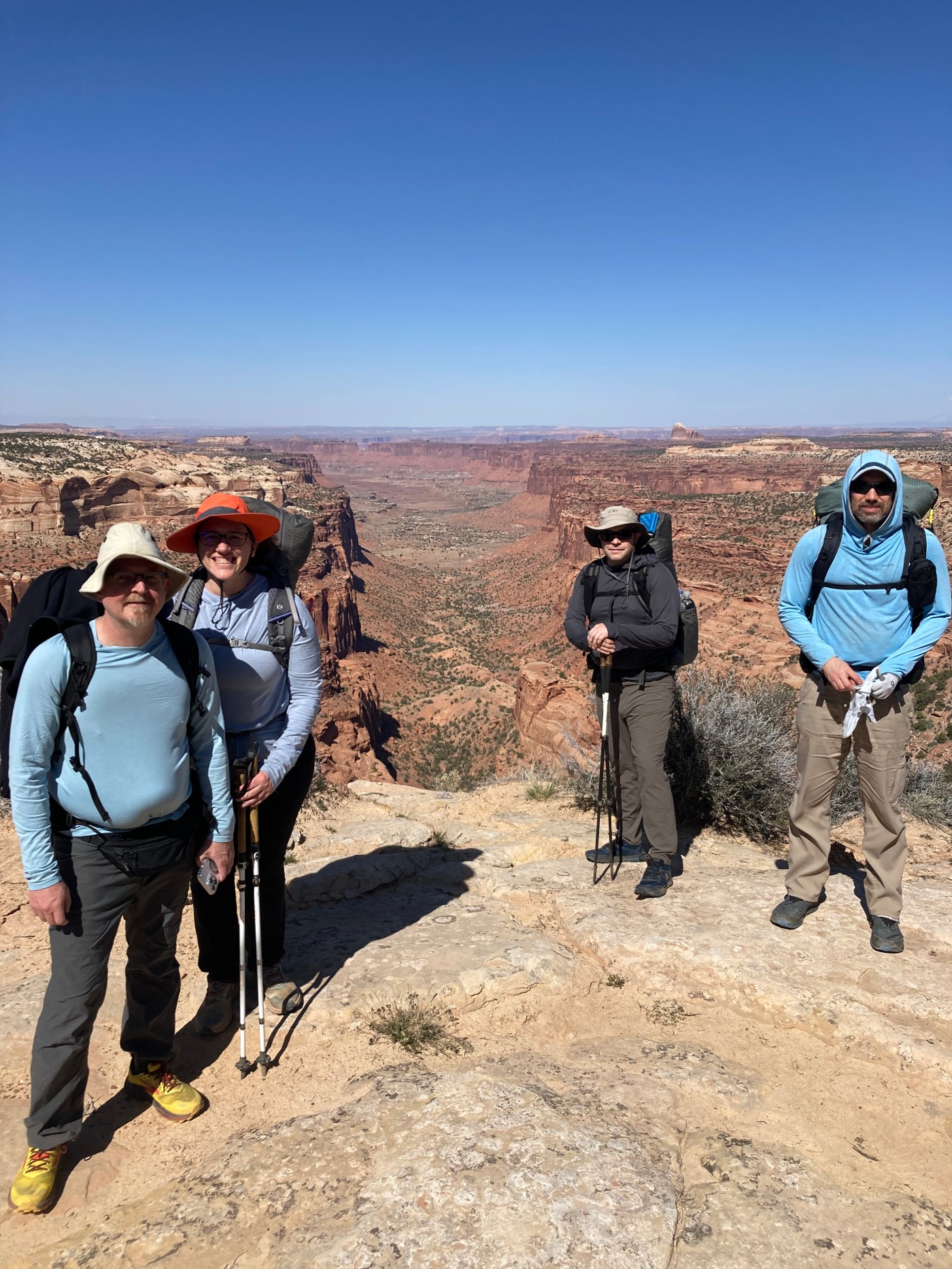
Camel, Logan, Michael (U-Turn), Shuttle, and I met in the car rental area of the Las Vegas airport on Saturday to begin our adventure. Steve (Baconator) had to drop off due to a late season ski injury. Yuna fell sick. And, Chris suffered an unexpected business travel assignment. So, only five of us were on the trip.
We hit an annoying delay when the car rental company overbooked themselves. Re-enacting an old Seinfeld episode, Logan learned how valueless a car reservation is. Fortunately, U-Turn, a bona fide road warrior, snapped into action. With a quick call to “his people,” he secured one of the last vehicles in Vegas from a different agency. I enjoyed watching him, a native Texan, adopt a Brooklyn gangster accent to say, slowly, to the clerk, “Yo! I need a car. It would be very irresponsible for you to disappoint me, capiche?” (Actually, he merely called American Express, asked for help, and they were very nice and helpful. My version is funnier, though. I wish it had happened that way). Soon, we were on the road in two cars screaming down the desert highway on our way to Escalente.
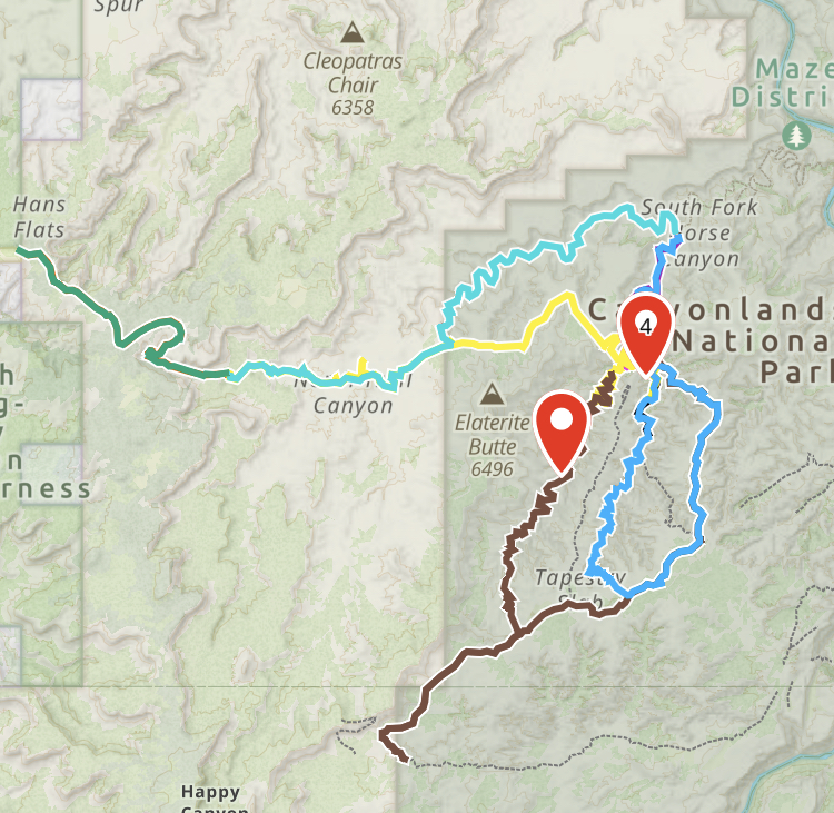
After entering Arizona, we stopped to camp for the night in some BLM land off the highway. We made camp in the short trees and sand. U-Turn and Jen “cowboy camped”—slept under the stars—while the rest of us pitched tents. Waking the next morning on Sunday, Camel proposed a change of plans. He expressed concern about an incoming cold front and the water level at Escalente. Waist-deep water crossings in freezing water with air temperatures in the low 50s could be unpleasant. He proposed going to Canyonland N.P. to backpack in the “Maze.”

Hiking through a maze certainly sounded intriguing. However, this change would result in a total of 8 hours of driving each way from and to Vegas. Yuck! It would also require a bone-crushing drive up a long dirt road to the park. Double yuck! On the plus side, Camel said the Maze was extraordinary. Oh, and he also said, we would not need to use “wag bags” in the Maze. Wait, what??? Well, ok! Where do I sign?
When Camel first told me our trip to Escalente mandated the use of wag bags, my first reaction was, “what is that?” He replied that it was for us to carry our turds. I regularly hike with—and carry—my own TRDD (“Tactical Rain Deflection Device,” pronounced “turd,” which looks like an umbrella—for a fuller explanation, see the Doing a Chicago Trip Report). So, I was unconcerned. I always carry my own TRDD. When he clarified, politely, that it was to curb waste—feces—I remained unconcerned. After all, as I told Camel, I had no intention of bringing a dog and would not need a wagbag. Exasperated, he clarified that the wag bags would be for us to contain and carry out our waste . . . well, heh heh, let me think about that . . .
Wag bags are the newest extension of the “leave no trace” environmental movement for backcountry recreation. Digging a cat hole to bury waste on the trail always seemed logical to me. However, I understand that even in remote areas adventurers overwhelm nature. So, in response, authorities increasingly mandate backpackers to pack out their waste. This is the antithesis of “ultra-light” backpacking, though. To use a wag bag, one must bring the empty wag bags, which are not super light, and—ahem—fill them and carry them out. (How many bags would I need to bring? One for every day, just in case? Less?)
Naturally, upon learning that I did not have to be an old dog learning a new wag trick if we changed up our plan and went to the Maze, I immediately embraced the new itinerary. We were soon back on the road to our new destination.
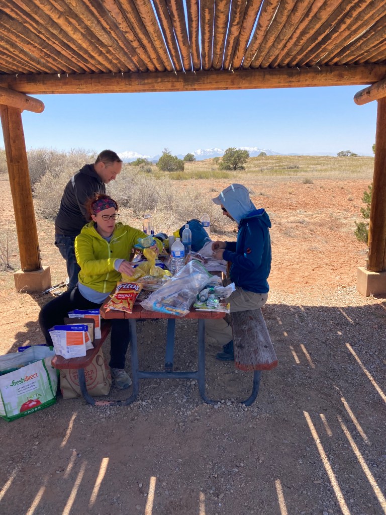
We arrived at the Maze district Ranger Station in the late afternoon, pulled permits, and repacked our packs for the new itinerary. Due to the heavy food and water we had to carry, we dropped gear with abandon. Wag bags? Out! Extra tortillas? Out! That small flask of single malt Scotch? Sadly, out! We hefted our ultra-heavy packs and began our hike to the Maze.
Camel’s plan was to hike to the Maze itself—a canyon walk that would take almost a day. Then, we would dip into the maze, find our way to the other side, pop out and return to the other side through a different path in the maze, continuing back and forth. All the paths are canyons with frequent intersecting canyons, most of which led to dead ends. As the name accurately suggests, it is a maze.
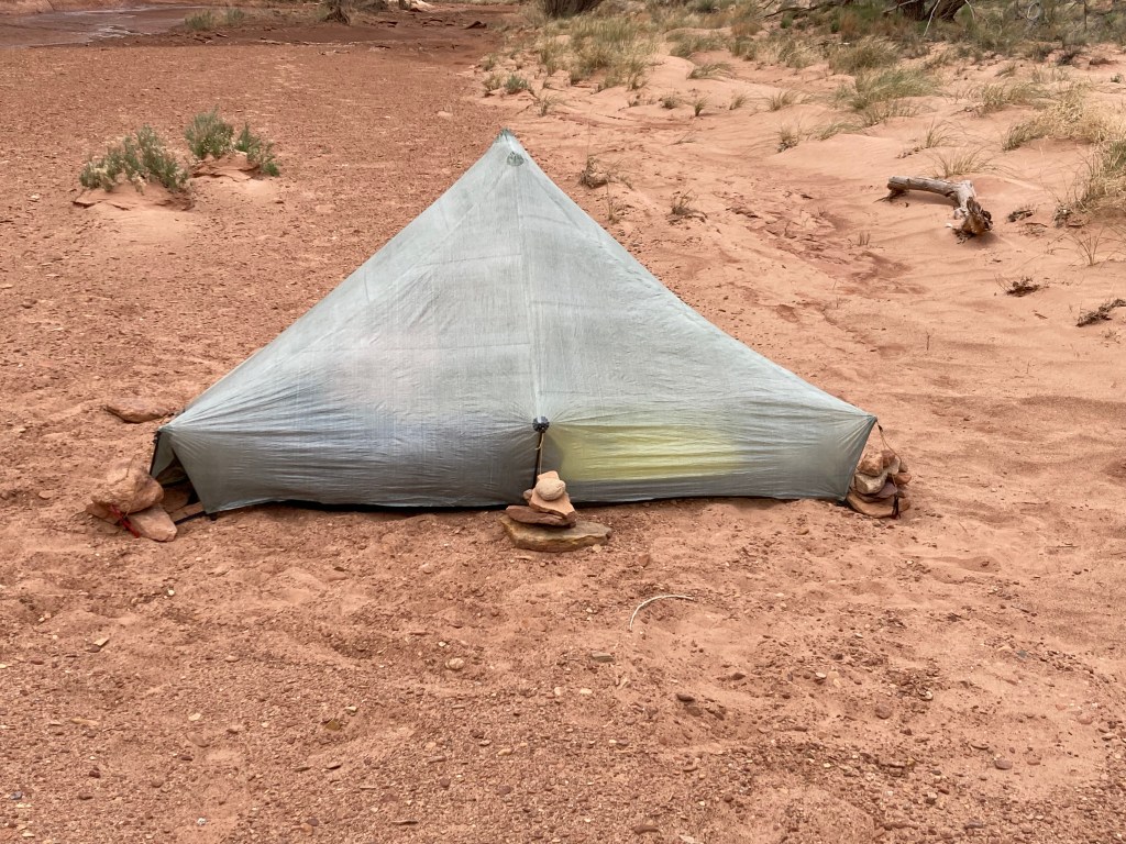
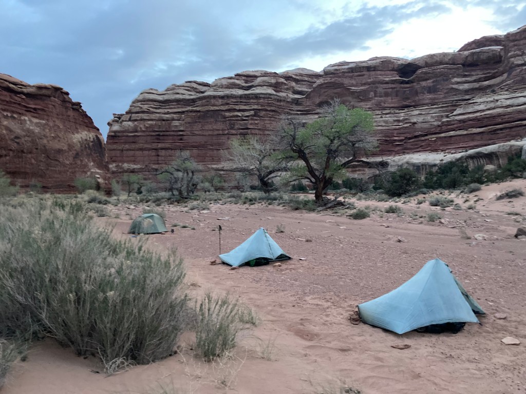
On our way to the Maze, we hiked down a steep canyon and spent the night on a flat rock shelf overlooking the remainder of the canyon. U-Turn and Shuttle again set out nests for cowboy camping. This time Logan followed suit. Camel and I set up our tents using heavy rocks to stake them out. U-Turn teased me for the saggy pitch of my tent—it is hard to get good tension with rocks as stakes. I let him know I did not appreciate the “tent shaming.”
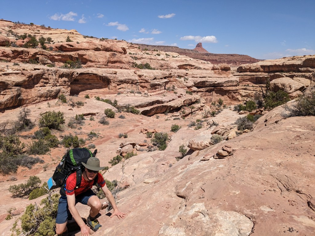
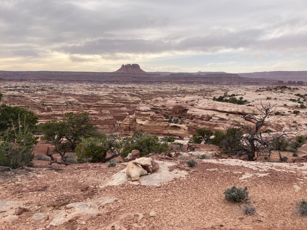
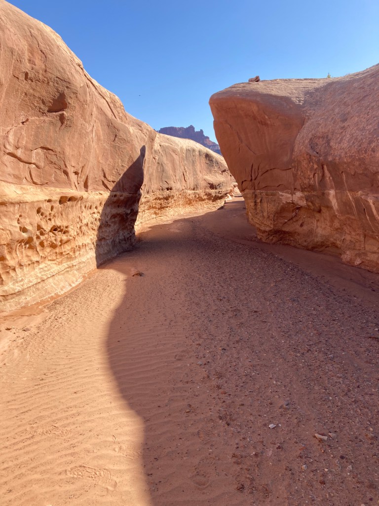
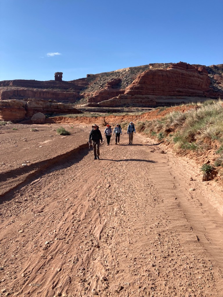
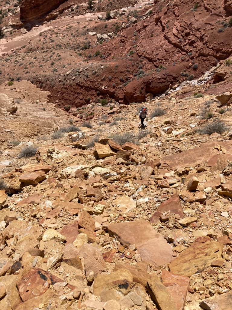
Monday morning, we continued onward to the Maze. We dropped down into the wash of the canyon and walked along the sandy bottom, the walls of the canyon always close. We came to some runoff from a spring, but the Ranger previously warned us calcium chloride contaminated it. We could see the white caking of the salt around the trickle of the stream. We climbed out of the canyon and traversed a huge plain that appeared unending. From our vantage we could not see the massive canyon network ahead of us. Naturally, we knew it was there just by consulting our maps. However, it felt like walking on a conveyer belt—we kept walking but never seemed to get closer because there was no frame of reference.
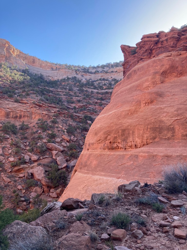
We approached the North Fork Horse Canyon around noon. This is one of the canyons of the Maze, but it did not give us a view of more than that one canyon. The canyon does lead to the floor of the Maze-proper. We marveled at the crevice. The top was dirty-white sandstone topping chocolate-colored walls brown from rusting iron particles. The floor of the wash was white sand and rock. We took photos but they disappointingly fail to capture the scale and grandeur.
Camel told us the Maze overlook was only a few miles ahead of us. He said he did not want to oversell it, but then proceeded to try to do so. I don’t recall his exact words, but his message was that one will never again see anything so fascinating. However, he warned, the descent into the maze was “sketchy.” By this he meant we would have to climb down a complicated rock scramble. We’d need to help each other lower our packs at points because it was not possible to climb down or squeeze through rock features with them. There was some danger. So, he also offered an alternate descent into the maze—down the Horse Canyon in front of us. That route would involve a longer hike and miss the overlook, but it was safer.
I tried to reduce the issue to my level. Was it a rock scramble like the Billy Goat Trail? Camel did not even respond to that. Was it like Old Rag? He considered this and replied that it was more challenging than Old Rag.
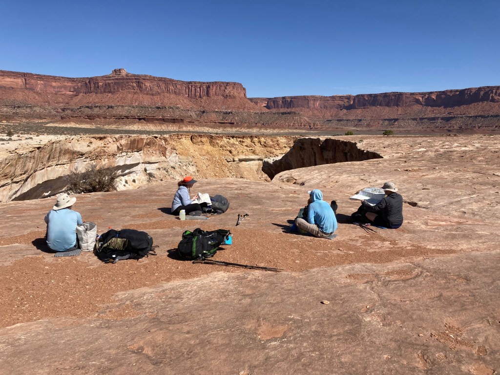
Shuttle opted for the Horse Canyon. Turning to U-Turn, she gave him “the look,” and said, “we’ll have to decide this as a couple.” (As a male-female relationship veteran, I knew how this would turn out . . . ) U-Turn briefly weighed the options before remembering he was half of the Shuttle/U-Turn couple and, wisely, selected domestic tranquility. He, too, chose Horse Canyon. So, after a snack, we split up. Camel, Logan, and I continued walking along the lip of the canyon leaving U-Turn and Shuttle to descend into it.
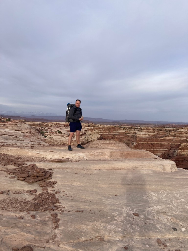
The walking was hot and dry. A desert, there was no shade. I don’t like direct sunlight, so I pulled out my TRDD and, as I expected, it provided a great job deflecting the sun and kept me cooler even as I looked uncool.
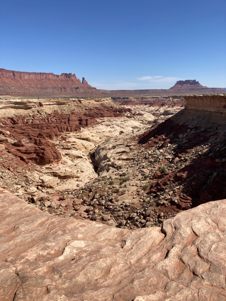
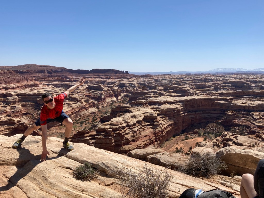
We reached the Maze overlook—Camel did not oversell it. It was extraordinary. It looked like the archeologically excavated Roman Forum, viewed down from the Colosseum, but at an indefinite scale. We gazed down at the network of canyons, all topped by white sandstone off into the horizon. It was the size of a large city. Distinct rock formations punctuated the top of the Maze at points.
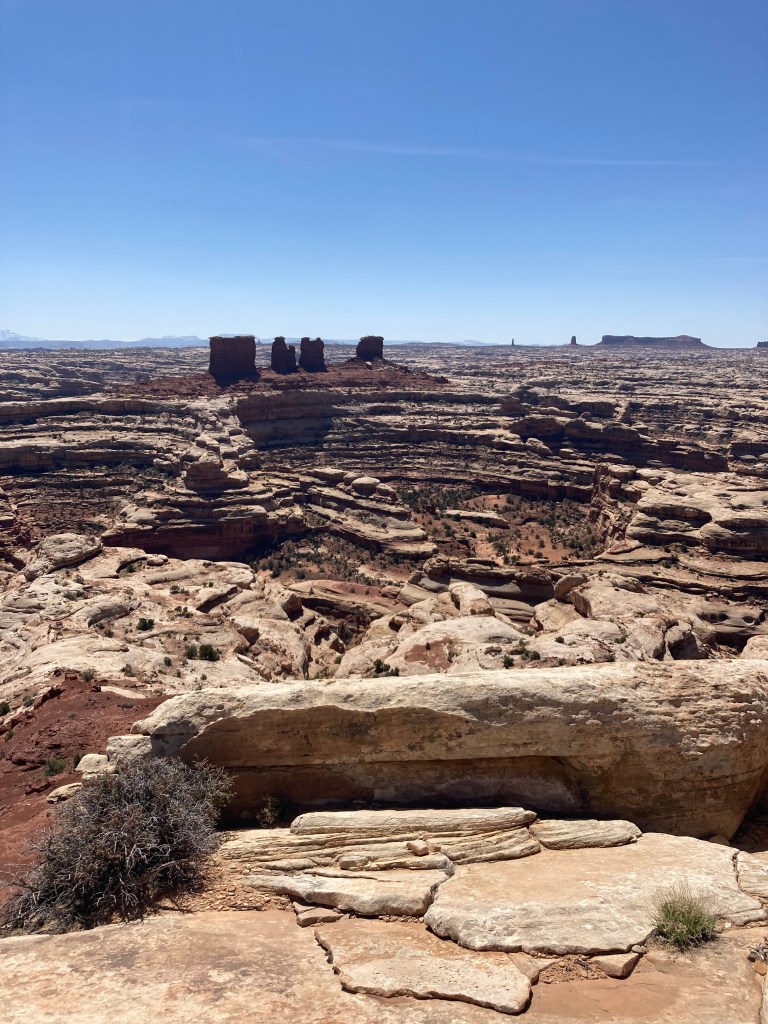
Imagine a mouse being held above a maze before placing it in to find the right path to the cheese. Effectively, this is what we saw and what we would be doing—except, instead of looking for cheese we’d be looking for water to drink.
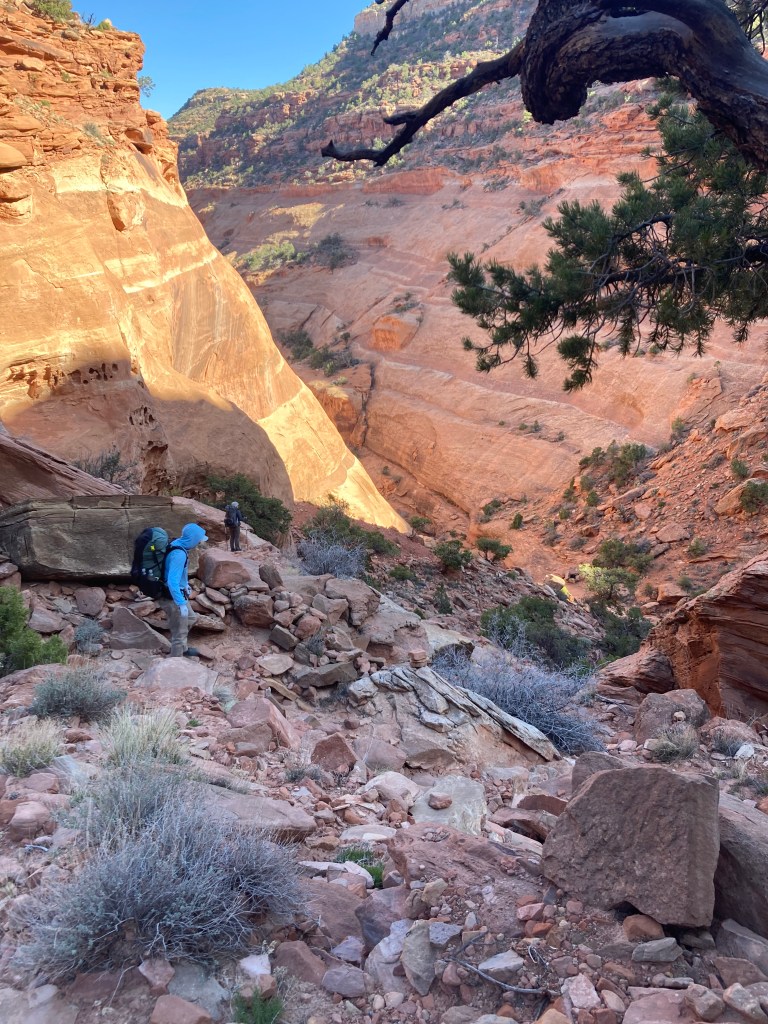
We descended into the Maze. Ok. I’ll admit it. I was outside my comfort level, but only slightly so. At times the three of us had to remove our packs to help each other down. One cannot do this alone. When Camel and Logan in turn hefted my pack, they each expressed surprise at it being so heavy compared to theirs. I reproached their “pack shaming” and we continued down.
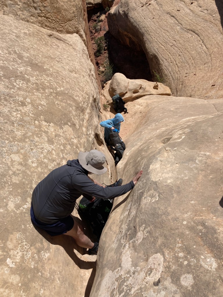
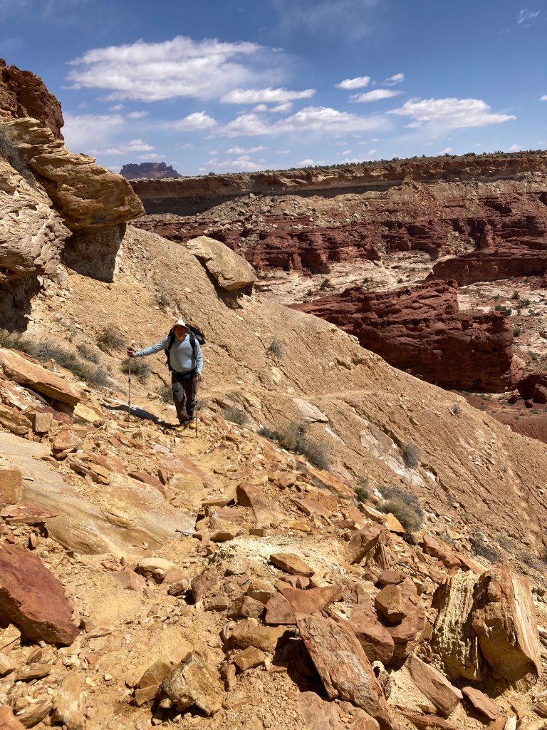
There were moments where a fall would be treacherous, but I looked for and consistently found barriers to obstruct the fall line of a cliff. If I lost traction and fell, the barrier would blunt my slide and keep me from falling to the canyon floor like Hans Gruber falling from the Nakatomi Plaza tower at the end of Die Hard. Camel, who has extensive climbing experience with ropes, helped tremendously. He would scale down a rock feature, finding cracks for his hands and feet. Then, as Logan and I followed, he would point out the crevices that a descending climber cannot see while in the act.
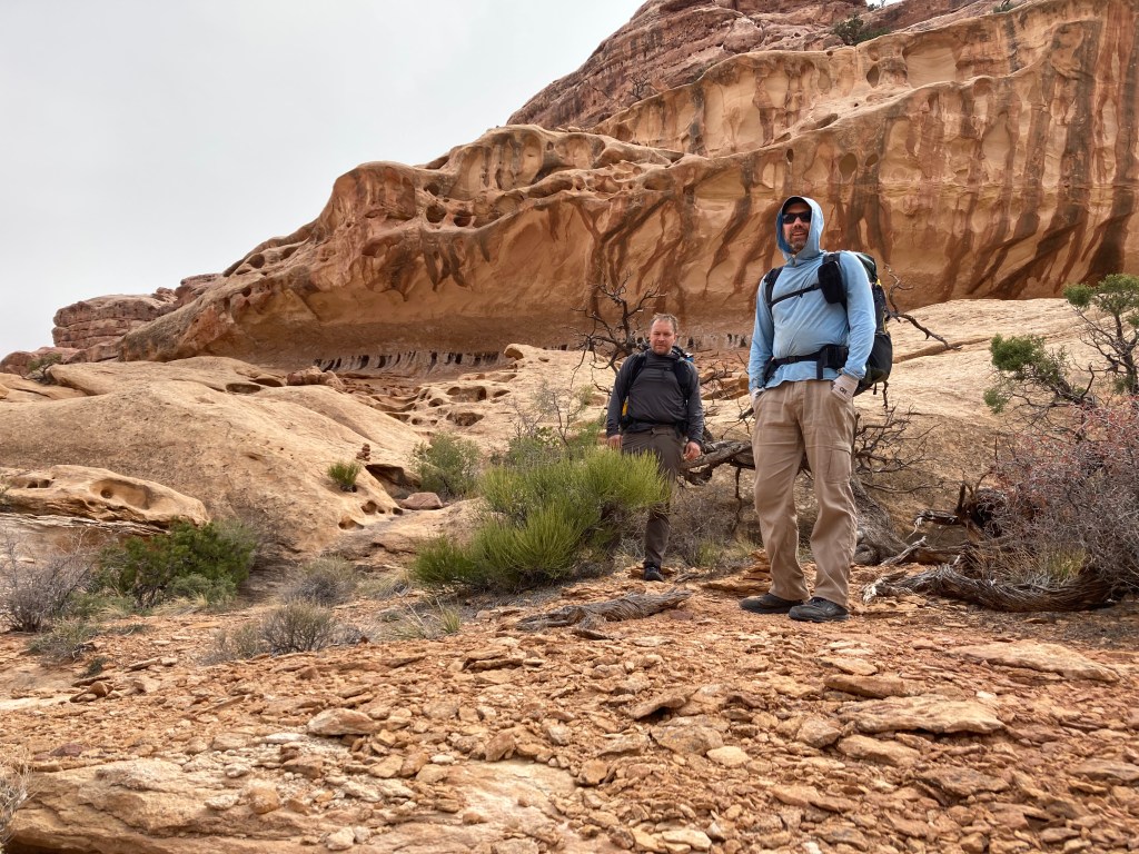
We reached the canyon floor relieved, pulled water from a nearby spring, and hiked into the central part of Horse Canyon. We took a detour to the Plug Canyon to see the “Harvest Scene” pictographs. Archaic People painted them over 3,000 years ago, before a prior episode of climate change chased them out of the canyons. The painting seemed to depict field workers with a priest blessing their toil—but I’m no art expert. It could have been a soccer game.

Back at Horse Canyon we found a giant boulder in the wash on which to make camp for the evening. Soon, U-Turn and Shuttle arrived. They reported a pleasant hike with a 20-mile day. With our detour, Camel, Logan, and I put in 19 miles.
Tuesday, the group split again. Camel wanted to do an overland trail in the canyons south of the Maze. He said it would involve some “sketchy” areas. Having completed the climb down the overlook in good form, I felt up to the challenge—especially after Camel promised we would turn around if the trail was too sketchy.
The walk along the canyon floor was easy—except for the periodic quicksand. Yes, really. Having watched 1970s era movies and television shows, I assumed falling in quicksand was a death warrant, unless you had a horse or camel to pull you out. We didn’t. The movie Lawrence of Arabia iconically depicted the terrifying quicksand genre. We would hike along the sandy canyon floor before, without warning, the ground would sink below the feet. Logan had the worst of it, falling in up to his knee. Horrified, I was ready to write him off. Luckily for him, he quickly extracted himself.
To my surprise, the climb out of Horse Canyon was itself sketchy. Since U-Turn and Shuttle had taken the north side of Horse Canyon as the easier descent, I assumed the southern side would also be gentler. I was wrong. Fortunately, it is easier to climb up a rock scramble than to descend, but there were moments when I definitely felt outside my comfort level. To punctuate the experience, it even started snowing.
So, as this Trip Report began, I found myself on a ledge over a cliff with a rock protrusion blocking my passage. There was nothing to block a fall. Just before I made my move, I had a premonition of a John Wayne saying we would later see on a poster at a restaurant in Hanksville, UT where we would soon be eating our victory lunch at the conclusion of the trip. The poster read, “Courage is being scared to death—but saddling up anyway.” I gritted my teeth, tightened the sternum strap on my backpack, and successfully swung my way around the obstacle, grabbing a crevice on the wall of the other side for comfort. Success! After some other “sketchy” areas, we reached the top of the canyon. I said a prayer of thanks and thought to myself, “I’m done with this “sketchy” stuff—certainly any descents.”

We had a long hike along the back side of the Maze to calm our nerves. The weather turned and the expected cold front was clearly upon us. I put on a jacket to stay warm. We then started down the trail Camel charted for us. Very nice at first, we reached an area with a steep slick rock angled like a steep slide down into the canyon. We realized we had to climb down that slide. Our trail runners gripped the rock well, but it was a long way down and there was no room for error. One slip or trip could have resulted in a death or disability slide. After having survived the earlier climb, I was not able to handle this. Camel agreed that this approached a technical climb that he typically does with ropes. It looked possible, but risky. We turned back.
At this point we remained in our planned margin of safety, but barely so. We had been counting on the spring in the canyon of our retreat. However, we each had a liter of water. This would be enough for us to walk back to the trails returning into the Maze—especially if we descended down the Plug Trail to a reliable spring.
The weather continued worsening. The wind became extremely strong—a push-one-off-balance strong. At the trail head we sat down behind some scrub brush to finalize a plan. Our options had dwindled. The sun was going down and our water supply was down to a quarter liter each. We’d already hiked 20 miles, so we were tired, too. We identified two choices. We could climb down the Plug Trail in front of us to the reliable spring. Or, we could hike another six miles along the lip of the Maze to descend via the Pete’s Meza Trail. Logan voted for the Plug. He wanted the close water, shorter hike, and better positioning for the next day. I voted for the Meza. Still shaken from the Horse Canyon Climb and our aborted overland descent I was done with “sketchy” descents. My reasons were that we were already on a “Plan B” having backtracked from the overland trail. If we descended the Plug and found it too difficult, we’d have to turn back and ultimately hike down the Meza with even less water, after dark, with an even longer mileage. My point was that we were entering a survival situation and in this state we should choose the safest option. As to the 26 miles, well heck—we’re DCUL! We eat 26 milers for breakfast! (See the 50 Miler Four State Challenge). I offered to split from the group and climb down Meza alone, but Camel strongly wanted to keep us together after having already split the group. Appreciating my apprehension, he voted with me and we hiked toward the Meza Trail.
The Meza Trail was easily the trip highlight. I’ve never seen a more sustained scenic trail in my life. I doubt one exists. We walked down a gently descending slick rock meza with views of the Maze in all directions. The setting sun displayed changing colors and shadows that looked of another planet. Many of the formations looked like they were carved by Antoni Gaudi (or drawn by Dr. Seuss). It was easy to overlook the gale-force winds pushing us around on the exposed rocks.
We made our way down into the wash of the Maze and, by the time we could find water, we had our headlamps on. We camped in the wash on the sand and separately ate in our tents to avoid the wind. None of us slept much that night. The wind violently battered our tents the entire time. Sometimes it would whip up enough sand that it hit us like a sandblaster. It kept waking us up.
We “woke” Wednesday to hike through the Maze along the Plug trail back up the south side of the Maze. This was the trail we considered climbing down the prior night but eschewed for the Meza Trail. However, it is easier to climb than descend. And, we were already accustomed to strategic retreats when necessary. The climb challenged us, but with only two exceptions I felt perfectly safe. We all agreed, however, it would have been a mistake to have come down that trail the prior evening. I could not have made it. As planned, we descended back into the Maze via the Meza Trail we loved so much. This time, there was no wind which particularly pleased Camel.
Back in the Maze, we hiked north up Horse Canyon for our planned reunion with U-Turn and Shuttle. We exchanged stories, had dinner, and set up camp. Everyone but me cowboy camped from this point onward.
We woke Thursday to exit the Maze and begin the hike away from it to the Ranger Station. This was mostly new to Camel, Logan, and me; it was a reverse repeat for U-Turn and Shuttle. The hike up the canyon was similar to most hiking in the wash. Most often the ground cover was fine sand, as one would see walking the beach in Ocean City. Fortunately, we trained for this. (See Assateague Island Trip). While tiring on the leg muscles, it is soft on the feet. At other places, the sand is firmer, like walking on the hard sand of South Carolina at low tide. At other times the ground is rocky, with variations of loose rocks and stretches of slick rock. I found the variety agreeable. However, our packs remained heavy despite us having eaten almost all of our weeks’ food. We had to carry enough water over this stretch to cover all day Thursday and most of Friday—there was no water resupply opportunity.
We camped near where we did on our way in—on a nice long slick rock overlooking the canyon. The weather remained windy and cold. Overnight, I even put on my down puffer despite being in a tent and under a 10-degree quilt. My closed-cell sleeping pad was insufficient for the cold rock that was sucking heat from my body. By sleeping on my side I stayed warmer. On Friday we climbed out of the canyon and returned to the Ranger Station. We toasted ourselves with the beer we left for ourselves in the cars. They were ice-cold.
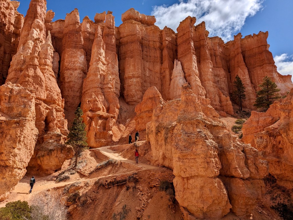
We broke up the long drive back to Vegas with restaurant stops and a day hike down Bryce Canyon NP. I was glad to have seen Bryce, but we only had time for a short hike. It was stunning, but it was a tease. Imagine being 12-years-old with your parents at Disney World. Once there, you look at some of the rides, take a photo in front of Cinderella’s castle in the Magic Kingdom, and then your father says it is time to go. Better than nothing, it was disappointing to be at Bryce for such a short time. We crossed the Escalente River and saw that it was not running as high as we feared. However, I’m still glad we changed our plans in favor of the Maze.
We arrived back in Vegas Saturday night. We did no gambling, our descents down “sketchy” canyons were all the gambling we wanted. We had our farewell dinner at a delicious Indian restaurant called Mint. Our waiter was a real robot, which I never before saw. (Do you tip robots? I’m asking for a friend.) They offered an “Inferno Challenge”—anyone who could eat their special curry was posted on their wall of fame. If DCUL ever returns, I’ll bet we could supply a ringer. Interested, Karan (BA)?
I can best describe the Maze to those who, like me, have never before hiked outside the east coast of the US as a trek along the Presidential Range of New Hampshire. However, the treeless Maze route is much longer than the Mt. Washington-focused ridge line. And, the New Hampshire mountain climbs are replaced by Utah canyon descents. Physically, the Maze is a very easy trek compared with most backpacking trails in the East.
Despite its majesty, I’ll likely never return to the Maze. It is truly remote. It took all of four days to get to and from there. And, I feel I sufficiently immersed myself in the Canyonlands. However, I’ll certainly be back hiking with Camel, Logan, U-Turn, and Shuttle—all strong hikers with great attitudes—unless they get trapped in quicksand.
- David O. (Spider-Man)
