It’s been a goal of mine this past year to explore more trails in Shenandoah that diverge from the popular spots. I also love hiking in the southern district, which tends to be less crowded and feels more rugged. So I was quite pleased to stumble across this loop, which had us starting from Turk Gap, taking the AT north to the North Fork Moormans River Road, then following that down to the South Fork Moormans River Road, and back up via Turk Branch. Of those 20 miles, 18 would be new ground to me, which was quite exciting.
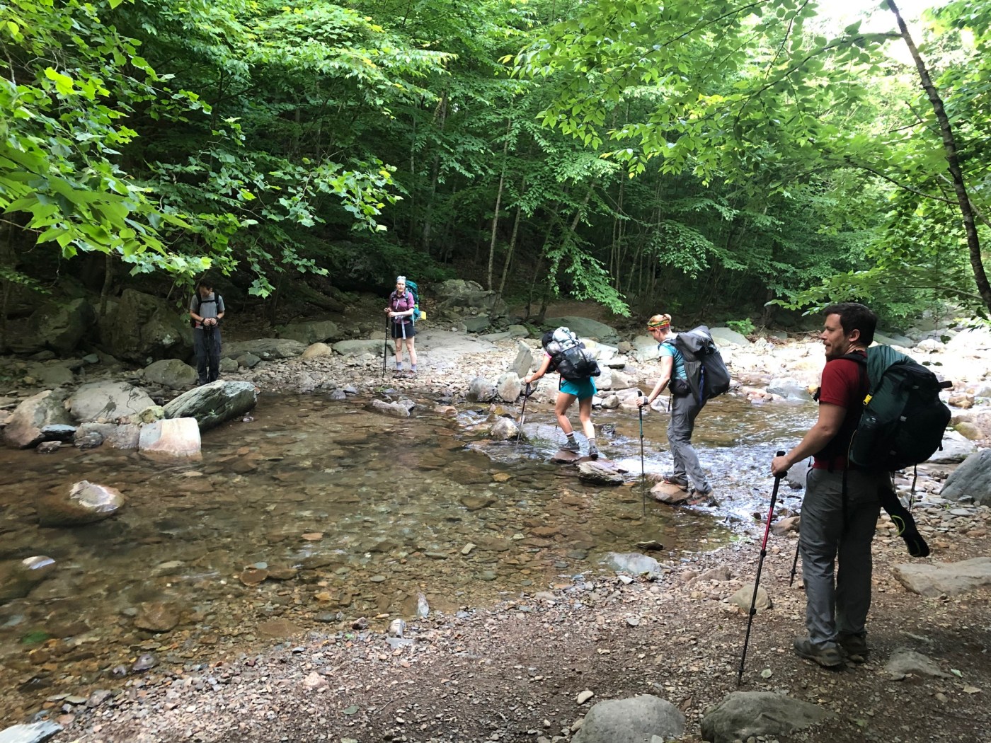
We headed out from Vienna and arrived at Turk Gap around 12:30 p.m. The parking lot was packed, however, so Laura and I took our cars to the overlook parking just down the road and then scurried back to the trailhead parking lot. We were eager to start hiking — but then Sandra quickly realized that her phone was missing and feared she had lost it by the overlook parking. Sandra, Paul, and I headed back to the lot, while Michael and the rest of the group forged ahead. We reviewed the map and figured it made sense to just walk along Skyline Drive to where the AT would soon cross the road rather than backtracking. The phone was found, and we made our way to the intersection–our timing was perfect as we arrived just a few minutes before the group did.
Now regrouped, we continued along the AT. You could occasionally see glimpses of the valley below and the mountains beyond, and our group stayed relatively close together for a while. Soon, though, I heard shouting. “A bear!” Sure enough, there was a bear that was remarkably close to the trail — maybe 15 to 20 feet away. He peered at us through the trees as we walked past.
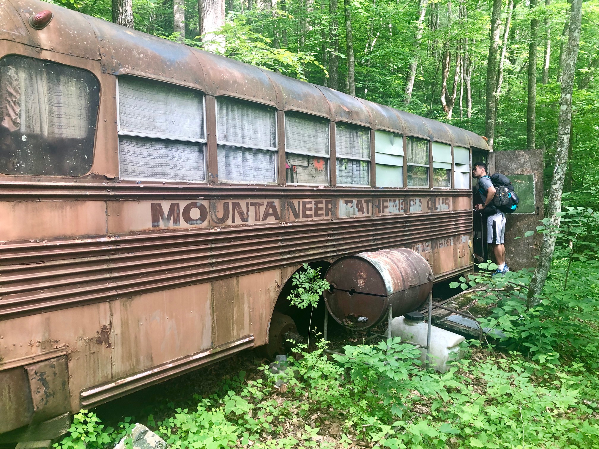
After that excitement, we moved along the trail, and arrived at the intersection with the North Fork Moormans River Road. From here, it was downhill to our campsite for the evening. The NFMR descends mildly from the AT, and occasionally widens up to allow our group to chat as we made our way down. I had told Michael to keep his eye out for an abandoned bus that I had heard could be seen from the trail. It turned out the bus was quite easy to spot, and James rather bravely peeked inside.
We found a nice campsite just on the other side of the river, and quickly set up camp. Ginny and Ian explored the swimming hole while others waded or generally enjoyed the peaceful setting. As night fell, the fireflies came out, and we retreated to our shelters with the sounds of the river and the flashing flies to help sooth us to sleep.
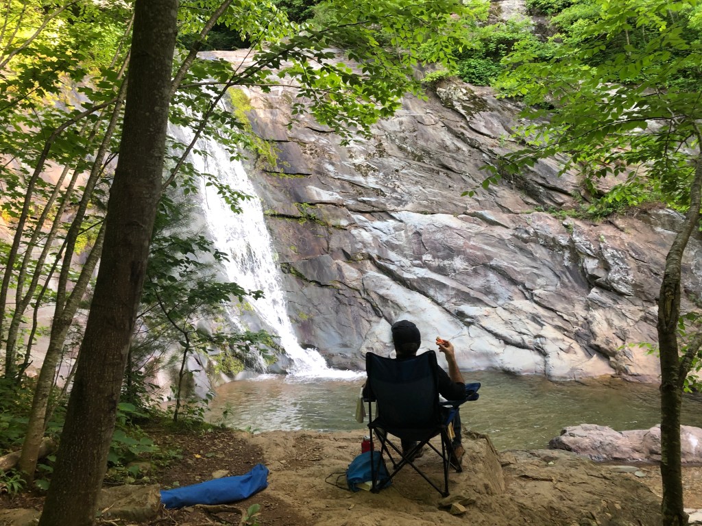
Sunday, we were up and on the trail just after 7 a.m. We kept our eyes peeled for the turn to check out Big Branch Falls — the lower falls are nice but it is worth taking the side trail to check out the upper falls.
We continued along the trail, which was mild and pleasant walking, and came to the intersection with the South Fork Moormans River Road — not the clearest of intersections. (Hint — it is the fire road and not one of the trails.) Tip for anyone who repeats this hike: after walking a bit, you’ll see a large swimming hole that will tempt you to take a dip but keep pressing on a few steps further to an even better one that has a rope swing. (Thanks to Ginny and Ian for the tip!)
After the swimming hole, we quickly arrived at the intersection with the Turk Branch Trail. It’s about 2.5 miles of a long steady climb back to Skyline Drive — we were all happy to see our cars. We treated ourselves to food, drinks, and ice cream at the Loft Mountain Wayside and then made our ways home. All in all, an excellent weekend.
I was quite pleased with this route. It was a satisfying loop–excellent for the summer and definitely worth repeating. Overall, the hiking is relatively easy but there are a number of ups and downs to keep it interesting. Both the North Fork and South Fork Moormans River Road trails are dotted with swimming holes, providing welcome temptation to stop and take a dip.

As Michael pointed out — and I agreed — we were almost too early in the summer since the temperatures were relatively cool during the day and at night. Doing this in July or August would make the swimming more tempting. The North Fork Moormans River Road trail had three decent campsites — campsites 1 and 3 were on the smaller side, but campsite 2 (the one we used) had a good amount of space and was situated next to a nice swimming hole. I’m sure there may be a few other campsites along the path, but those three seemed to be ideally situated.
Thanks to everyone for joining — and welcome aboard to Ginny, Kat, George, and Seth who completed their first trips with DC UL and are now members! Here’s to more explorations!

Leave a comment