
Back in June when Karan and I started planning our 4th of July weekend, we landed on a lesser known backpacking route in southern Maine where we hoped to escape both the crowds and the heat. On Wednesday afternoon, we picked up Trang and Sharon from Grosvenor and started the long drive north. Traffic was better than expected and we arrived at Cassie’s parents’ house in the Catskills at a reasonable hour. We left early the next morning to finish the drive. Unfortunately we found out why it’s a bad idea to take the backroads on the 4th of July: small town parades and celebrations added about an hour and a half to the journey.

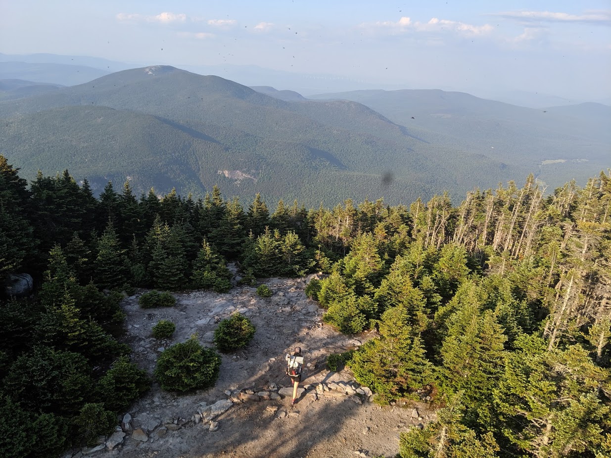
Twenty-five hours after leaving Grosvenor, we were ready to hike. The four of us left the parking lot on ME-26 around 4pm and started south on the AT. Despite our long drive north, we had not escaped the DC weather. It was in the high 80s and humid so we were quickly sweating buckets on the 2,500 ft. climb. Despite the heat, it felt good to be hiking among the pines, evergreens and big rocks of the north. At 3.5 miles in, the Grafton Loop Trail turned off the AT to the left. Karan headed for an extra out and back to Speck Pond while I battled a swarm of black flies to regroup with Sharon and Trang. Trang, it turned out, had twisted her ankle pretty badly about a mile into the hike. She wanted to soldier on so we continued to the Old Speck fire tower, which offered nice views, and then another 2ish miles down to the Bull Run campsite. We arrived at camp around 7:30pm and had a quick dinner before heading off to bed.
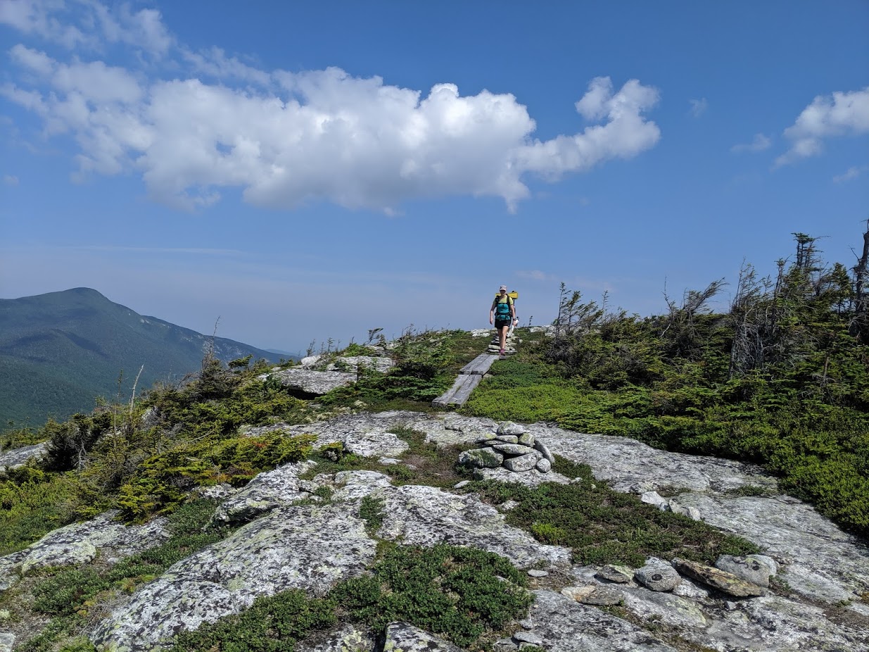
It was already warm when we started out the next morning. We descended 1.1 miles to the next campsite. This part of the trail was a bit overgrown but it cleared up and became a pretty nice stretch of forest. The bugs that started to swarm us again were not so nice. We had a 1,000 ft. climb up to Sunday River Whitecap. The trail opened up along the way and was clear on top offering us nice views, a breeze, and temporary peace from the bugs. The four of us took a break there to soak it all in.
From there the trail descended, meandered along some flats and short uphill climbs before dropping steeply. Karan and I stopped near the Bald Mountain campsite for lunch and later found out that Sharon and Trang had stopped just above us. It was a gentle 1.8 miles from there to the road. I took advantage of a small swimming hole along the way. If there was ever a day for a swimming hole, this was it.
We walked along the road for about half a mile to the southern parking lot and regrouped there. A group of young college-aged kids were trying to pack their unwieldy gear and box of Franzia. We started the climb up Puzzle Mountain before they could get their act together. The climb was gentle at first but the humidity and heat took a toll. Breaks were required to keep from overheating. Towards the top, the trail was steep and rocky. We took a break at the top to enjoy the view and more importantly, the stiff breeze. A sign at the summit noted that our campsite for the night was 2.7 miles away, contradicting our map and GPS track. Sure enough, after about 1.5 miles, we reached Stewart campsite. Guides listed this water source as unreliable. We were hoping to find water there but I became concerned when I saw the dry stream bed. Karan persisted following it further and found the trail leading to a plentiful source. We had the site to ourselves for most of the evening—aside from the bugs that is. We retired to our tents after eating dinner to avoid them.

Saturday morning was also steamy. I was drenched even going downhill at 7:30am and it was only getting warmer. The trail descended for about two miles before crossing a stream at the bottom. The group of college students was camped there directly on the trail. From there, we climbed up Long Mountain. It was a fairly well-graded 1400 ft. climb. Karan and I took the turnoff for the viewpoint but stayed for the breeze.
The trail descended again and followed a nice stream. We found a great swimming hole and took advantage of the chance to cool off. We started climbing again and passed by Lightning Ledge before taking a quick break at the stream by East Baldpate campsite. It started to sprinkle and thunder as Karan and I left to climbed up to the summit, hoping to make it across the exposed peak before the storm really got going. It was still clear to the north when we arrived at the summit but we could see the storm coming in from the southeast. We snapped photos as we crossed the summit and descended the open rock face. It started to rain, the wind picked up and the thunder grew closer as we started the climb up West Baldpate. Luckily we had the shelter of the trees as we descended the steep, rocky trail to the West Baldpate shelter. There we met several hikers: Schmutz, a NoBo, Over It, a SoBo, and Jesse, a section hiker from Arlington. We chatted with them while we waited out the storm. Sharon showed up. She had waited below the top of East Baldpate for the storm to calm some before she crossed and unfortunately missed the views on top. She had also been behind Trang and hadn’t knowingly passed her. Trang arrived some time later. She had gotten off trail on the section before East Baldpate where blowdown obscured the path but found her way back.

Everyone set up their tents and cooked dinner. The good thing about the rain was the relief that it brought from the bugs. Karan helped Over It retrieve the stuff sack he had gotten stuck in a tree while trying to hang a bear bag. The process involved two trekking poles, a large stick, a rock, and lots of medical tape. The four of us retired early and woke up at five am. It was a beautiful morning- cool, clear, and crisp. We soaked it all in on the two-mile descent to the cars. After that, it was just a 12 hour drive back to Grosvenor!
While the conditions weren’t exactly what we were hoping for, we still enjoyed the loop. And considering the packed parking lots for one of the Mount Washington trailheads we saw on the way in and the way, I think we made the right decision about which trail to hike.

Yes it was a long drive, and the weather wasn’t perfect, but it was totally worth it for a chance to get out in the middle of the hot summer. Thanks for arranging and for doing all of the driving. I added a photo (on the meetup page) of the top of East Baldpate an hour later, to show the stark difference.
LikeLike