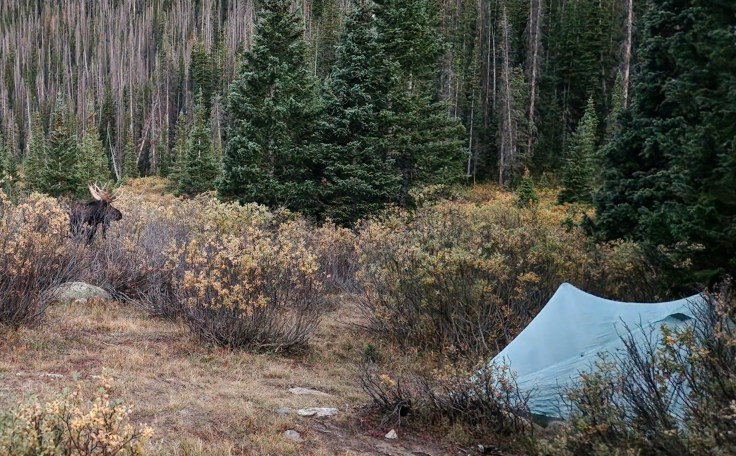
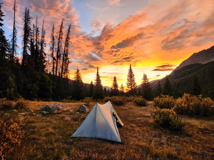
“David! A giant moose is 5 feet from your tent!” Logan (“Professor”) whispered this warning flatly but urgently. I had been lying comfortably on my back under a fluffy down quilt, reading before falling asleep after a strenuous day hiking in the Rocky Mountains of Colorado. Of course I had heard an animal outside my tent, but I wasn’t alarmed when I didn’t know what it was. It sounded to me like a small mammal making low grunting sounds every two seconds. Camped next to a mountain prairie stream, I thought it was probably a marmot or a beaver.
A few days prior, I would have met news of a moose near my tent with an unconcerned shrug. I thought of moose as “gym deer.” They look just like regular deer but have spindly legs supporting an overdeveloped torso. They look like guys at a gym who focus on upper body workouts, forgoing “leg day,” because they only see their arms and chest when admiring themselves in the mirrors between sets. They wind up looking like awkward, inverted triangles—just as moose do.
However, Maddie informed me of the extremely underrated danger of moose. When she first started spinning tales of “dangerous” moose, I laughed. First, we were backpacking in the mountains of central Colorado—far from moose habitat of Canada or Maine. Second, I grew up watching Rocky and Bullwinkle. This popular cartoon featured a moose and squirrel who were best friends and Cold War special agents who foiled Soviet spies. Bullwinkle, the moose, was good-natured and a bit goofy and silly. Unless one was a commie sympathizer, there was no reason to fear Bullwinkle!
Maddie informed me that moose were prolific in the Rockies. She also taught me the darker side of moose; that moose injure more people than bears. When I asked what she feared more: moose or lions? She paused, unsure of what I thought was the obvious answer. She was truly afraid of moose. I laughed.
I was not laughing as I lay in my tent with a killer moose 5 feet away! My eyes were opened wide with concern with my eyeballs darting from side to side. I didn’t know the best strategy for self-protection. If the moose was a black bear, I’d make a lot of noise. That works to scare off bears. However, what if noise would just make the moose more aggressive? In the wilderness of the Rockies, there was no cell signal, so I couldn’t consult AI for guidance. I whispered to Professor for advice, but did so too softly for him to hear. (Or, Professor thought that our friendship had run its course and, to him, the only thing worse that a moose attacking me was a moose attacking him, so he stayed silent! I admit, I was thinking it was more likely he’d be attracted to Professor’s tent since Professor kept his food in his tent overnight while I dutifully hung mine outside in a tree. But, then again, Mattie had previously informed us that it was moose mating season. While I’m no expert on the moose dating scene, I feared a moose might find me more attractive than Professor. Yikes!)
Clearly, I had a lot to learn. Fortunately, the theme of our backpacking trek was “Back to School.”
# # # # #
Six of us met in Denver to hike the famous Collegiate Loop trail through the Rockies. The loop is created at the confluence of two long-distance trails, the Continental Divide Trail (“CDT”) and the Colorado Trail (“CT”). The CDT bisects the central US, north through south, from Canada to Mexico. The CT crosses a portion of Colorado from Denver southwest to Durango. The two trails share the same path for a time, splitting at Twin Lakes in the north and Monarch Pass in the south, before reconnecting. This “split” makes a natural 160-mile loop called the “Collegiate Loop.” Professor taught us that the Collegiate Loop (“Loop”) is so-named because it runs adjacent to the several 14,000-foot mountains each named after famous universities: Oxford, Harvard, Columbia, Yale, and Princeton. He said that the first person to summit each mountain, with documentation, named it after his university. When I expressed my disappointment that my alma matter, the George Washington University, was unrepresented, he frowned. “Haven’t you heard of Mt. Washington in New Hampshire?” I suppose having the highest mountain in the northeast named after one’s university is a fair consolation prize.
We planned to hike the loop counterclockwise from the trailhead at US 50, hiking northbound on the eastern side of the loop to Twin Lakes. There, we’d resupply and continue the loop southbound on the western side of the loop, back to our starting point just after Monarch Pass. We budgeted for 10 days on trail but substantively hiked the loop in 9 days. On our first day, a Friday, we hiked only 3 miles to get warmed up. On our last day, a Monday, we hiked 8 miles. For the remaining 9 days we hiked full days of between 15-20+ miles each. The total cumulative elevation gain was 36,000 feet! That’s massive. For comparison purposes, a typical Mt. Everest trek requires only 30,000 feet of cumulative elevation gain. And, unlike an Everest trek, on the Loop we each carried all our own gear and food—no porters for us like those soft Everest “tourists.”
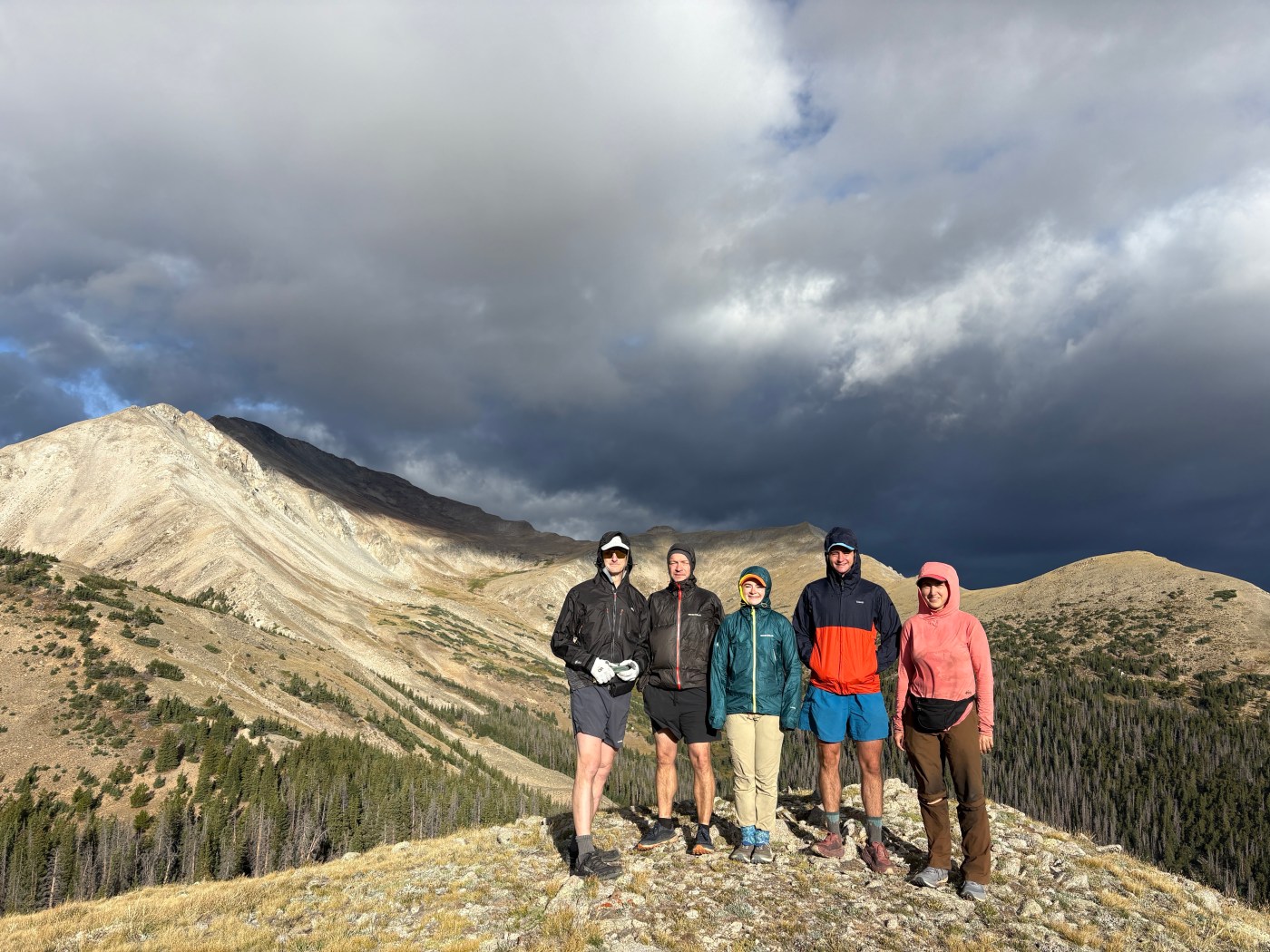
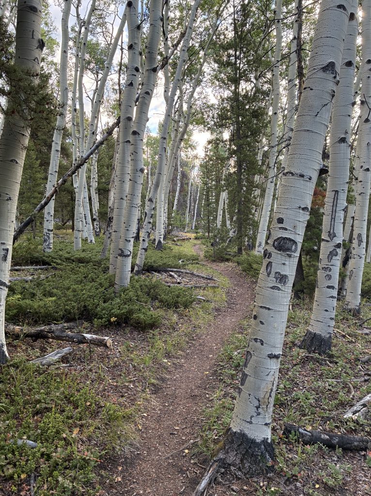
The eastern and western sides of the Loop couldn’t have felt more different. On the eastern side, where we started, the trail predominantly ran below the tree line at relatively lower elevation: 8,200 feet to 11,900 feet. Our group was from the mid-Atlantic east coast where forested trips are the norm, albeit it at lower altitude. So, we started the trek much like any other backpacking trip. Our initial average mile per hour pace was identical to our experience at home—3 miles per hour or faster. I don’t intend to minimize the eastern side, however. Some of the more challenging sustained climbs were on that side. Despite the general familiarity of that side of the Loop to us, the combination of prolific aspen groves and spruce forests let us know that we were in Colorado.
The western side was mostly above tree line on exposed mountain tops and passes at elevations of between 9,200 feet and 12,550 feet. By the time we reached this side our pace had moderated. It is simply harder to backpack at higher elevation. In the east, for example, Virginia’s highest mountain, Mt. Rogers, is 5,729 feet. West Virginia’s highest mountain is Spruce Knob at 4,863 feet. The mountains in Pennsylvania and Maryland barely exceed 3,000 feet.
Even though our typical daily elevation gain in the east was like that of our loop—4,000 to 5,000 feet of total gain per day—it was harder to hike in Colorado than Virginia. The thinner air impacts the body. It takes considerably more effort to hike the same elevation gain at the same speed. A couple of us deliberately arrived in Colorado a few days before our trek to more slowly acclimate. On a prior DC UL trip to the Loop one strong hiker had to self-extract when his heartrate would not slow from a runner’s rate at night. However, most of our core group just jumped right in from sea-level to airline flight to sleeping in a tent at 9,000 feet. Typical complaints of fatigue and mild headaches aside, no one in our group suffered altitude sickness.
In addition to the challenge of elevation, none in our group previously hiked 160 miles nonstop during a backpacking trip. We’ve all previously had a “zero” day on a long backpacking trip where we had the opportunity to rest at a hotel, enjoy some restaurant meals, and shower. On this trip, there were three resupply opportunities, but in the form of just picking up food at a convenience store as we were passing. There were no “hotel breaks.” This steady diet of big climb/distance days without break added to our challenge.
Backpacking Styles
We six quickly fell into a group hiking pattern. All of us hiked with one another in the past, so we knew each other’s paces. Typically, Veronica was the first one out of camp, at first light. She would take much shorter breaks than anyone else, so often she would hike alone. We usually would not see her until arriving at or near camp. She wound up camping alone two nights. On the other extreme was Wesal (“WB”). She often hiked with Professor and me. However, she occasionally elected to start hiking later in the morning than the others. On those days, like Veronica, she spent a lot of time hiking alone. A particularly fast hiker, WB managed to catch up with the core group during the day or shortly after everyone else arrived at camp.
Maddie would often start hiking soon after Veronica and before the core group. Her pace and breaks permitted others to catch up to her. Thus, she spent the most time of all of us hiking with different combinations of us.
Reid was the fastest of the group. No matter what time Reid left camp one could expect Reid to arrive at the evening’s destination first. Professor and WB easily tied as the next strongest hikers.
The core group started at a time we set by consensus each previous night. Usually, we woke at 6:00 a.m. to start hiking at 7:00 a.m. Naturally, a DC UL backpacking “wake up call” gave us the necessary motivation to wake early, pack light, hike far—the slogan of DC UL.
Wakeup Calls
A charming DC UL Backpacking club tradition is the morning “wakeup call.” While each hiker could always start as early or late as desired, a wakeup call alerted everyone as to when the core group would start hiking. As the one who posted this trek, I reluctantly assumed wakeup call duty. (Actually, I embrace this duty with aplomb. In contrast, Maddie cringes when she posts a DC UL trip and this duty falls on her).
Fitting with the trip theme of “Back to School” I kept my wakeup calls to education-related calls. Unfortunately, there were a couple of campsites where other hikers were set up within earshot of ours. The only thing worse than a corny wakeup call is a corny wakeup call from another group! So, out of respect for our neighbors, I refrained from calling in those locations. I also didn’t bellow a wakeup call on the one occasion where none of us reached the intended campsite and we individually set up camps dispersed from one another.
The first wakeup call, on Saturday morning was, fittingly: “Good morning! School is in session!” The next wakeup call was on Monday where I sang the chorus of the Jackson 5 song “ABC.” I sounded pretty good. For Friday, I shouted, “We’re deep in the second semester; there is still time to raise those grades!” On Sunday, I called, “Wake up! It is time for our final exams!” Then, on Monday morning I greeted our group with, “Good morning! It’s graduation day!”
There was no wakeup call on Sunday because we were in a crowded campsite, Tuesday because we all woke early in anticipation of hiking a big day to Twin Lakes in time for a pizza lunch, Wednesday because we camped in a dispersed manner miles from each other, Thursday because I chose to start hiking earlier than the core group, and Saturday because I again woke early so I could pray on a mountaintop at sunrise.
I concluded that my friends preferred to wake up to my calls and found it harder to motivate on “silent” mornings.
LESSON: A great way to make friends on a backpacking trip is to wake them up with a cheery, corny wakeup call!
Hiking in the Sky on Exposed Terrain
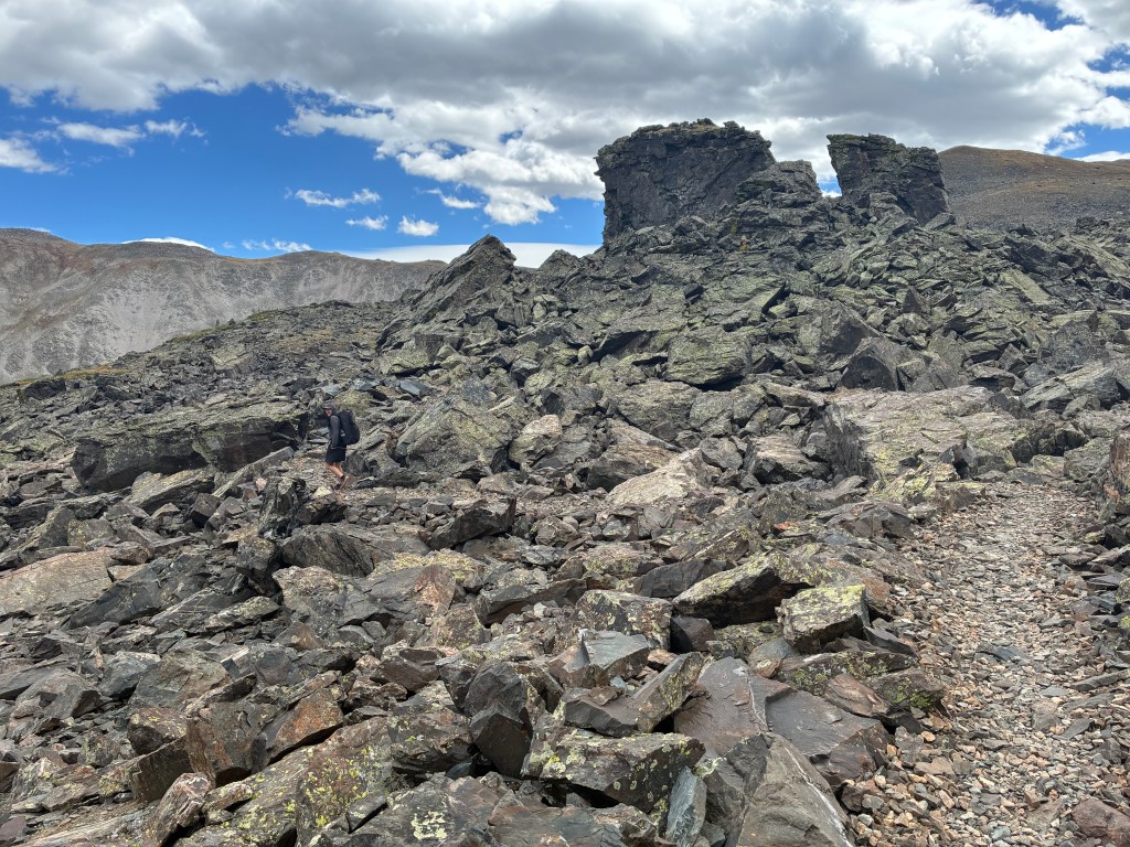
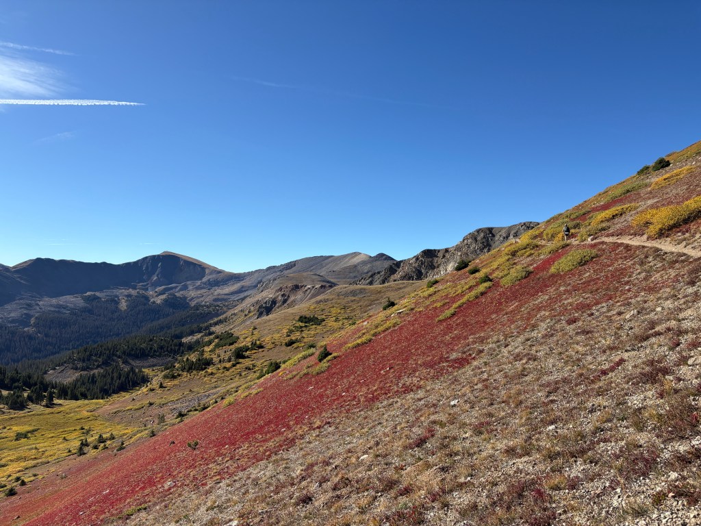
After completing the eastern side of the Loop in its familiar terrain below tree line, the western side treated us to a steady, exposed alpine environment. It started on our second day after leaving Twin Lakes. For this half of the trip we would spend entire days above tree level in exposed mountain tops and passes. With the sun shining bright and hot we had no worry of lightning storms, a common concern about this hike in July or August. Instead, we regarded the endless jagged mountain peaks with slack-jawed wonder. The different colors of the mountain rocks popped, juxtaposed with the autumn colors of the ground shrubbery and the trees we saw when looking down from our skyline perch.
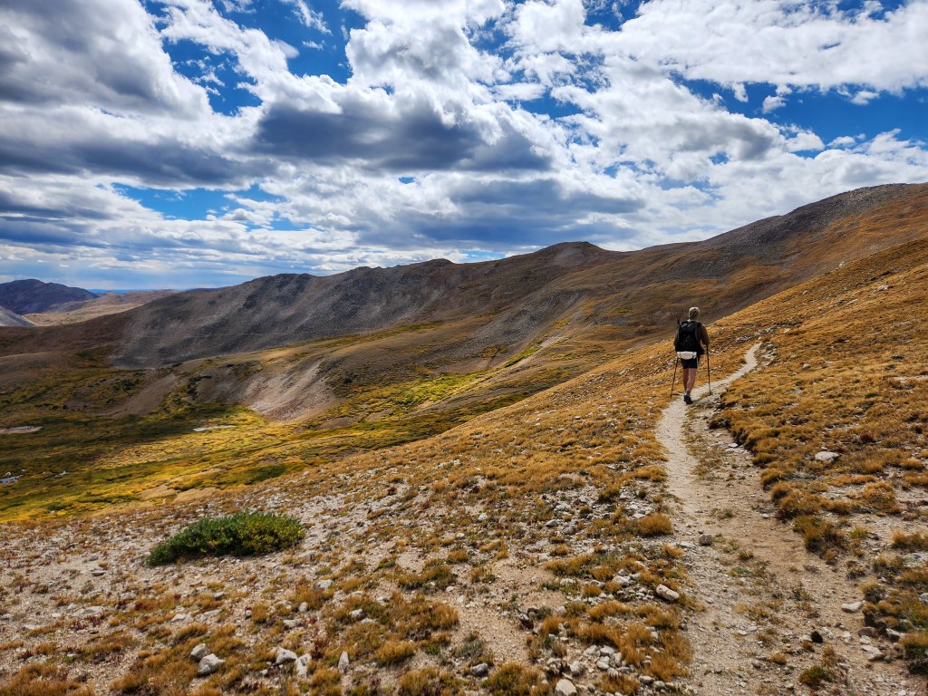
Three of our group hiked the Alps around Mt. Blanc the prior year. The Rockies and the Alps share a resemblance in many ways. However, the Rockies are unique with their endless vistas of pure wilderness with no sign of human presence other than our nearby friends and the scar of the trail snaking its way across the mountain tops. In the Alps, it is common to frequently spot civilization.
Hiking the Loop counterclockwise as we did resulted in the views building over time as we hiked. Just when one thinks the mountains can be no more extraordinary, they become more extraordinary.
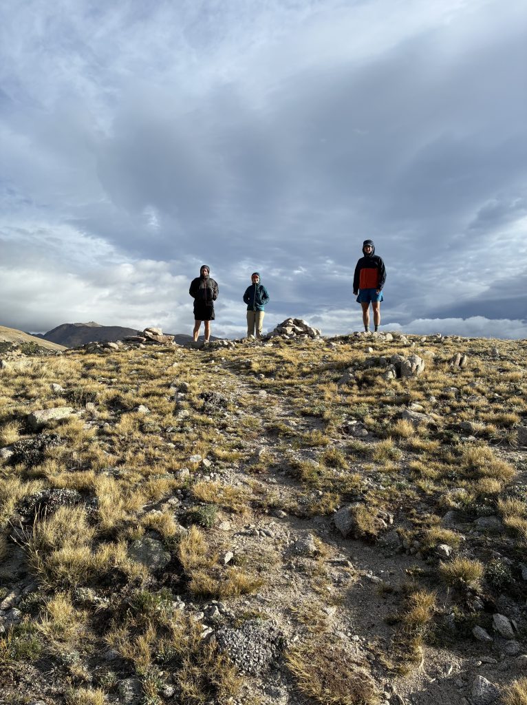
Hiking the trail on these days felt like riding a roller coaster. First, there was the relatively slow ascent up the mountain, like a coaster clicking higher and higher up a hill. Then, there is the apex, where time stands still, and one can see the countryside in all direction. It is hard not to gasp. And then there is the traversing descent with a whirl of light, color, sound, and wind until everything stops, and one sits momentarily dazed. When climbing to an exposed mountain pass, one feels the hot sun, amplified by the climbing effort in the high altitude. Then, at the apex, one marvels at the mountains as far as the eye can see. However, the high, cold winds at elevation prompts one to zip up jackets and hold onto hoods blowing off the head. The combination of the hot sun and the ice-cold wind caused physical confusion. Am I hot? Am I cold? It was hard to tell. Walking along the thin trail on the mountaintops and along the sides of the mountains completed the roller-coaster analogy. The wind provided the illusion of great speed, even though we were just moving at a fast-hiking pace. Then, occasionally, we’d turn a corner, or the wind would be blocked by a rock outcropping and wind would instantly stop, leaving us a bit dazed and spent. It was exhilarating!
We spent hours hiking long traverses on the top and sides of the mountains. We couldn’t help taking millions of photos knowing that they would not accurately depict the scale and majesty of what we were witnessing.
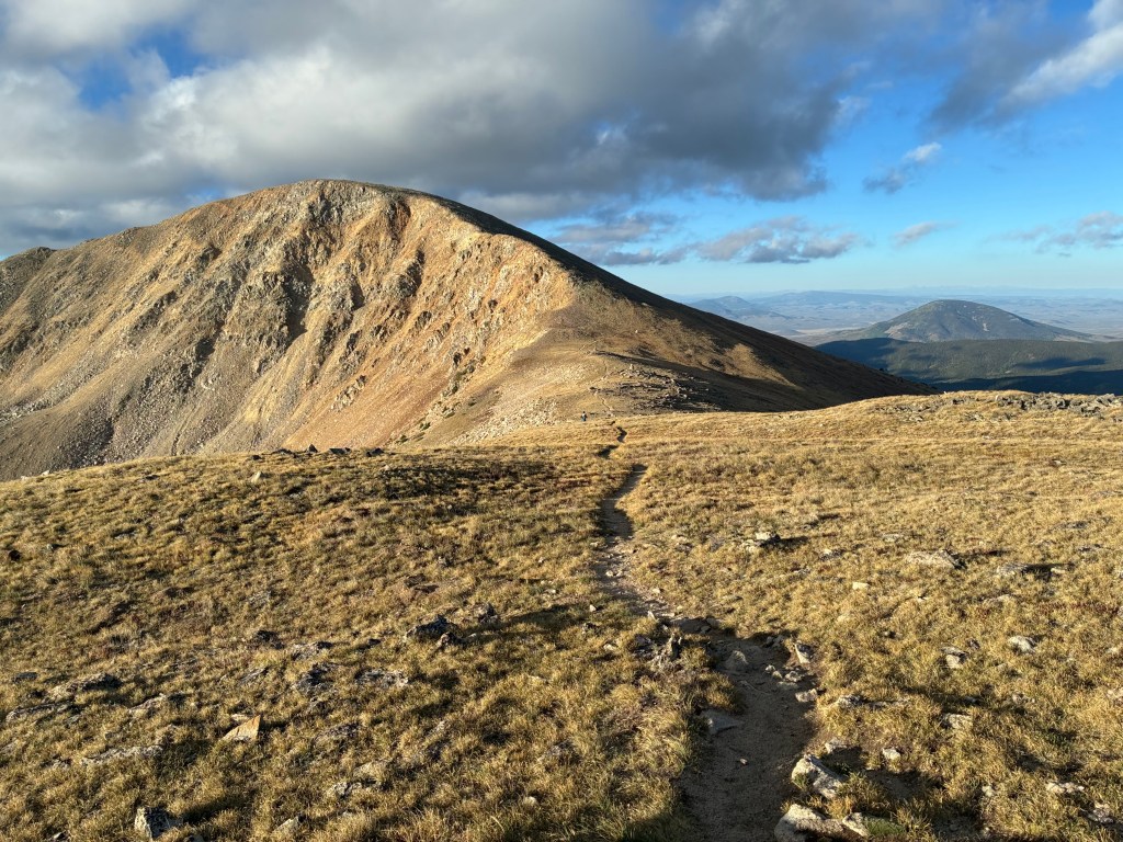
LESSON: Save the best for last. Hike the Collegiate Loop east side first and save the west for the end.
Mountain Lakes
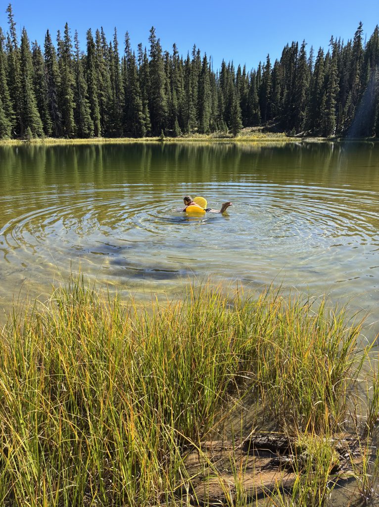
We passed several alpine lakes on this trek, which always make me happy for some reason. We camped along the banks of three of them. The contrast of the water against the desert-like or forested terrain is stark and inviting.
Maddie found one lake so inviting she went for a swim, using her sleeping mattress as a float so she would not have her feet touch the deep sediment muck at the bottom of the otherwise clear water. She said, “If this were a movie, someone would go swimming. So, I guess I should,” as she launched herself. I was also thinking of swimming in movies. Jaws sprang to mind so I watched on the bank.
Veronica told us her theory of the difference between lakes and ponds. She said that lakes are fed from streams while ponds are repositories of rain and melted snow. In the wilderness, without internet or AI to fact check, we accepted her theory.
LESSON: According to AI, there is no universally accepted distinction between a lake and a pond. However, ponds are typically shallow enough so that sunlight reaches the bottom. Lakes are deep enough for deep-water “aphotic zones” and thermal stratification (separate cold and warm layers).
Campsites: Falling Trees/Tree Math/Water Opportunities
We targeted campsites at lower elevations, where possible. It is easier to handle high altitude when one sleeps at lower elevation. Also, water disproportionately flows at lower elevations, and it is nicer to avoid climbing while weighed down with water necessary for a dry campsite. Water on the Loop was plentiful as were good campsites near it.
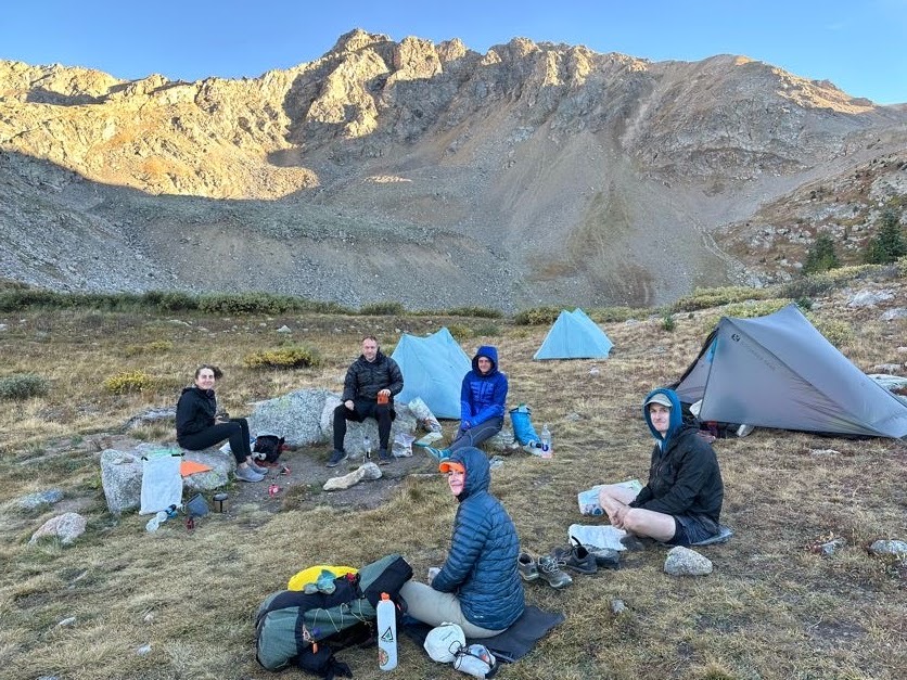
Our campsites were, in sequence, in a pine forest near Lost Creek, at the Bootleg Trail junction by Chalk Creek, at another pine forest near Dry Creek, at a spot near Pine Creek, in dispersed locations up the mountain from Twin Lakes, on the banks of Lake Anne, on the banks of Axolotl Lake, in a field along Chalk Creek (yes, this was a loop and this creek bisected it), on the banks of Hunt Lake, and along Foos Creek. Roughly, our campsites were 15-20 miles from each other.
Unfortunately, Colorado has suffered attacks by spruce beetles and forest fires that decimated the spruce/pine forests. At least two campsites of ours were in one of the many “ghost forests” in the area. In such forests, almost all the trees are dead, many have fallen, the remaining ones will fall eventually. Understandably, this made me very uncomfortable. Professor, who had backpacked the Loop the prior year, noted trees that he remembered being dead and standing at that time as still standing. His point was that the dead trees were unlikely to imminently fall. Also, we were blessed with good weather during our entire trip. There were no high winds. In my entire time on this trip I didn’t hear a single tree fall anywhere.
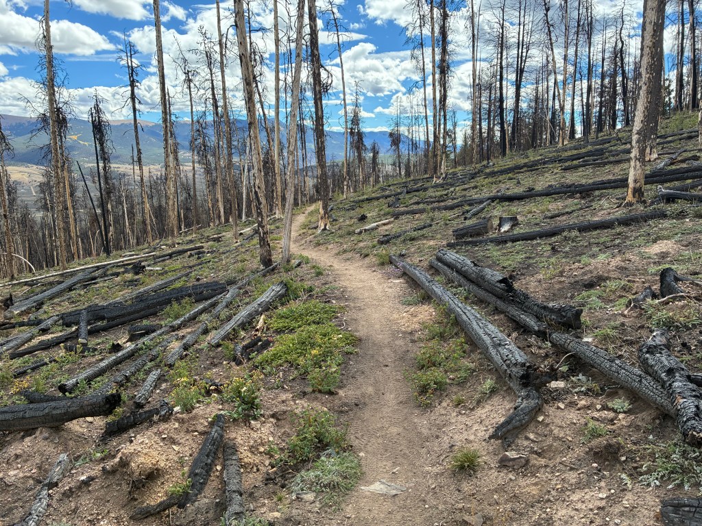
Nonetheless, I spent a lot of time selecting a site to pitch my tent in these “ghost forests.” I would choose a site and look all around me to evaluate the direction of the prevailing breeze, the lean of nearby dead trees, and the location of other fallen trees. In at least two occasions I pitched, saw a tree in a way I hadn’t seen it before, and re-pitched elsewhere. In some instances, I tried to measure with my eyes how far a particular tree would fall based on its height. Regarding one concerning tree, I asked Reid, a brilliant mathematician in their real life, whether it would likely reach my tent if it fell in my direction. Reid smiled and gave me the mathematical trigonometry formula to calculate this. “Great!” I thought. “So, what is the answer?” Reid frowned, I need at least one input for the formula—the height of the tree or the distance of the base to your tent.” Since I knew neither input, I just estimated by sight.
LESSON: I later learned from AI a field hack that requires no math. Hold a stick vertically at arm’s length so that the length of the stick above your hand is approximately equal to the distance from your eye to your hand. Then, while looking at the tree, line up the bottom of the exposed stick with the base of the tree. Walk away from the tree until the top of the stick lines up with the treetop. At that point the horizontal distance to the tree is approximately equal to the tree’s height. Who knows if this really works. AI is often wrong. I’d pair this method with my “by sight” method.
Water and Food Planning/Frozen Filters
Veronica packed almost all the food she’d eat for the entire trip and carried it all from day one. The rest of us divided our food in two, carrying half the food supply from US 50 to Twin Lakes and then the second half from Twin Lakes back to our car. We each mailed boxes of our second-half food to the general store in that “town.”
I didn’t weigh my food bag for each half of the trip, but by volume it was huge and felt ridiculously heavy. The food filled a 15-liter Opsak bag. To put this in perspective, my pack was only 40 liters, so my food took up over a third of my pack!
Most of us brought custom-made backpacking meals. I carried three dinners for each half of the trek. I had mixed my own beans, rice, and vegetables dehydrated meal that really filled me up. For variety, I also had a dehydrated Indian food meal I bought from an Indian grocer in Virginia. They sell the meals in a paper cup for one to make by just adding hot water—like a Cup O’Noodles lunch. It tastes much better than the Americanized Indian meals sold in backpacker stores. My third meal was lightweight, spicy ramen to which I added textured vegetable protein. I supplemented these dinners with a dinner of cheese sandwiches that I bought at Twin Lakes and a burrito I bought at Monarch Pass. For our first night on trail I ate the second half of a pizza I bought on our drive to the trailhead. It tasted better on trail than at the restaurant!
Veronica’s variety was even more austere than mine; she had only two types of meals on her dinner menu. Wisely, she had each meal in a giant bag and would parcel out even portions of one or the other at each mealtime. This dramatically reduced the trash she would have to carry. Over 9 days it is amazing how heavy food packaging/trash can be!
My breakfasts consisted exclusively of Bob’s Muesli. I just packed a whole bag of the grains for each half of the trip, eating a cup a day Veronica-style. I soon learned that I would have enjoyed more variety.
My lunches were tortillas with peanut butter and a variety of snacks—mostly dried fruits, nuts, Fritos, and candy bars.
Fittingly for a trek we called “Back to School,” we traded food with each other just as kids do in grade school. I got a great deal trading a Snicker’s bar with Professor for a mint chocolate protein bar. A vegetarian, I didn’t pack enough protein for this trip, so this was a good deal for me. Professor mistakenly bought a mint bar at the general store. He hates mint. So, this was a good deal for him. As is the custom for these things, we each shouted, “no takebacks!” after the exchange.
LESSON: Reduce food packaging to minimize trash weight.
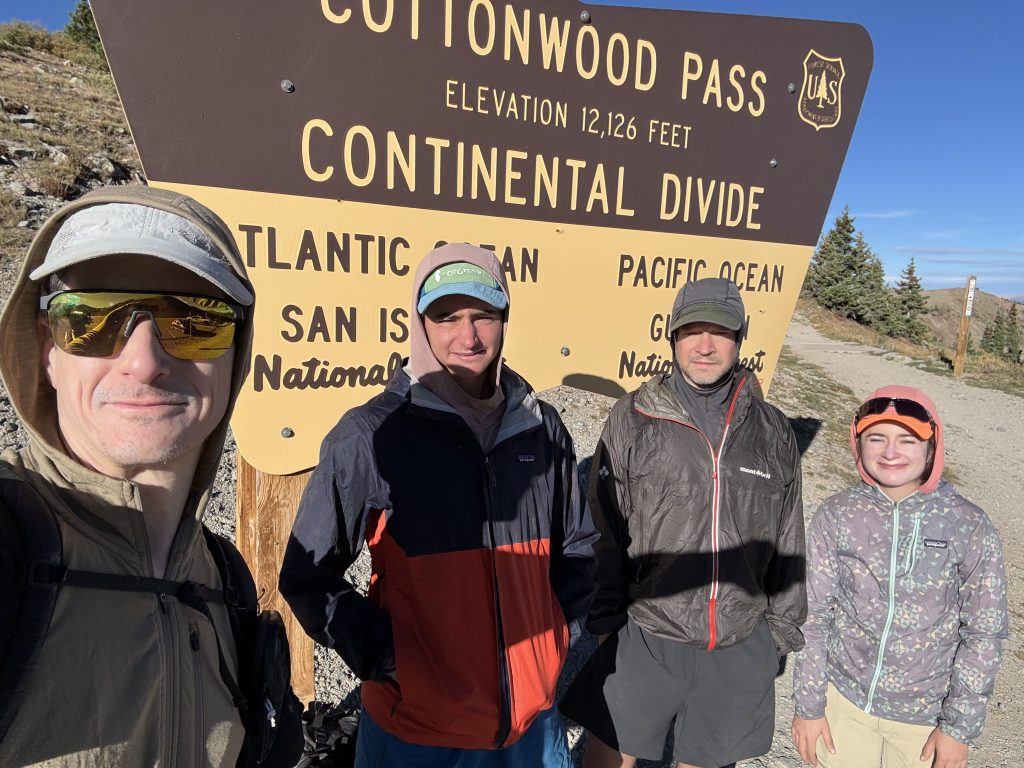
It was easy to get water on this trail. All marked water sources were flowing and there were plenty of unmarked sources. But for an 8-mile dry stretch southbound from Cottonwood Pass, we did have to contend with a heavy water carry.
Most of us filtered our water using Sawyer filters—as we typically do when backpacking in the Mid-Atlantic. One problem with these filters is that they break once frozen. They work by forcing the water through tiny micropores that trap bacteria and parasites, such as giardia. However, when droplets of water freeze in the filter they irrevocably expand the micropores rendering the filter ineffective.
On Wednesday night we camped along Lake Anne just north of Cottonwood Pass. This high elevation lake turned out to be our coldest night of the trip. I had planned for overnight lows below freezing, so I had everything necessary to stay toasty in my tent. However, coming off the summer, and having daytime highs on trail at an uncomfortably hot level, I was out of practice with winter practices. Professor and Veronica were, too. None of us slept with the filter in our pockets to keep them from freezing. Only Reid had the foresight to protect their filter. The next day, with some alarm, Professor looked at his filter to see the grossly expanded micropores. His filter unlike the more popular Sawyer filters, let one look at the micropores. He performed an integrity test, and it failed. Fortunately, he had water purification tablets to use as a backup.
I frowned at my Sawyer filter. I had no way of knowing if my filter had frozen, too, or not. I did not have any backup tablets and Professor did not have enough to share. It didn’t feel to me like the temperatures dropped below freezing in my tent. My water bottle had been resting next to my filter in my backpack. It had no water crystals or frozen chunks in it when I drank that morning. I saw no frost on my tent. Veronica shared the same experience she said. Reid, fortunately, slept with their filter.
With no choice, I continued to use my filter. I hoped that it had not frozen like Professor’s did. I did have some basis for hope: Professor said his filter had fallen overnight onto the ground while mine (and Veronica’s) was stowed in our packs three feet off the ground. This may have been the marginal difference necessary to have kept the filters from freezing. As of this writing, we may or may not have escaped giardiasis—the incubation period can be as long as two weeks after infection. We’ve been off trail for only twelve days . . .
LESSON: Be like Reid and sleep with your water filter if there is any possibility of freezing temperatures.
On Monday evening, as we camped along a nice stream on the eastern side of the Loop, I was disappointed to see a giant beaver dam blocking the lazy stream. Beavers are less than fastidious about using pit toilets. Let’s just say they don’t wash their hands after using the restroom. Plainly stated, they tend to foul the water around their dams. When we backpack in Dolly Sods in West Virginia, we are very careful to avoid drinking “beaver water.” Now, we had no choice. Professor advised that our water filters should adequately purify the water. He reminded me of the time when we were backpacking in the canyons of Utah and had to pull “cow water” from the canyon stream draining from a cow pie infested field just above the wash. We had survived that. Maddie, a botanist by education, was the closest we had to a wildlife biologist. I asked if the water would be cleaner upstream or downstream of the dam. Maddie reported that beavers swim (and spoil) both sides. However, she thought the water would be fouler upstream from the dam because the waste could collect there blocked by the dam. Professor agreed with that assessment. I pulled my water far downstream from the dam and filtered it twice. Fortunately, this occurred before Professor’s filter froze a few nights later.
Resupplies
There were three resupply opportunities on this loop: Hot Springs, Twin Lakes, and Monarch Pass. However, since we passed Hot Springs so early on the trip, only Professor and WB stopped there.
Twin Lakes is a small dot of civilization. The focal point is a general store/gas station. It was like a 7-11, but with a section for hikers with dehydrated food and camping supplies. In addition to the general store there were a handful of other buildings and homes. Everything but the general store looked deserted. Professor had hyped a pizza truck. Unfortunately, it was closed, along with the only restaurant. (The restaurant had a “for sale” sign on it, so it may be closed forever). The general store proprietor told us that everything shut down after Labor Day. He said this had been a very slow year for hikers. A persistent forest fire just north of Twin Lakes closed a portion of the CDT and CT for much of the season, steering hikers away from this small town and drying their businesses.
At the general store we all successfully recovered the resupply packages we mailed to ourselves there. WB had a momentary scare when the proprietor reported that her package did not arrive. Fortunately, his list had her last name and first name scrambled. Once corrected, she had her box, too.
There was no place to sit inside the general store, and the afternoon sun was blazingly hot. We ate bland 7-11-style fare, such as skimpy premade sandwiches and reheated frozen burritos. The proprietor treated us to free ice cream, though. We sat huddled in the shade of the building along a dirt road as we relaxed, ate, and repacked our backpacks with resupply food.
Since we were all counting on the burritos at Monarch Pass toward the end of our trek, Professor thought to call ahead from Twin Lakes to check on their operating status. We were all relieved to find that it would be open.
I made two cheese sandwiches to eat for dinner that night, along with some dessert, and hiked them up to my dispersed campsite. However, after setting up my tent, I could only find one sandwich! I assumed that I either mistakenly threw away the second sandwich or, more likely, it fell out of my overstuffed resupplied backpack on the climb from town. The single sandwich and the dessert satisfied me, so I was not devastated. However, in the morning, as I packed my tent, I found the second sandwich. It had fallen from my pack and a small animal had nibbled on it. Obviously, I couldn’t eat it. Worse, I had to carry it—for the remaining 80 miles of my hike through the hardest part of the trail!
LESSON: Don’t count on food trucks when backpacking.
LESSON: If you think you dropped something, look all around before giving up the search. Otherwise, you, too, may end up carrying for 80 miles a spoiling cheese sandwich you cannot eat.
inReach Adventures
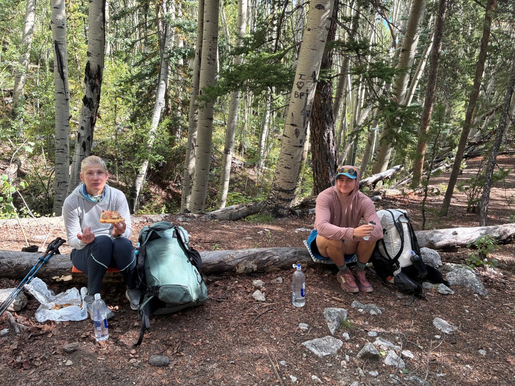
On the Friday night of our trip, we field tested our inReach communicators with each other. This small device, about the size of a hand palm, permits satellite texting. All of us had one except for WB. We tested ours on our first night on trail while eating leftover pizza from our lunch on the drive to the trailhead.
The inReach gave us great peace of mind on two occasions when the group split up. On one occasion, Veronica hiked far beyond the targeted campsite for that evening. On another, our designated campsite did not exist. That night we each wound up camping dispersed within a couple miles of each other on the slope up toward Hope Pass. It was nice knowing where everyone else landed.
As the only one without an inReach, WB communicated the old-fashioned way. On Thursday night, when she did not see everyone camped on the southern side of Axolotl Lake and hiked on, angry with us for changing up the plans, she conscripted a day hiker for communications. A guy was hiking up from Cottonwood Pass and back. Since he was hiking the way she had come, and in the direction of where we had planned to make camp, she sent us a message through him. Specifically, she asked him to look for a group of five unusually buff, good-looking hikers—like superheroes—to let them know she didn’t see them at the lake. Of course, with that description he had no trouble finding us and delivering WB’s situation. We relayed a message back to WB through him and she hiked the three miles back to us. This is how backpackers communicated before inReach.
LESSON: Bring inReach or another reliable satellite communication device when hiking as a group. It just makes logistics easier.
Animals
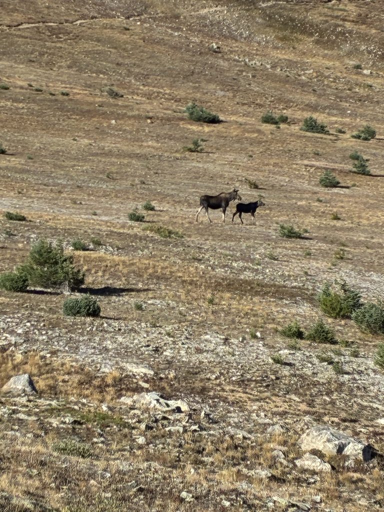
Of course we saw moose. The moose that treaded too close to my tent was not the only one. We saw a female moose (called a “cow”) and her baby (called a “calf”) on an exposed ridgeline. We stopped to take photos. Veronica later bragged about her “five moose day.”
I learned that elk hunting season opened the Saturday during our trek. I had not seen any elk but saw approximately 10 hunters. One told me he was not hunting elk but was hunting moose. “Good,” I told him. After my fearful night with the bull moose near my tent, I wanted moose to be afraid of humans.
We saw marmots, cute little groundhog-like mammals. When camping at Lake Anne we saw their dens all around the lake and our campsite. We feared a marmot army attacking us at some point. However, they did not make any appearance. The overnight temperature that reached freezing on the ground may have resulted in them hibernating. We also saw pikas, which are smaller than marmots but very cute. They cheered us on our hike with their short, sharp chirps as they ran alongside us.
We saw game birds, like grouse or turkey—I couldn’t identify them. We also chased some curious birds down the trail who just ran ahead of us rather than fly away. I later learned they were white-tailed ptarmigan.
I saw deer and, of course, squirrels. Some of the squirrels sat in a tree as Maddie passed below and they started throwing acorns at her. She later complained that this was “very disrespectful” of them. It was, but some squirrels are just bastards. We had some chipmunks regard us expectantly at dinnertime along the bank of Lake Axolotl. I don’t speak “chipmunk,” but I thought I heard two saying to each other about us, “please, please sleep with your food in your tents tonight; for the love of God, don’t hang your food in animal-proof bags!” I hung my bag in case these cute creatures were bastards like Maddie’s squirrels.
Spirituality
On Saturday morning, on a long climb up a mountain from Lost Creek, I heard what I thought was an animal sound. It sounded like short trumpet bursts. Was it a moose? An elk? A lost marching band trumpeter? The deep honking was intermittent and was getting slightly louder as I continued climbing. I started feeling delusional because my mind compared the sounds to shofar notes. A shofar is a ram’s horn that Jews ritually blow like a bugle on Rosh Hashanah, the Jewish New Year, one of our most important holidays.
# # # # #
Rosh Hashanah this year fell on Saturday, September 12—just a week later than my climb up to the moose or elk call. I’ve always spent this High Holiday at home in Temple. Unfortunately, Rosh Hashanah falls on a different day each year, just as Easter or Ramadan does. When I planned this trek, I hadn’t had the 2026 holiday schedule in my calendar and did not recognize my error until I was fully committed to this trip.
I considered foregoing the trip but then rationalized that several biblical figures had spiritual encounters in the wilderness. Moses first encountered God at the burning bush. He later interacted with God after twice climbing Mt. Sinai to receive two sets of the Ten Commandments. Before him Jacob had a spiritual encounter in the wilderness on his way to and from Haran when he was fleeing and reuniting with his brother. The list goes on: Hagar, Balaam, Elijah, Mrs. Manoah, Ezekiel, Jonah, Daniel. They all had spiritual encounters in the wilderness.
This is not surprising. When alone in the wilderness one’s concerns reduce to the elemental.
Do I have enough water? Where is the next water? Do I have enough food? Am I eating too much food? Am I eating enough food? Are there animals who will hurt me? Am I walking at a sustainable pace? Am I walking too slowly or too quickly? Will a tree fall on me? Am I going in the right direction? Am I warm enough? Am I too warm? Am I dry? Am I prepared for rain? Am I getting too much sun? Are moose more dangerous than lions?
I had downloaded a Rosh Hashanah service on my Kindle in advance of the trek and planned to wake before sunrise that holiday morning for a private moment. I did so very early on Saturday morning.
Perhaps a mind cleared of the mundane opens one to experiencing the divine. I did feel a spiritual connection as I climbed in the dark by headlamp up to the next mountain pass south of Cottonwood Pass. I prayed by Kindle, alone, as the sun rose over the Rockies. I won’t make it a habit to miss important holidays at Temple, but my experience became a lifetime highlight.
LESSON: “Surely God is present in this place, and I did not know it.” Genesis 28:16.
# # # # #
That Saturday before Rosh Hashanah, as I was climbing the mountain from Lost Creek to the sounds of the moose or elk mating calls that sounded like a shofar to me, I learned I was not delusional. I reached a man standing on the side of the mountain with a large, twisted ram’s horn. It was a shofar! He was blowing it into the valley below. I greeted him by saying “L’shannah tova,” Hebrew for “happy New Year,” a traditional greeting for the holiday. He smiled but looked at me quizzically. It occurred to me that he may not have been Jewish, but it didn’t matter. Hearing the shofar made me feel happy.
Graduation
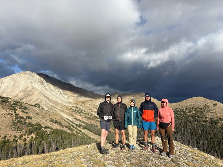
The Collegiate Loop was a great wilderness university for us. A tough trail, we all had completed the necessary prerequisites before the trip by so actively hiking in the mid-Atlantic all year. We were in great shape for the challenge. The elevation gains we practiced at home meant we only needed to acclimatize ourselves to the Rockies. Some of us discussed a future trip to the mountains of Poland and Slovenia for our “post-graduate” education. However, before we move on to bigger and better things, it is appropriate to declare our 2026 graduation superlatives.
Most Likely to Succeed: Reid. Reid’s climbing strength and foresight to sleep with their filter on a night that edged freezing will suit them well.
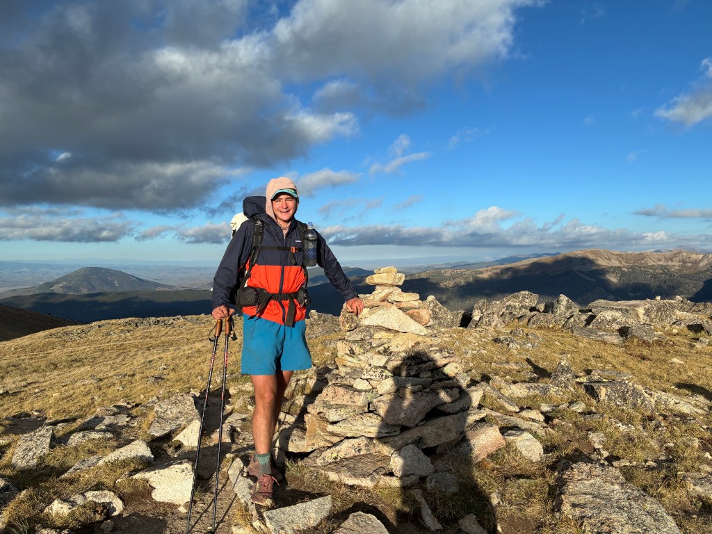
Most Likely to Get Going: Veronica. Veronica fully embraces the concept of the “the early bird gets the worm.” No one will outstart her—except for me on a prayer day. She was (almost) always the first awake and hiking. As poet Shel Silverstein advised: be an early bird, “but if you’re a worm, sleep late.”
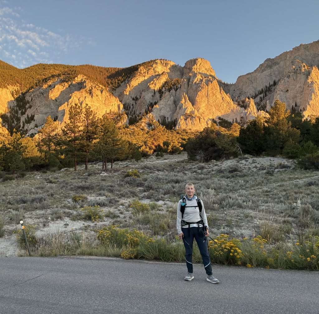
Most Likely to Come Back as a Professor: Logan (of course). One could ask him almost anything about the trail: history of the trail, identification of wildlife along the trail, location of campsites, and location of water sources. He knew everything! It was very nice hiking the Loop with a guy who had previously completed it.
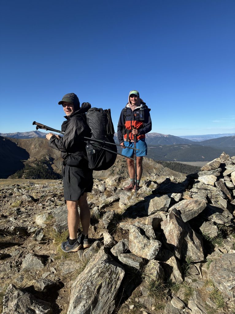
Most Improved: Maddie. When I first backpacked with Maddie she habitually hiked at a pace much, much slower than mine. This time, she would regularly surprise me. I’d finish a climb at an aggressive pace, pause to take photos, and then turn to see Maddie right behind me, smiling!
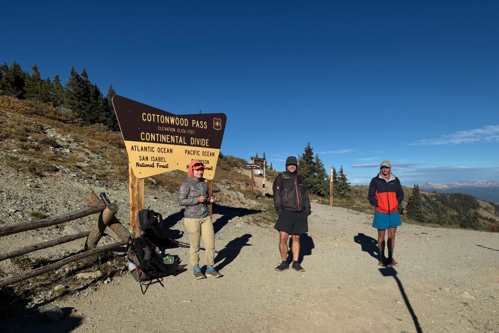
Most Likely to be a Superhero. WB. WB would often be the last out of camp in the morning only to mysteriously reach the core group by mid-day. The core group was not hiking casually. We were crushing miles! Yet, WB caught up to us as if we were standing still. WB must have used her teleportation superpowers to catch up because, when she did, she didn’t even look fatigued! Seriously, it is a Wonder why this Woman won’t accept the obvious trail name for her!
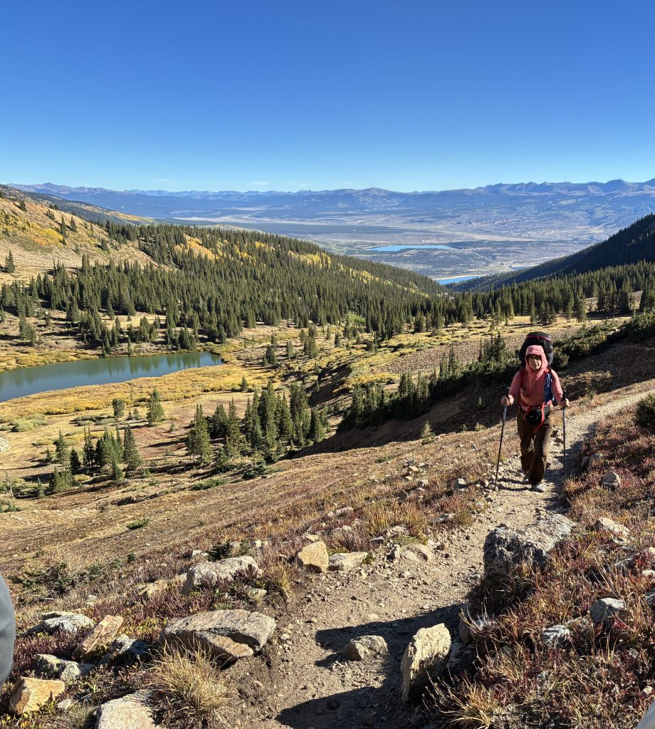
Most Likely to Write a Bestselling Book: Ahem. Me!
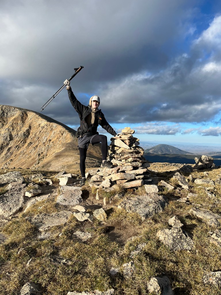
—- David O (“Spider-Man”)
NOTE: Logan has not accepted the trail name “Professor” (yet). Unless he does, the name is applicable only to this Trip Report under literary license. I’ve been recommending trail names to him for years: Scorpion, Sting, Man with No Trail Name, Just Logan, More than ‘Just’ Logan, and now Professor. This guy is picky!


Leave a Reply