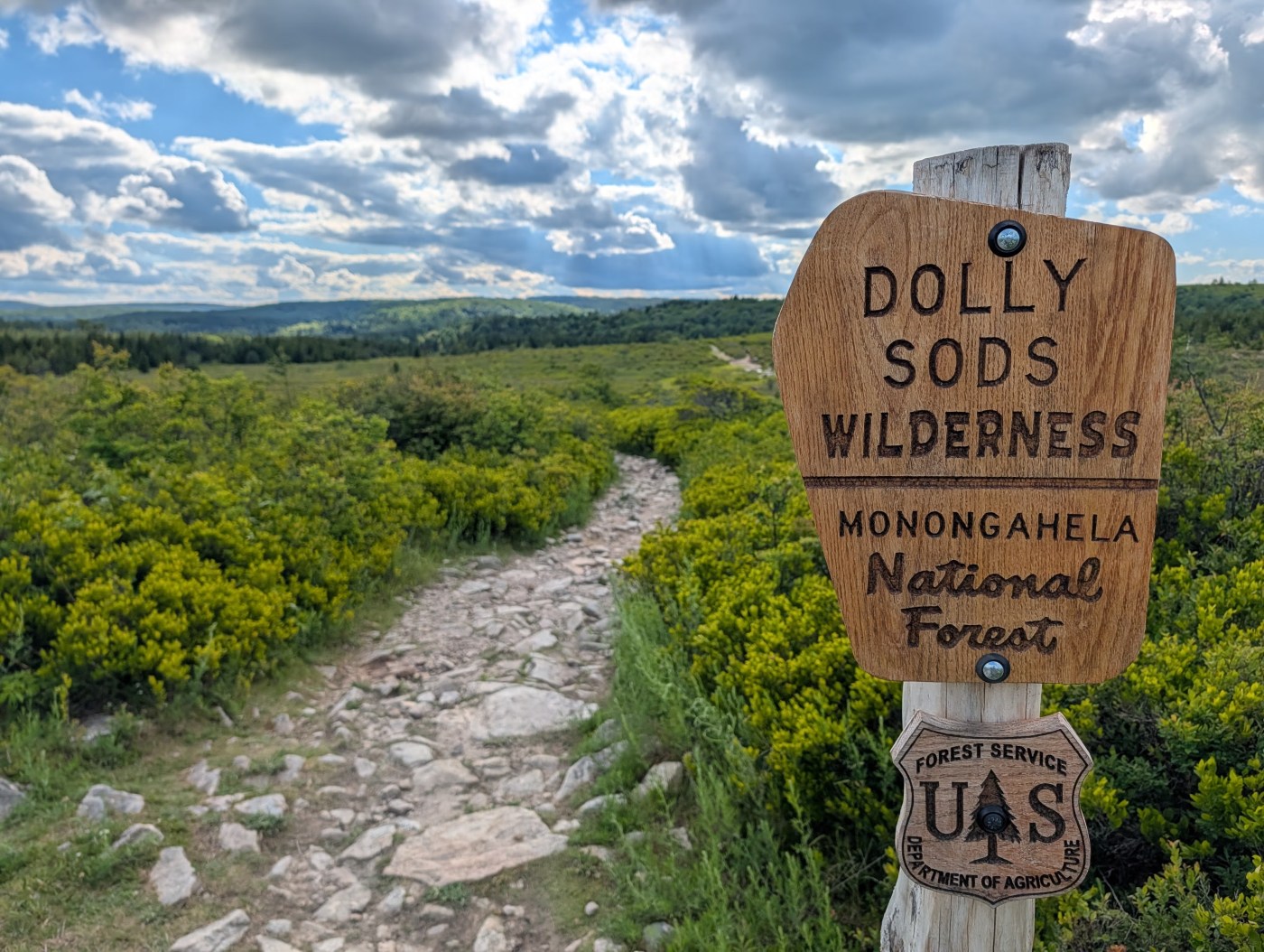
Dolly Sods is a unique place with an interesting history. Dolly Sods gets its name from a German settler Johann Dahle and the local sods (a term for a field or meadow). Over time the name “Dahle” shifted to “Dolly.” It sits at the edge of Allegheny Front, more or less along the eastern continental dividing line between water that flows into the Mississippi River Basin rather than into the Chesapeake Bay. In the late 1800s and well into the early 1900s, logging and uncontrolled fires left the area ecologically destroyed down to the rock. A Great Depression-era CCC crew planted trees at Dolly Sods in an early attempt to begin its resurrection. During WWII, the U.S. Army used the area to train soldiers, including firing artillery at the mountains for target practice. In 1975, Dolly Sods was designated a wilderness area as part of the Eastern Wilderness Areas Act. In 1993, the Nature Conservancy acquired and donated additional acres north of Dolly Sods, but the addition wouldn’t become officially part of the wilderness until a 2009 act of Congress. From the destruction a century ago, life has gradually returned to the Sods with various parts in transition from bog, to brush, eventually to forest.
I have my own history with Dolly Sods. My boy scout troop growing up would backpack Dolly Sods each and every Memorial Day weekend. From what I remember, most years it was kind of a muddy mess but it’s where I grew to love backpacking. Rain or shine, we’d return to Dolly Sods each year like clockwork. It helped to know that good or bad, there was an all-you-can-eat Pizza Hut buffet waiting for me on the way out of town.
A trip to Dolly Sods may be preceded with various warnings of its dangers, some perhaps more sincere than others. I’ve read that in 1852, Dolly Sods was described in a magazine as “an ill-omened region, filled with bears, panthers, impassable laurel-brakes, and dangerous precipices. Stories are told of hunters having ventured too far, becoming entangled, and perishing in its intricate labyrinths.” Most trailheads into Dolly Sods have signs explaining the danger of unexploded ordinance (“UXO”) still left over from the military training in the area and what to do if you find any. The Purple Lizard map for Dolly Sods cautions, “WARNING: Visiting this part of West Virginia has inherent risks. You may not want to return to your regularly scheduled life. You may find yourself deep in the Mon with no thought of ever leaving. Please plan accordingly.”
In spite of the warnings, no one these days seems afraid of Dolly Sods. On the Friday afternoon of our Dolly Sods trip, the parking lot was filling up fast. I was beginning to get nervous whether the crew meeting me from Ohio and DC would have space enough to park.


I had been in Dolly Sods since Sunday, doing trail work through the American Hiking Society’s Volunteer Vacation program. It had been a great week with an amazing crew of volunteers, National Forest Service staff, and Dolly Sods Wilderness Stewards.
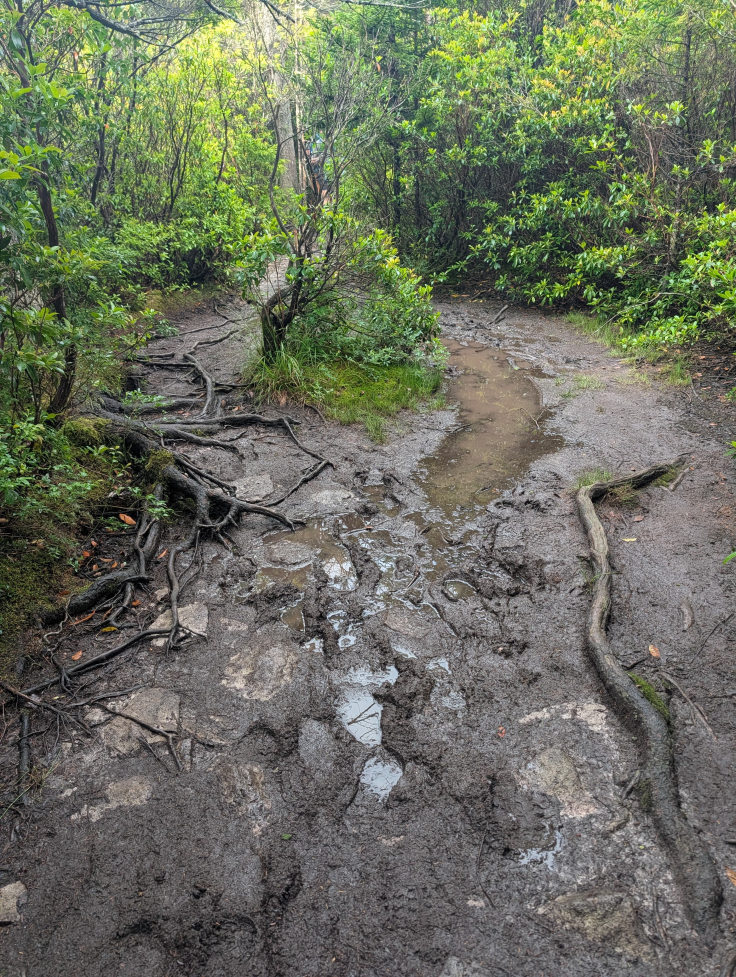
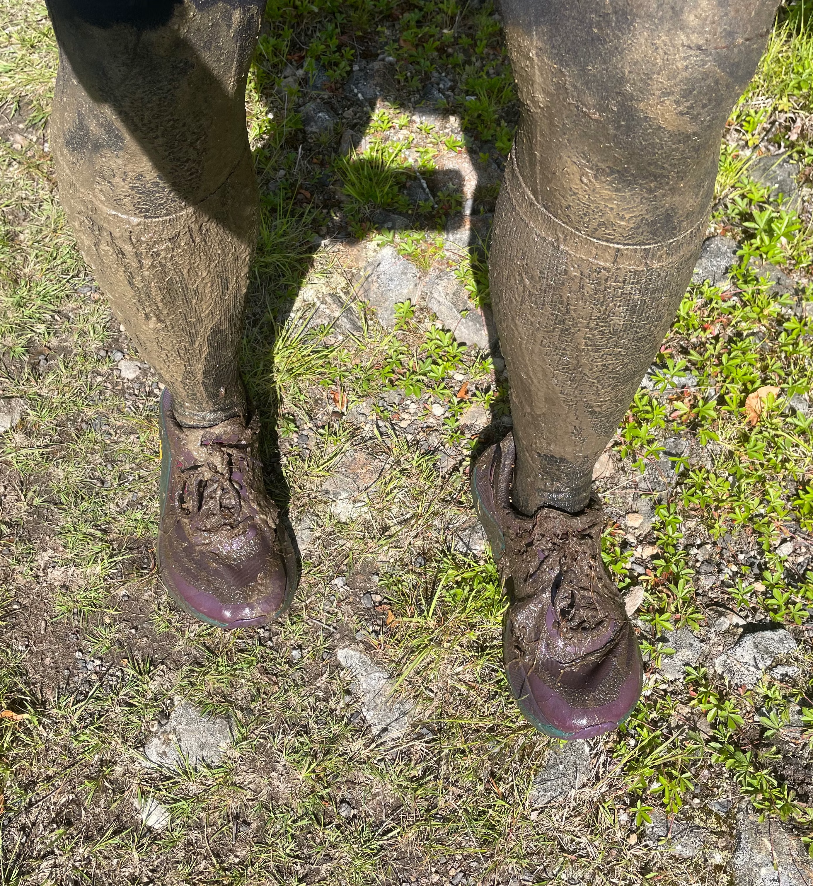
Friday afternoon I hiked in early to set up a hammock in a lovely campsite (the location of which I won’t describe here lest it become too popular). Not long after I got situated, Vera arrived and began to set up her own shelter. I ran up to the trailhead to see if the DC crew had arrived yet, but didn’t see them. I chatted with Bill, one of the Wilderness Stewards I had worked alongside earlier in the week. He was posted at the trailhead, helping out visitors. We talked about the route I was planning and how I was not looking forward to the notoriously muddy Dobbin Grade Trail. He gave me a fantastic tip about Dobbin Grade: if you use your trekking poles to feel around for the rock below and stick to the trail you’d only get muddy up to your ankles he promised. He said that Dobbin Grade was originally a railroad they placed through swamp during the logging era and the builders created a rock berm for the track; if you step off the rock berm, no telling how deep the mud would be.
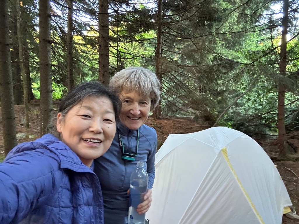
Kudos to Aileen; because I was pretty sure I’d be off grid all week, Aileen volunteered to manage the waitlist / carpool from Vienna. (As it turned out, I could get cell service at Bear Rocks and at the Sundew Trailhead but virtually no where else in Dolly Sods). I posted a note to the group chat about the campsite location and got a like from Beth that confirmed my message had gotten through. I made my way back to the campsite where I relaxed in what felt like paradise. I was thrilled when eventually the rest of our group arrived: Aileen, Beth, Philip, Ryan, and Sophie. The week before there were 9 people signed up and 13 on the waitlist, but Aileen explained that lots of last minute drop-offs had shaken up the list quite a bit.
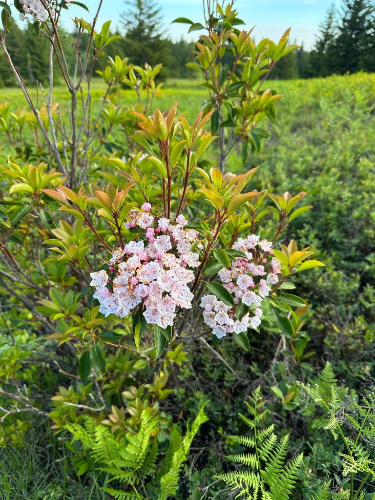
At some point Friday night, Beth floated the idea of changing up the itinerary a little bit for the weekend. Her plan involved adding some miles to take a side trek to a place where she’d seen some amazing mountain laurels on a previous Dolly Sods trip, but taking away some miles to camp near Lions Head instead of down by Red Creek. The group seemed sufficiently either persuaded or indifferent that we settled on adopting Beth’s recommendation.
On Saturday things went great with excellent weather, great views, and easy miles. Beth and Philip woke early to catch the sunrise back at Bear Rocks which sounded spectacular. Beth’s additional miles in hopes of mountain laurel blooms was somewhat of a bust. However no one seemed to mind, especially as other segments of the trail greeted us with loads of them.
The only downside Saturday from my perspective was that the rain from Thursday had left many spots on trail waterlogged or muddy, but that’s to be expected for much of Dolly Sods regardless of rainfall.
There was a 40-mile race going on that day, part of which ran through Dolly Sods, their course marked off by red flags. We did see one runner but only one, so perhaps we saw the winner. We stopped to set up camp in the camp spots near Lions Head.
Beth was concerned it would be packed since it had been a very crowded weekend in Dolly Sods, but it was thankfully not that bad. We had gotten there fairly early in the day and spent time at the lions head overlook, chatting around the campfire, taking naps, or doing some reading (Ryan impressed us with having packed two thick paperbacks). Vera and Sophie made us all laugh with some hilarious trail stories. It was a very relaxed day and just what a lot of us on the trip seemed to need after stressful weeks.
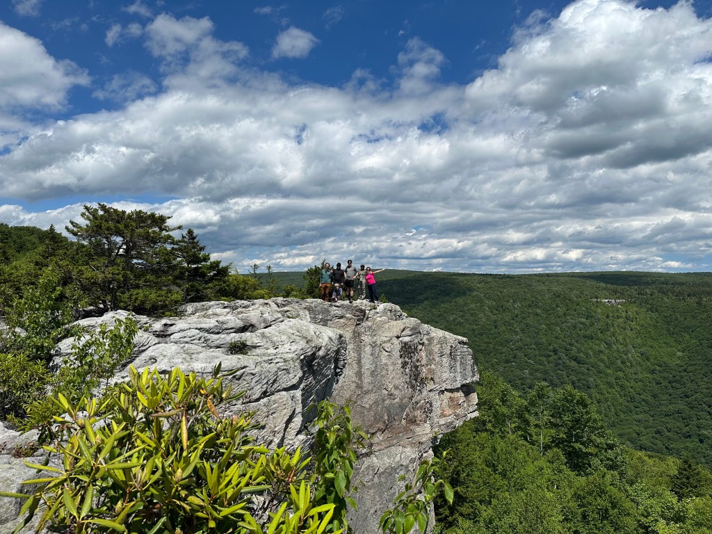
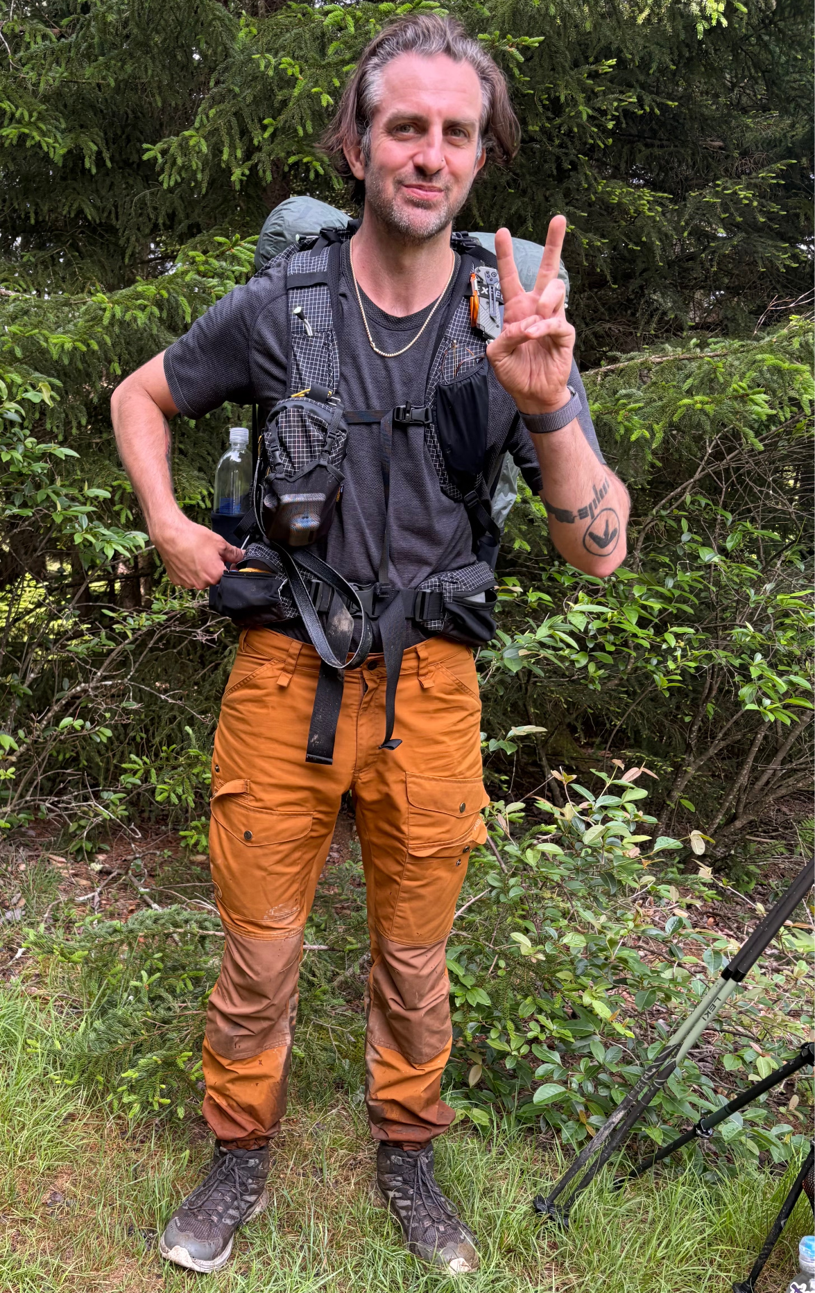
On Sunday we started the day with a final view from lions head before starting the trek back to the cars. It had rained a little Saturday night so the rhododendron leaves slapped us with water like a car wash. In the back of my head I was wondering just how bad the Dobbin Grade Trail was going to be. As it turned out, I shouldn’t have been worried because Vera, Sophie, Aileen and I accidentally missed the worst of it. At some point we’d accidentally turned onto Alder Run Trail and when Vera alerted the others that we’d gotten off course, none of us were worried because it met back up with our route further up. (Aside: Alder Run Trail is on the Caltopo, but isn’t on Forest Service or Purple Lizard maps.) When we eventually got back on Dobbin Grade the remainder wasn’t all that deeply muddy. Philip, Ryan, and Beth had done the muddiest Dobbin Grade section that we others had inadvertently skipped. Philip suggested that it was not nearly as muddy as he was worried it would be and agreed that Bill the wilderness steward’s tip about staying on the rocks served him well. Beth got considerably more muddy than Philip, but I also suspect she kind of liked it.
On our final mile back to the cars, I reflected on how this DC UL backpacking trip had been a delightful capstone to an already great week spent out in Dolly Sods. Though decades ago a visit to the Pizza Hut would have been the obvious choice, those of us heading east stopped at Pupuseria Emerita in Moorefield.


Leave a comment