
I. “I can’t wait to read the trip report,” Karan said with a sly grin. It was the Wednesday before the trip. We had met up for a goodbye dinner. He couldn’t join us on the trip. But if he didn’t have family plans would he have ventured out in July on an infamous Mid State Trail section that is more jungle briar than foot path? Michael and Jen opted out themselves after pondering the rising heat and my aggressive hiking plan.
II. “If Evan ever asks me to go on another backpacking trip, I’m not going! In case I waver, remind me of this conversation!” Mark said to his wife. He called her on the phone as he pounded out the last, sweaty miles of our tough 25+ mile Saturday.
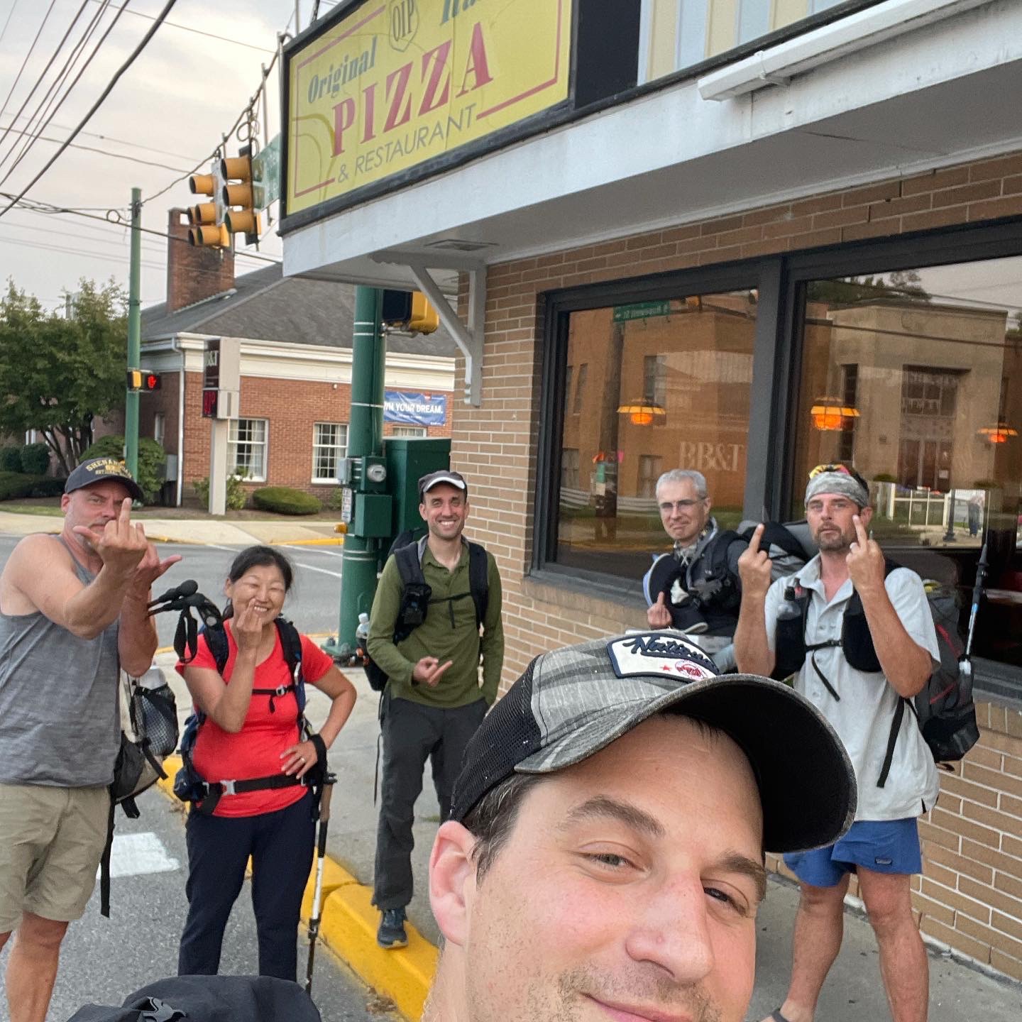
III. “F$ck that man!” Claudio bellowed as he tossed open the front door at the Juniata Hotel and Bar in Everett, Pennsylvania. He was pointing at me. “Get that man a beer,” I responded with a laugh.
It certainly started swell. It most definitely ended with joy (and beer). But sure, there were indeed some challenges in between. Wouldn’t want it any other way.

I knew I needed to get one last outing with DC UL Backpacking before moving to Canada. In the roughly seven minutes of planning it took, I had a eureka moment to finally go hike the approximately five miles of the Mid State Trail (MST) through Everett, Pennsylvania I had never actually gotten around to in 2015-2017 when I section hiked the rest of the MST. I had hiked the Tussey Mountain ridge south (and north) of Everett in the summer back in 2016-2017 and thought it was stunning despite being slightly overgrown. Seemed like a no-brainer to go back and re-hike enough of it to get a full 20 plus mile day for our Saturday, gloriously ending in Everett to celebrate with food, drink, and a night at Tenley Park to celebrate.
I gathered like-minded backpackers and we (Evan, Sophie, Claudio, Shane, Mark, and Andrew) rendezvoused north of Everett to leave a few cars at our destination and drive south to start our northbound MST hike. I arrived last and found a strange scene at the Blue Triangle Hardwoods parking lot: Claudio pulling Sophie’s driver’s side door apart. The insides of the door, that is. Turns out Sophie’s power window motor decided to die on her — with the window down — as she waited for the rest of us to arrive. Good thing we had Claudio around as handyman to fix it!


We piled in a couple cars and drove to the Beans Cove Rd. parking area on the MST, not far from Sweet Root Natural Area. The sun was setting and though a few bugs were buzzing about as we jumped out of our vehicles, the pine and mountain laurel of the ridge welcomed us with open, woodsy arms. I smiled. Back on the MST at last! (For anyone keeping track, we were starting at approximately kilometer 13 of the MST as it headed northbound in what is considered Section 1 in the MST guidebook and website. The plan would be to hike all of 21 kms of Section 2, which ends at Ashcom Rd. south of Everett, and do the first 10 kilometers of Section 3 going through Everett itself. When I hiked the MST before, I simply started sections on the outskirts of Everett, skipping this walk through town. Everett is the biggest city on the MST and while there are a few blazed options of sorts, it was never exactly clear what the preferred “trail” was through there.)
We hiked 1.5 kilometers at night to reach one of the few designated campsites on the MST. It wasn’t great as far as primitive sites go, but it didn’t need to be. We all found a spot to set up our personal shelters and proceeded to hang out and finish the beverages we had packed in. Then we hit the sack, had a pleasant night’s sleep under the swaying pines, and jumped up again at 5:30 a.m. to begin our planned 23 mile day on the trail.

The morning was cool as we ascended Martin Hill — the highest point of the MST — and descended back down again to follow a creek valley. The weather was great. The trail was pristine. Thanks to Andrew for spotting a perfect water source gushing out of the trunk of a tree, we filled up on water before our expected long, dry ridge walk. When we finally started to ascend back up the ridge, Andrew’s speed picked up and we all figured we wouldn’t see him for the rest of the day. No bother, we’d all enjoy ourselves on a ridge the guidebook notes as being reminiscent of the gorgeous North Fork Mountain Trail in West Virginia. We were pumped for a great day. We took a nice break at the first expansive overlook and noted gleefully how many more such spots were marked with asterisks on our map.


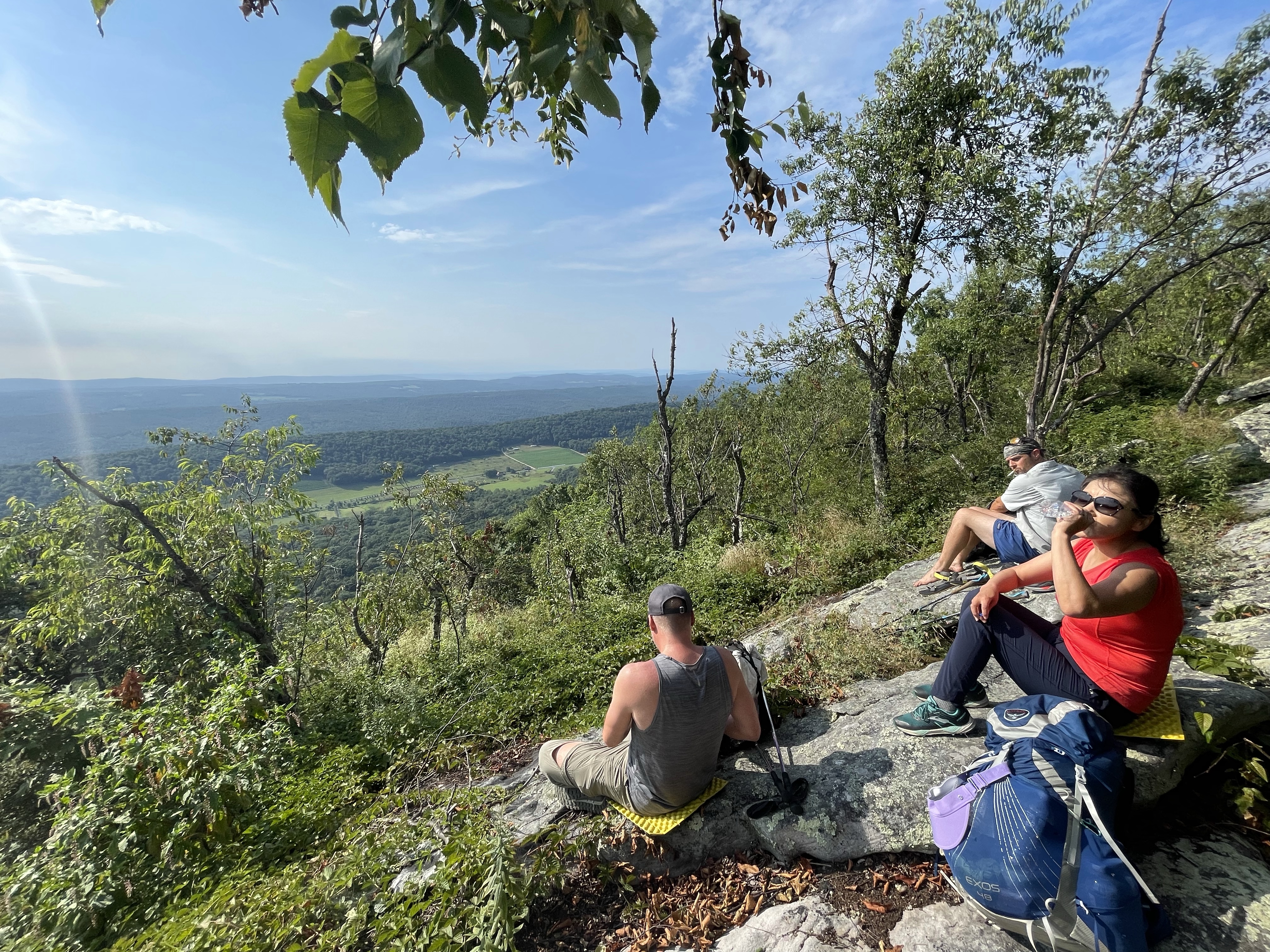


From there, however, things began to take a little turn. Though we had feared high heat and the need to carry upwards of 6 liters of water each, the temperature and weight didn’t really affect us too much. For the most part, it really did stay in the 70s for much of the day. But the thorny briar of wild berries and other difficult bramble proved worse — much worse — than on my last outing up here. Karan and others were worried and had indeed warned us as well. But we didn’t expect to be fighting through a veritable jungle of blade-like pickers.
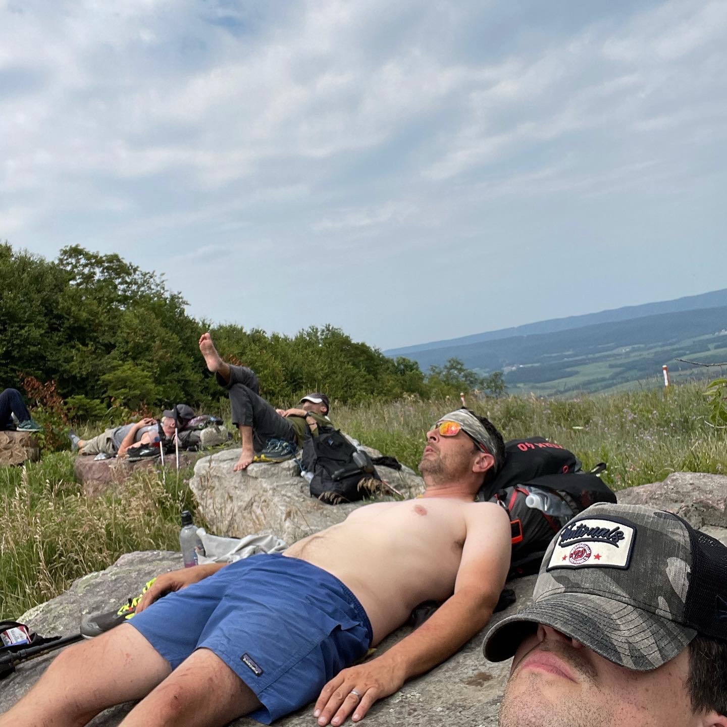
Andrew slowed down, demoralized by the nearly impassable trail. Claudio and the other fast-moving backpackers next hit the wall, dropping down to almost one mile per hour to fight their way through the underbrush. We took turns “breaking trail” by swinging our hiking poles or trying to squeeze through the dense briar. Mark might have regretted his tank top choice for trail attire too. After some slow-going kilometers, we decided to take a long lunch break at an overlook where a gas pipeline bisected the ridge. It wasn’t but a couple miles (sorry to switch in and out of metric system here) and would be good to regroup. It was a loooong and painful couple miles. The only good thing to be said about the trail conditions up there was the fact that it was actually well-marked with fresh orange MST blazes that turned out to be easy to follow even in the nonexistent (at times) foot path.
We gathered and spread out to rest as planned at the overlook. Claudio’s legs were torn to shreds. He had picked up the trail name Tarzan for badass antics on the AT as a thru-hiker, which included usually opting for shorts over pants. Tarzan had met his match, however. We realized that if we continued on the ridge as planned for another six plus miles we would either all be similarly torn up, pants or no, or at the very least roll into Everett too late to buy beer and food. We had set a goal of getting to town by 6:00 p.m. to make sure to hit a beverage store down the block from our preferred food spot, Original Italian Pizza (OIP). So we spotted a way to get off the ridge and parallel a number of miles in the valley before reconnecting with the trail. There was unanimous consent.


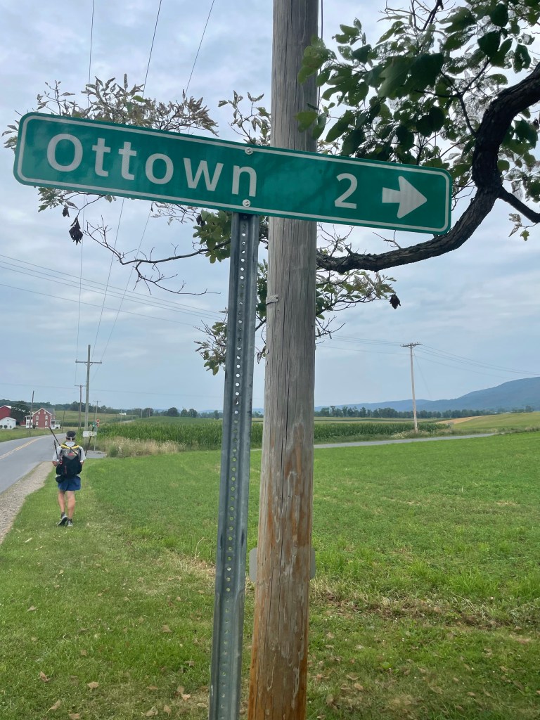
As the miles piled up and the afternoon dragged on, we did indeed find ourselves off the ridge proper and traversing scenic farmland. This definitely added a few total miles to our overall hiking day but most definitely saved time compared to the jungle up high. Some light and welcome rain rolled through. Eventually we crossed back toward Tussey Mountain after visiting Ottown, which seemed to me a township comprised of three total houses, and approached the orange-blazed MST one more time.
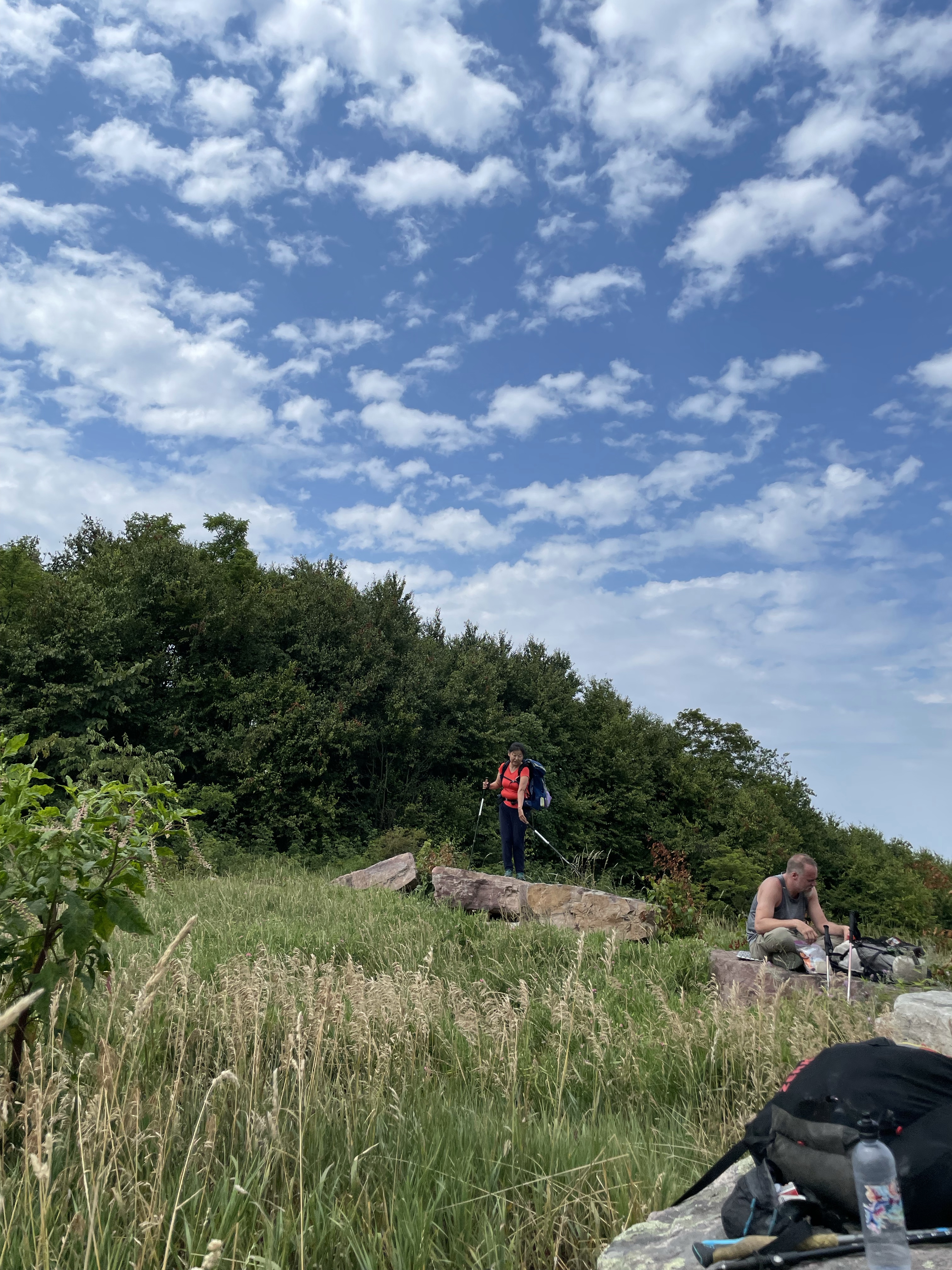
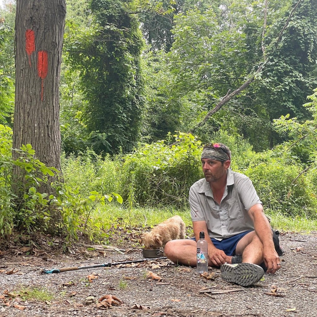
A couple dogs joined us out of the blue on the trail, a little too far from houses to be understandable. They were cute, terriers of some sort. One had a collar. And though they weren’t emaciated yet it didn’t make sense that they were the type of dogs able to survive in feral fashion out here. Claudio and Andrew made sure one of the dogs got water (the other had scampered off). There had been a house not too far back that had what seemed to be dozens of dogs on property. We assumed/hoped that these dogs somehow belonged to that abode and eventually pushed on up trail. Just as Andrew predicted, we even hit stinging nettle.
Claudio and I ended up in the vanguard as the trail — again — thickened into a dense tangle. I kept trying to keep up with him to laugh it all off. But he wasn’t in a talking or laughing mood by this point. I don’t blame him, though, because with exposed legs every step probably hurt. He and I finished the trail as it hit Ashcom Rd. and immediately proceeded under the highway overpass to hike along the old road and R&R tracks alongside the Little Juniata River. It was a bit longer than I had anticipated mentally, and occasionally, yeah, there were some more overgrown sections. But we hiked it. And ate berries along the way. Claudio and I met with the rest of the gang at the bridge crossing into Everett proper. The others had decided to forego the actual routed MST and use the direct road instead.
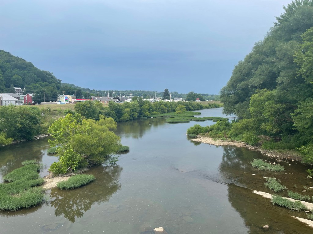
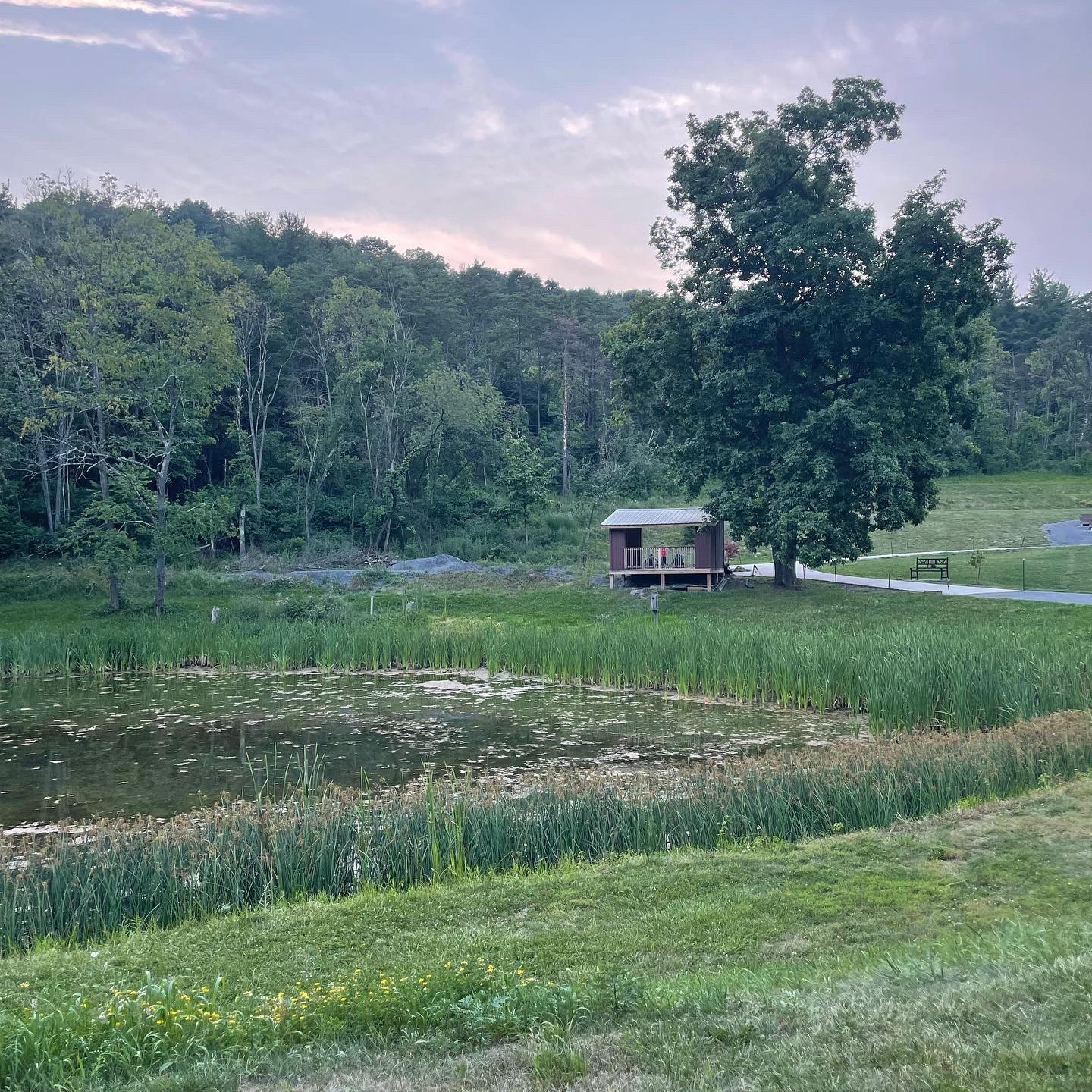
And there we were. 25 miles down for the day. The worst behind us. Everett, Pennsylvania before us. I quickly spotted a fantastic dive bar, the Juniata Hotel and Bar, in town and we set up figurative camp for a bit to suck down some beer and jello shots. This was the scene Claudio, the last to arrive at the bar, entered with his loud expletive lobbed in my direction. After that, we hit Original Italian Pizza for a feast, just as planned. From there we strolled to Tenley Park, set up camp in the gorgeous new shelter overlooking the frog pond, and let evening relaxation, the fun part of the hiking day, revive our spirits.


Come Sunday we had but a few miles to go to walk back to our cars at Blue Triangle Hardwoods, grab a tasty breakfast together, and go on home. I was happy. It took a few years to get back and hike the flat town kilometers through Everett. That deed is now done and my perambulation of the mighty Mid State Trail complete.
DC UL, I’ll miss you. You know you’ve got friends for life when they join you for a trail like this. Thank you, Andrew, Claudio, Mark, Shane, and Sophie!

Leave a comment