
Cassie, Erik, Sharon and I left Vienna metro Friday on time and battled I-66 traffic on our way out. As we drove by the Bear Rocks Trail Head after the requisite Sheetz stop, we noticed the long line of cars parked off the road. I was returning to Dolly Sods after two years, and it seemed that the area had grown even more popular. We managed to find a parking spot at the Blackbird Knob trailhead just off the road and started hiking. In the dark, we got off the Blackbird Knob trail which resulted in a bit of bushwhacking. About a mile in, we found spots near Alder run and set camp. About an hour later, Brian C. found us and setup as well.
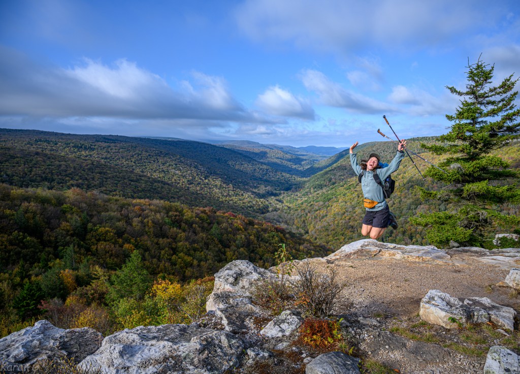
We woke to chilly temps (around 40 degs) and hit the trail early. After a couple of miles, we took the Red Creek trail which connected us to the Fisher Spring trail. The water-levels in the creeks were on the low side after a dry summer, but still plentiful. The upside was that the trails weren’t muddy and stream-crossing was easy. Along the Red Creek trail, we passed many campers who were still asleep or hanging at camp. Hiking the Rohrbaugh Plains trail was nice. We came upon the beautiful viewpoint – and we got a glimpse of the early fall colors.

After a little road-walking on FR-19, we entered the Roaring Plains area via South Prong Trail. We took a lunch break at the campsite where the trail makes a u-turn. Sharon caught up with us here and from here on we hiked fairly close to each other. As we started on the unmarked trails, I noticed some signs that this area was getting more foot traffic too. We noticed many people setup in the area, and came across ~10 people while hiking. The trails seemed easy to follow – I had to use my GPS very few times. It was still very pretty – I certainly prefer Roaring Plains to Dolly Sods. The ferns were bright and yellow, we saw bright-red colored berries, and the views off the Canyon Rim were scenic.

Memories of Route Finding Course 201 (‘the pit of doom’) flashed back as we hiked the dense TeePee trail. The hiking was easy once we made it to Boars Nest trail. Cassie tested Erik with some puzzles which he solved in impressive time. At the Red Creek Trailhead, Sharon found a phone on the ground. As she was figuring out what to do, the owner of the phone came back and graciously thanked her for finding it. At the base of Stonecoal trail, I convinced Erik and Cassie that there was water at the top right next to the turnoff towards Rocky Point trail. Alas, my memory served me wrong – sorry for the extra 0.5 mile walk, guys! We met Brian C., who after hiking bonus miles in Dolly Sods, cut his Roaring Plains miles short. All of us did make it to Lion’s Head before sunset. We setup quickly and enjoyed the views right as the sun went down lighting the foliage.

Another chilly night, and another early start. The forecast called for rain, but since it was dry we decided to stick to our plan. We resumed hiking on the Stonecoal trail. It sprinkled slightly along the way. The views turned more scenic and open when we got near the Raven Ridge trail. The clouds appeared dark and threatening to the West. The rocky section north of Dobbin Grade trail junction was pretty cool. Slowly and steadily, the miles passed by. We were reunited with Blackbird trail and the rest of the hike East to the cars was uneventful. It started raining again just as we started driving. We stopped at El Rancho in Moorefield – the food was pretty good. The ride back was easy (for us riders) – Thanks to Erik for driving.

Overall, our splits were ~1/26/13 miles (rough plan: https://caltopo.com/m/78QT ). There are some photos on the meetup page and some on this link. The weather was fantastic. The hike was challenging, but I don’t know if it is at the ‘scharfing’ level – I think it was maybe a notch lower. Erik, Cassie, Sharon, Brian C. – Thanks for joining me on this trip. I had a great time.
Karan

Excellent photos, as always. It was a beautiful trip, and I agree with you completely about Roaring Plains. Better views and fewer people.
LikeLiked by 1 person