When looking at the schedule for the Wind River High Route, some of us decided to take 2 more vacation days and extend the trip to get an additional 4-5 days hiking out west. While we weren’t positive what we’d end up wanting to do — would we all be exhausted from the high route, or would we feel strong and acclimatized? — we focused in on the High Uintas Wilderness and I put together a variety of options for different scenarios
The Uinta mountains are an east-west range in northern Utah, just a couple hours drive east of Salt Lake City. Most of the area is at fairly high elevation, but the mountains generally aren’t overly rugged and there’s a huge network of trails throughout the area. The Uinta Highline trail runs for 120 miles through the range, and while we only overlapped with it for a short period, I’d recommend it to people looking for a vacation-length hike.
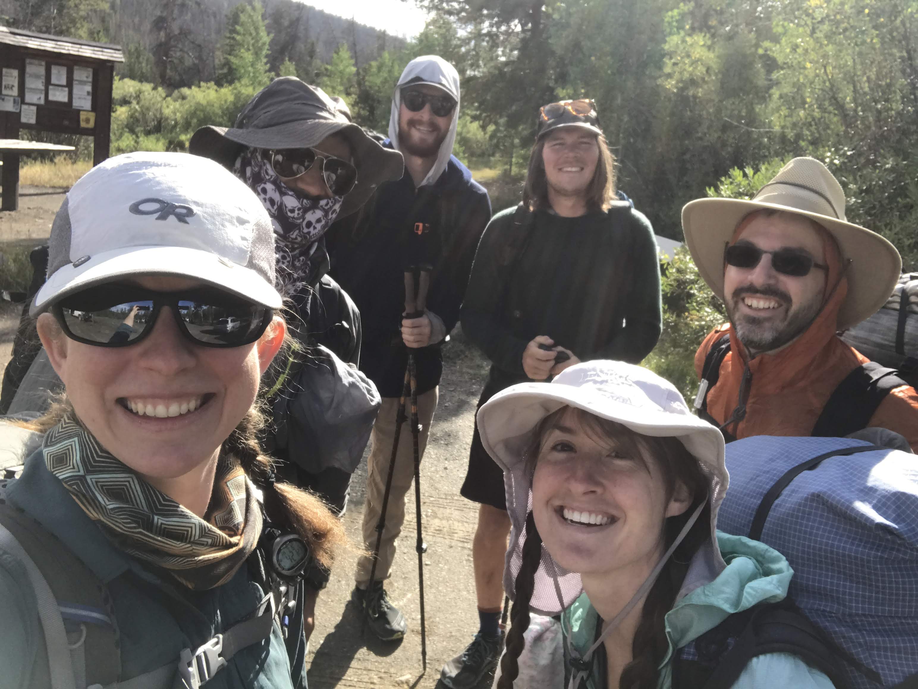
Our “plan A” was a 55 mile loop starting from Henry’s Fork Campground, and it ended up working perfectly for us over 3.5 days and 3 nights. After finishing up some errands and laundry in Rock Springs, we (Karan, Kylie, Brian, Erik, Greg, and myself) got on trail Wednesday afternoon. As we hiked in along the moderately graded, well maintained trail, it felt like we had superpowers – we could walk so easily! And even talk while walking! Very different from the talus and scrambling in the Winds. The miles passed easily, and we took turns asking and answering questions down the line.
We made it a little over 4 miles before deciding to pull over for the night, seeing that the sky was getting a bit cloudy. As we were setting up our shelters, it actually started to snow! This was the only precipitation we got on the trip, although all of the nights dropped just below freezing. The snow didn’t deter us from building a campfire, though!

On Thursday morning, we kept hiking in through the valley towards the main mountain range. Our big goal for the day was to summit King’s Peak, the highest point in Utah at 13,527’, but first we had to get over Gunsight Pass (and finally make it into the sunlight after a long morning hiking in the mountains’ shadow!). From there, there isn’t a trail that goes directly to King’s Peak, but some route research suggested that it was possible to cut across a saddle and take a shortcut. Trickier travel, but still likely faster than staying on trail, dropping into the valley, and then having to regain all that elevation.
From there, there isn’t a trail that goes directly to King’s Peak, but some route research suggested that it was possible to cut across a saddle and take a shortcut. Trickier travel, but still likely faster than staying on trail, dropping into the valley, and then having to regain all that elevation. After some deliberation, the group decided to go for the off trail challenge. I’d slipped in a stream crossing earlier and wanted my foot to finish (or at least start!) warming back up, so I stayed on trail and went down to the valley while the rest adventured off. It took a lot of *very* hard work, exacerbated by the last night’s snowfall, but everyone successfully made it to the peak!

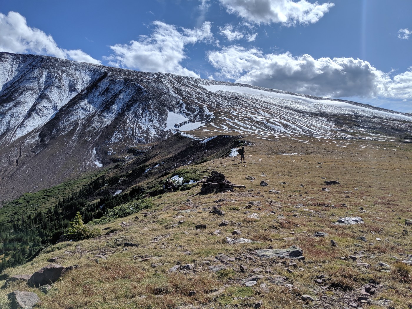
The rest of the day was fairly straightforward, and we all really enjoyed the rolling terrain across big open meadows. The snow layered onto the mountains in many thin horizontal stripes; it was really special to get to see them in that context. We lost the trail briefly as it passed through a campsite; there was some misalignment between the Nat Geo map, the USFS map, and real life, but it was pretty easy to resolve.
That night, we camped near Kidney Lakes. I’d heard that people had camped there before, but it ended up being a fantastic, well established site with many tenting areas, great fire rings, and beautiful views of the lake. Despite damp kindling, Karan persevered and we warmed ourselves around campfire #2 of the trip.

Friday ended up being a surprisingly challenging day, with a sturdy climb up to Divide Pass (it reminded us a lot of Burro Flats in the Winds), some marshy route finding challenges around Island Lake, steep switchbacks up Thompson Pass, and difficulty figuring out how to get to our planned campsite (more misalignment between our maps and real life). But as with many challenging days, it had its moments: the lazy hour we spent sunning ourselves and skipping stones (Greg was modest but excellent), the three moose we saw (although one might’ve been a cow?), hunting for giant (6+ feet tall) cairns in the meadows, and going 3 for 3 on having campfires each night of the trip.
Just next to our campsite (once we finally got there) was a group of 3 hunters, who were surprised to see anyone else out in the area and briefly came over to chat with us. They’d come in with horses and had set up a big canvas tent; it was probably cozy inside with cots and a wood stove.
Finding the trail again Saturday morning was significantly easier than it had been to find the campsite; we weren’t quite sure where we ended up having so much trouble. We warmed up quickly on the first climb, but somehow managed to lose Karan and Kylie coming down the other side. Waiting for them to catch up was the perfect moment for us to use a sliver of cell signal to check into our flights; it wasn’t fun to think about getting off trail, but at least we wouldn’t be stuck in middle seats!

From there, we followed the West Fork of Beaver Creek north until it reached a parking lot, and road walked back to the cars. This was definitely a lowpoint of the trip, and I’d suggest anyone following a similar loop cut off the road walk and replace it with doubling back to the trail that we’d hiked in on. The road was hot and sunny and dusty, we didn’t realize how long we’d end up having to go without water on this section, and we didn’t even see a single moose.
At the parking lot, we met up with Andrew, who had generously driven in early from his adventures in the Tetons to help drive Brian, Greg, and myself back to SLC. The lot was completely full, which was unsurprising since it was a Saturday and the area is so accessible from the city. After some repacking and gear tetris, we headed out for a post-hike meal at Fiesta Guadalajara, a nearby Mexican restaurant that was en route for all of us and our different itineraries (Erik on to Colorado, Karan and Kylie out for another overnight in the Uintas by Amethyst Lake, and the rest of us back to SLC).
The Uintas extension ended up being a welcome follow-up to the rigor of the Winds. While still challenging, it was a significant step down in required physical & mental exertion and helped us decompress, and the crisp temperatures made us all excited for fall hiking back home. Thanks, everyone, for a great trip!
[featured image: photo credit Kylie Lipinski]

Leave a comment