At one point, the Baconator strolled up to me on the trail and asked, “How exactly did you arrive at deciding to backpack the Baker Trail over this long Memorial Day weekend?” I scratched my head. Well, I knew it was out here. I knew B~~~ needed it (and, by implication, I needed it) to get his Pennsylvania award. I figured, “What could possibly go wrong?”
Thursday morning, 5/23, we all rolled out from the D.C. area. After lunch at the Knickerbocker in Altoona, a scare with one of my tires (ably repaired by Brian C.), and a fairly elaborate car shuttle scheme that would, we hoped, enable people to complete an 87-mile and a 129-mile variants, we’d all arrived at what would serve for us as the southern terminus—Godfrey’s TH. The bridge south of this point was closed, so I didn’t see any point in trying to mess with the true southern terminus.
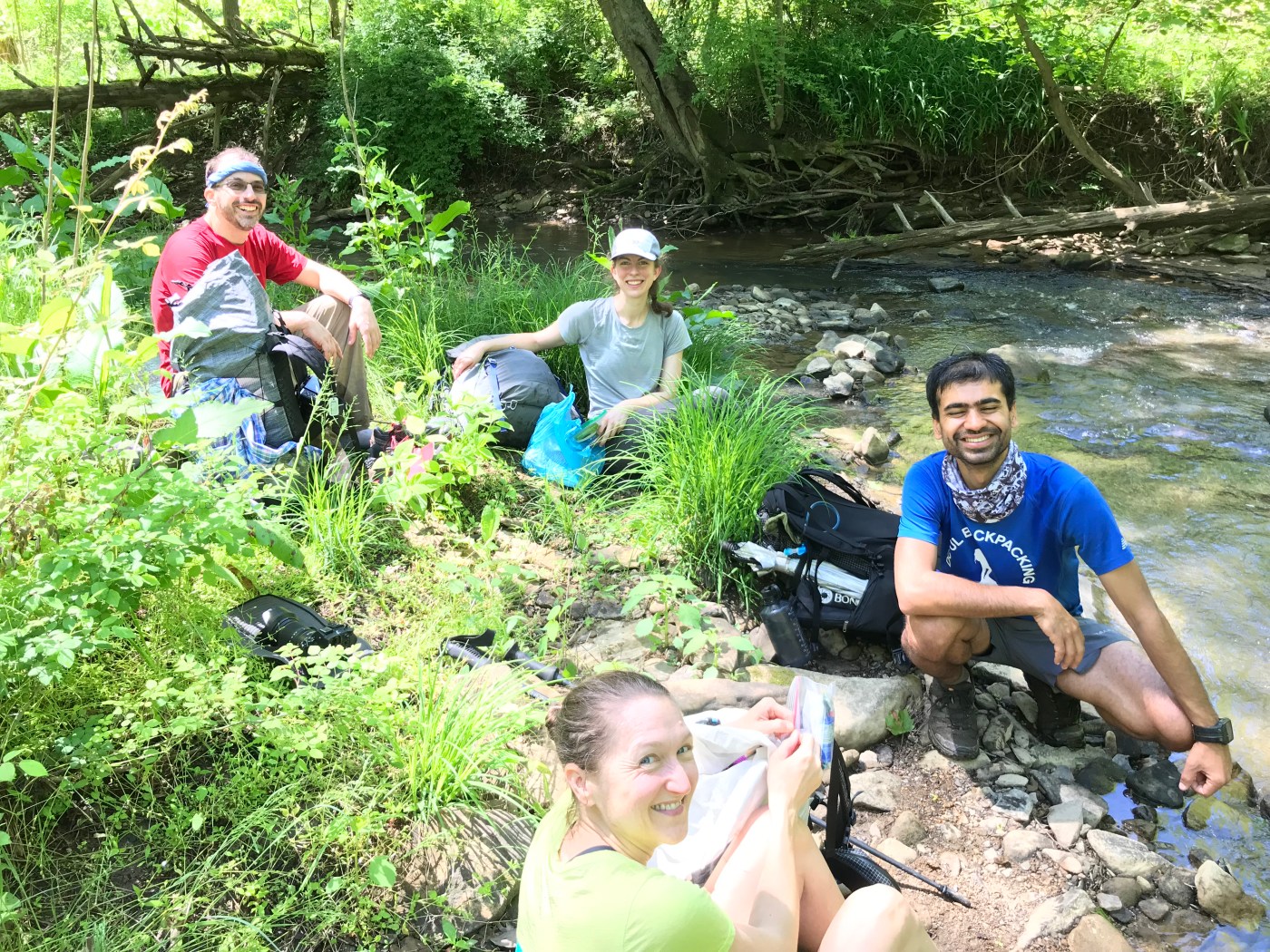
Part of the later group, I walked north, following the yellow blazes, with Cassie, B.A., and Faceplant. It was suburban road walking at first, through pleasant enough farmlands. People were friendly to us. Thunderheads massed in the sky. In the Taylor Creek area, where the trail passes through woodlands, I made a bit of a wrong turn and had to scramble up a muddy, messy hill to get back on track. I arrived at Logansport Road in an absolute downpour and took brief shelter in a carport. The squall abated, I found the cable and scrambled up the rocky shelf—weird for PA, I know. I hiked the remaining stretch in the fading light, but I crossed the open field just prior to the Crooked Creek Shelter without headlamp. This well-situated shelter is where we would pass the night. So, 7 miles or so for Thursday.
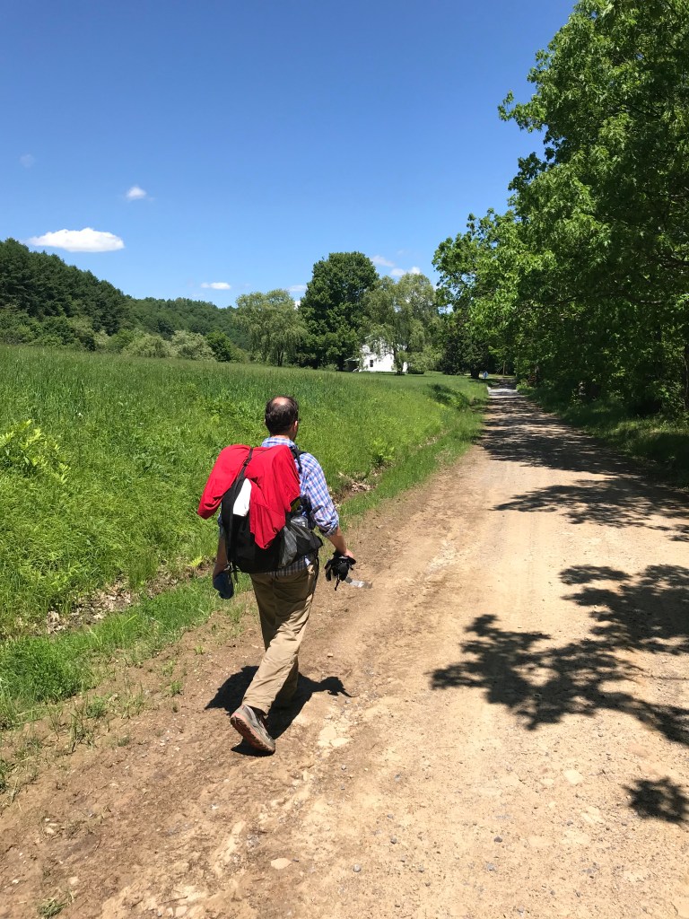
Friday, 5/24, we were up for a long day. We were hiking by 7 a.m., skirting farmlands as we approached, then rounded Crooked Creek—a nice stretch. I took a break at a little bridge at about the 114.75 mile mark, then we had some extended sunny road walking through the countryside. I took a longer break in Cherry Run, which is certainly one of the finest stretches on the trail. Tadpoles populated every puddle. Road walking in the afternoon turned into a brushy climb around mile 103, but then we hiked through a Christmas tree farm—a pleasant stretch before we descended to 210 through a forest of poison ivy. We tanked up at the bountiful spring there, then made our way to camp at about 100.25, in the shadow of the Keystone Power Plant—not the best campsite in the world, but it would do. 21 miles or so.
During the day, the Baconator and Brian C. had fallen off a bit. The Baconator came in at about sunset. He then poured boiling water on his thigh—we really need to stop having medical emergencies on trips after WFA courses. Brian C. texted to say that he was not feeling well and that he would bail at 210, which he did by hitching a ride back to Godfrey. We slept to the sounds of deer huffing that we had invaded their spot.
Saturday, 5/25, after a rough stretch through the brush, we emerged on Coalbank Road—with the expectation of spending the entire day on road. Cassie, B~~~, B.A., and Faceplant went a mile out of their way to have breakfast at Tina’s Log Cabin. MacGyver, me, and the Baconator stayed on route. Probably, the water icon should be removed from the map at the picnic area as we found none (the tap didn’t run). In a rarity for PA, we often found water to be an issue, as lots of the creeks were plainly draining agricultural fields, or were behind strident “No Trespassing” signs.
And so north we went, on the roads. I stopped at a house where a woman was playing with her little boy. He showed me the corpses of cicadas while she let me fill up my bottles. A man on riding lawnmower stopped me, “You’re letting a girl beat you!” I looked at him. “That girl [MacGyver] is pretty tough to catch.” MacGyver had jetted ahead to go off trail at a nearby lake, where she reportedly had a shower. I asked him if there were any good spots up ahead to take a break. I was hoping for a rural bar and a pint of Yuengling. He said, “Well, hikers used to stop at a shed up the way, but I think the only people who stop there now are cows.” I decided I would pass on that particular opportunity.
The local color was definitely part of the charm of the Baker Trail. A little farther along, I passed a man painting his fence. He asked me if I wanted employment. I said, “No, but I have some friends coming up behind and they’re not as smart as I am.” He offered to let of them paint, each and every one of them.
The day wore on and in the early afternoon I reached Plumville. Now, the map says there’s a place called the Silver Dollar Lounge a mile off trail to the east. So, you can imagine what I was thinking. A Google incident led me to an adult entertainment site in Georgia, but that wasn’t what I was after. I strolled into town and fortunately had the good sense to ask a couple hanging out in their garage. The Silver Dollar was closed sometime back, they said. You were thinking that you’d like a cold beer? They offered me one and we stood and chatted. I struggled to have much to say about motorcycles—an obvious area of interest—but we talked about the various trips they had taken across the country. Thanking them, I headed back to the trail, and walked the few remaining miles to the Milo Weaver Shelter at 81.50—our destination for the evening. So, that’s 18.50 miles for the day, though the folks who went to breakfast got 20.50.
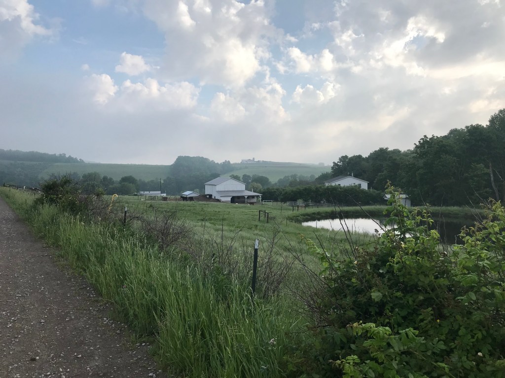
The Weaver property is a pretty incredible oasis—a big grassy field with multiple buildings and a few ponds. I heard they sometimes hold concerts there, but this Memorial Day, people were riding ATVs around and enjoying the pool. MacGyver and I relaxed by a pond as the others arrived. Mr. Weaver rolled up and welcomed us. He said seeing a group of seven was uncommon. When he heard we were from D.C., he asked if we were keeping Trump in line. I told him it was a full-time job. He said he bet it was. We ended up camping up on the lip of the fields—we had two hammockers who needed trees. After dinner, a pretty awesome storm blew in with high wind and rains. B~~~ said it was the highest wind he’d ever hammocked in; I was glad he helped me batten down my tarp.

Sunday, 5/26, 7 a.m. And we’re off for the last full day on the trail. Though we had discussed going farther the previous day, the next few miles highlighted the difficulty of backpacking the Baker Trail. We road walked through farmland dotted with cows and horses. An Amish family in a horse and buggy rounded a bend in front of me. I waved and they waved back. The next section of woods was muddy as heck—we would have been in a pickle if we’d planned to camp there. But around mile 75, we entered a lovely passage along the Mahoning Creek Reservoirs. Pleasant, easy miles were interrupted by a thunderstorm. We reached the bridge and the Milton Loop Campground, where we sheltered in a pavilion and ate some ice cream.
The afternoon was dominated by some tough hiking along the Mahoning Creek Lake. This area was often beautiful, but the trail was newly cut sidehill and showed the signs of a long struggle with hostile landowners. All of us reacted a little differently to some spurious “Keep Out!” signs placed athwart the trail. In my case, I turned uphill and walked for a spell on a dirt road. That caused a real morale check, as I realized I could easily cut off a bend of trail and get to camp much more easily. I didn’t do that, and instead used the GPS to cut back down to the trail. B~~~, Cassie were behind me. We three caught B.A. and Faceplant and then we forged our rugged way down to the dam and Creek Bend Campground. I understand that the Baker Trail folks put a lot of energy into this stretch. It seems too bad that the landowner can’t come to an agreement, as I suspect the current situation is benefiting neither owner nor hiker. Certainly, the trail work was Herculean.
After a break at the campsite, we strolled along Creek Road, where there many Memorial Day campers. A few were flying a hybrid American / Trump “Make America Great Again” flag. Truly, I thought I had entered an alternative reality. The trail climbed some roads for the last few miles. It started to rain cats and dogs. A driver pulled up and offered us his barn to sleep in, but fortunately we found a pretty good spot to camp, where the trail leaves Fisher Station Road, at 58.75. This was a shot in the dark on my part (a guess based on the topographic map), so it was great it worked out. It was a rainy and wet campsite. B~~~ and I dozed off drinking whisky in our hammocks. Roughly 23 miles for the day.

Monday, 5/27, up at 5 a.m., trail at 6 a.m. Well, we had about 16 miles to do, and then the driving. Immediately, we wished we had been up at 5am every day. We were treated to a magnificent sunrise with mist obscuring the Pennsylvania hills. The roads passed behind us. In North Freedom, a friendly resident asked if Sharon and Steve were Kylie and Cassie’s parents! He also let me have some water. The Langville Road section was pleasant, as were the rolling farmlands above it. And then followed some beautiful forested walking near Red Run and Tarkiln Run. At a break at the 46.50 mark, Faceplant fell in a creek, re-earning her trail name. I noticed Cassie wasn’t walking well. It soon became clear she would not be able to hike beyond the Anderson Road mark (she ended up hitching a ride a few miles ahead). Her condition made B~~~ and Faceplant consider if they were down for the remaining 40 miles. The weather looked dicey and I think the pavement had taken a toll on their feet. A lively debate ensued, as the trail sidled over fields and descended to follow a bike trail for a spell.
The approach to Somerville was very nice. The trail follows Redbank Creek, climbs steeply, and then follows Johns Hill Road, which was a pleasant enough walk. Soon enough, we were in town, where another friendly person had permitted Karan to park his car. The only hitch is that we now had seats for 4-5 people and 7 people needing a ride—a bit of a design flaw.
Karan drove me, Steve, and Sharon back down to the southerly cars, then came back to get B~~~, Cassie, and Kylie. He then dropped Cassie and B~~~ back at her car on the northerly end. Obviously, not ideal. Note to self: plan for extra capacity at mid-points. There was some late driving to get everyone home.
So, that was our 85.5 or 87.5 jaunt on the Baker Trail, with splits like 7 / 21 / 18.50 or 20 / 23 / 16. B~~~ and I have a 20-odd mile stretch of trail that we’ve not done before in the northern sector and those few miles of trail in the very south. I’m sure we’ll get these miles soon enough.
So, how was it? Well, as I remarked to the Baconator, these Memorial Day jaunts were meant to do routes that are rarely done and that are off-the-beaten-path. The Baker Trail was an adventure of the right sort in the series. It definitely resists being backpacked— campsites and water are all problems, which is unusual in Pennsylvania. At times, it was lovely, in much the same way the North Country Trail is through Allegheny National Forest. But it is a lot of road walking in stretches—A LOT. I was doing some thinking about what it would take to switch it to footpath and it would truly be a generational effort. In some areas, I think you would have to conclude that certain roads are good enough, while trying to develop relationships with farmers to let people walk along the edge of their fields. It would be a lot of work. As it stands, I’m glad we were able to do this big stretch. I’m sure we’ll be back to finish up, and we’ll get a donation to the Rachel Carson people to help keep the trail open. As always, the work that goes into these trails is very much appreciated by those who walk them.

It is so weird how different one can feel about a trip during and after 🙂
The locals were really nice. I won’t forget the lady in McWilliams who offered me Steak (which I don’t eat) and Lemon cake (which I chowed pretty fast), when I asked for water. That was amazing!
LikeLike
Bwahaha! I hadn’t heard the part about someone thinking Steve and I were Cassie and Kylie’s parents. I’d be a very proud mom if that were the case. =)
LikeLiked by 1 person