Ours is a tough neighborhood. The Shenandoah National Park (“SNP”) is, relatively, in our backyard—a bit over an hour from Washington, D.C. But don’t let the proximity to civilization or the “park” name fool you! This 36-mile loop of ours skirted a densely packed rattlesnake den, unusually savvy fish, a coyote kill zone, complicated rock hopping over icy streams, weather fluctuating from below freezing to the mid-40s, and 6,000 feet of elevation gain and loss.
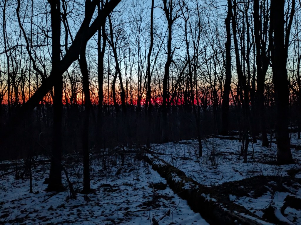
We started hiking 1.5 miles Friday night into a strong wind that pushed unseasonably cold weather to the mountains. The weather had been crazy all week. If I didn’t know better, I would have thought that Mother Nature turned weather control over to her 3-year-old son with permission to “just do whatever.” That brat clearly colored outside the lines. In the week leading up to our trip, D.C. enjoyed summer-like weather with highs in the 80s, only for a heavy snowstorm to hit the very next morning. The following day—the day of our trip—the weather returned to the 60s, only for it to plummet to below freezing wind chills for our first night in tents near the Pass Mountain Hut.
Our trip plan was to hike a giant, oval loop between Thornton Gap to Gravel Springs Gap. The SNP is a narrow north-south mountain chain with the AT running along the top. To hike west from the top, one descends to the Shenandoah Valley; to hike east, one drops to Virginia’s piedmont (which looks like a valley). Thus, our path had us starting on the top, dropping down to the base in the west, climbing back to the top, and repeating the descent/ascent the next day on the east side. Obviously, this plan backloaded the climbs each day. It is simply harder to take on a sustained climb at the end of a day than at the beginning.
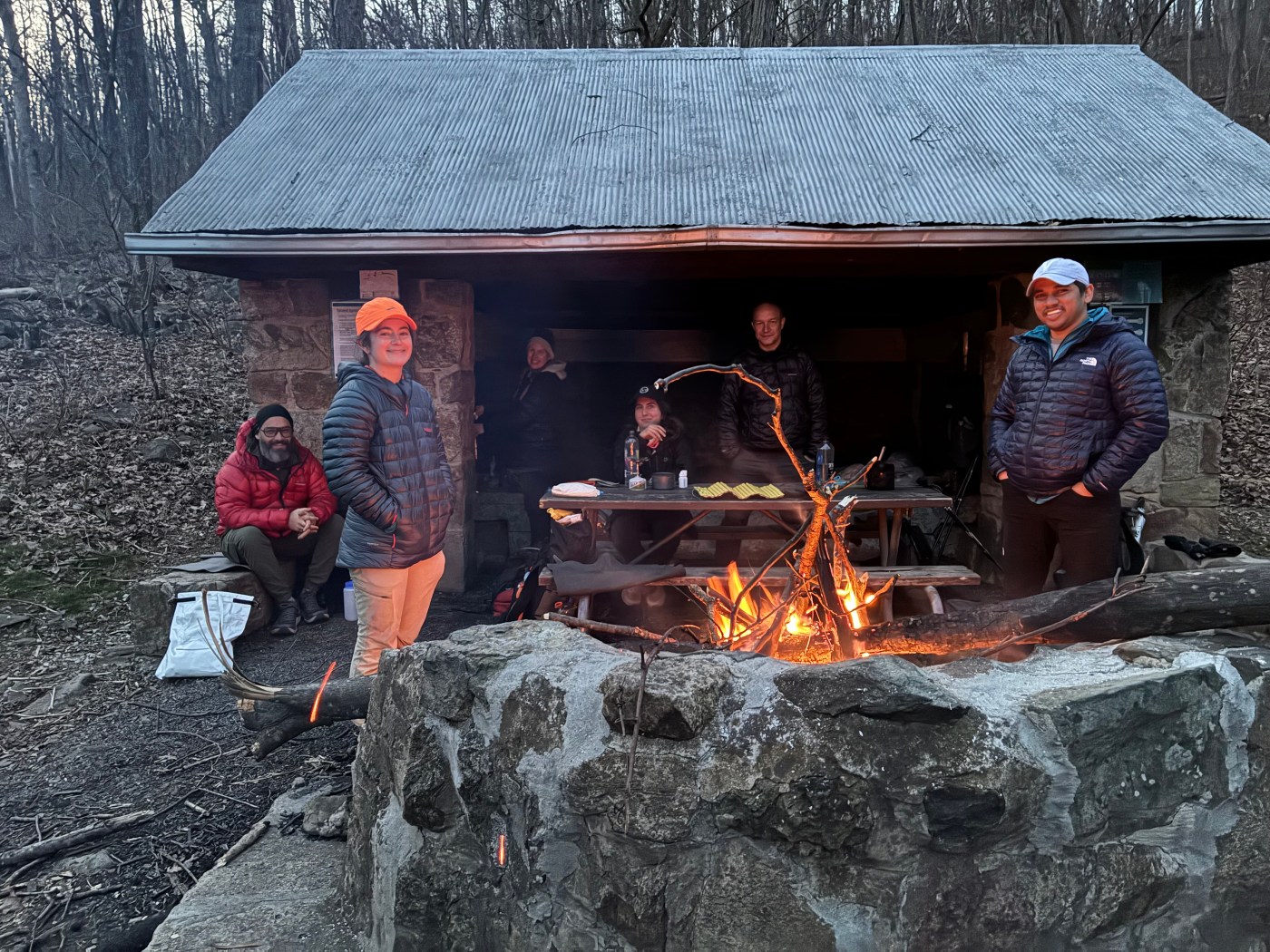
We arrived at the Pass Mountain Hut quickly in a tight pack line and quickly set up camp. Maddie and Emily chose to get a head start on sleeping and stayed in the shelter. The rest of us quickly set up tents and followed them into dreamland.
After a cold night with an incessantly howling wind, I shouted the DC UL wake up call for this trip: “It’s a beautiful day in the neighborhood!” I belted out into the lightening darkness. No one laughed. I instantly worried that this mostly Millennial/Gen Z crowd missed the “Mr. Roger’s Neighborhood” connection—a popular children’s television show in the olden days. (Later, as Maddie was having her ID checked for the beer she ordered at the post-hike restaurant where we ate our victory lunch, she assured me that everyone knows “Mr. Roger’s Neighborhood.” I guess the wakeup call was just not funny. This is why I won’t make many Mr. Roger’s Neighborhood references in this trip report).
We arose at sunrise to hike the western side of our loop. This part of our loop bowed out west from the Appalachian Trail (“AT”) onto the Neighbor Mountain Trail and down to the Jeremys Run Trail back to the AT.
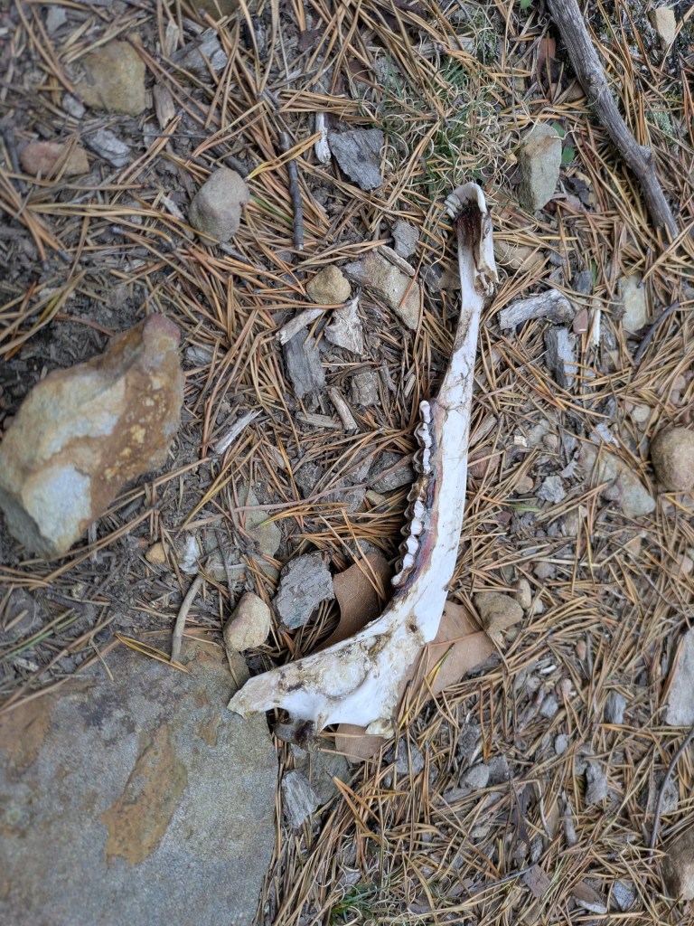
As if to broadcast this trip would not be “just a day in the park,” some coyotes left a dead deer jaw on the trail as a warning for any “creampuffs” to just turn around and go back to D.C. Ha! They weren’t expecting a crew from DC UL Backpacking! James spotted it and, after a bout of maniacal laughter last heard at the end of Michael Jackson’s song Thriller, he took a picture of it.
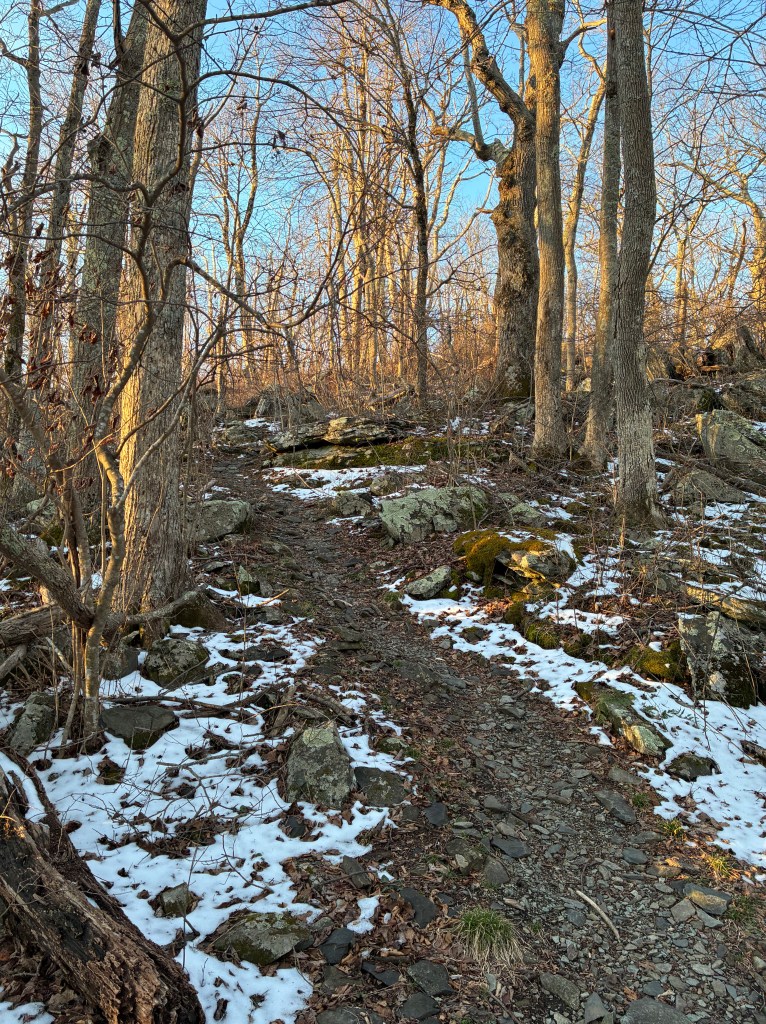
We pressed onward. The trail up and over Neighbor Mountain is a ridge and, with the trees shorn of leaves, we enjoyed long views of the valley below and the Massanutten Mountains beyond as we hiked. Logan pointed to the Massanuttens and said, wistfully, “that’s where we’ll be next month.” Indeed, we will be. In April, an army of DC ULers will hike the 72-mile Massanutten loop on a trip we call the “Death March.” Emily declared this “Neighborhood” trip would be good training for it.
The Neighbor Mountain trail descended to the Valley floor where we picked up the Jeremy Run Trail to take us back up to the top. This new trail introduced a completely different experience. Instead of a steep descent from a long, dry ridgeline, we now ascended along a spring-swollen stream with frequent crossings. The water level was just at the point where rock hopping seemed possible, but the odds of completing all of them with dry feet was unlikely. After shivering in the cold the prior evening, few wanted wet feet. James was among the first to miss a rock. He took that as an invitation to eschew future hopping and to just splash through each crossing with aplomb.
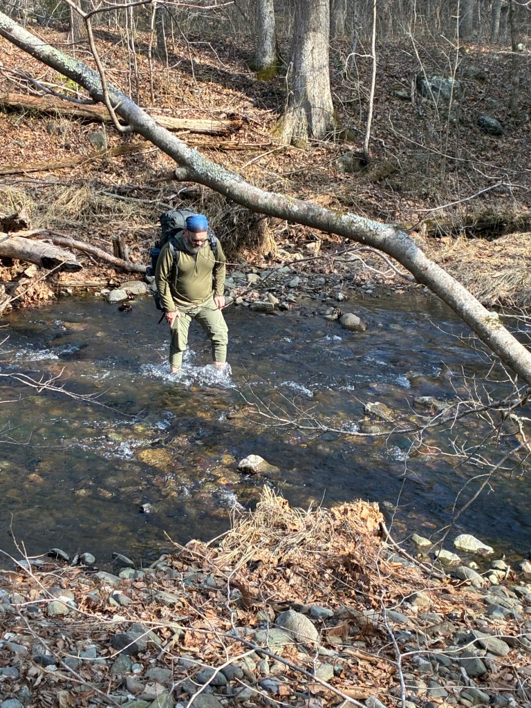
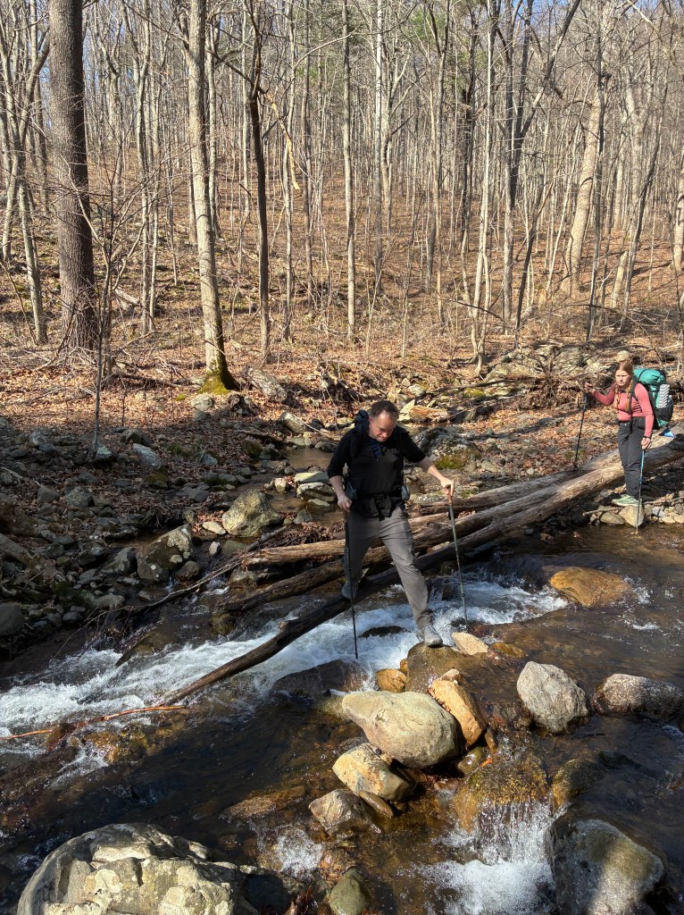
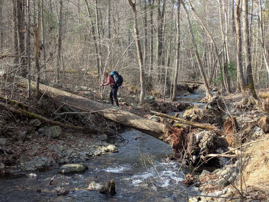
As we continued to shimmy across fallen trees, or tiptoe across slick rocks, most of us wound up with at least one foot soaked. I know I did—and my trail name is “Spider-Man!” Wesal (“WB”) tried to show off by falling on one crossing soaking her entire side. When I asked if she was ok she gave me this look that may have meant, “you better not put this in the trip report unless it is really funny.”
Per the plan, most of the elevation gain for the day came at the end. Hiking over 20 miles in a day is tough. Doing so where the climbs come at the end of the day is especially exhausting. Yes, this can be a tough neighborhood.
We did not see to many other people that weekend, which is unusual for such a popular national park. The weather likely scared away the mortals. We did see a few folks out fly fishing for the day. We passed a particularly chatty fisherman on the trail who seemed to know just a little too much. We needed a break so, as we stopped to catch our breath, eat some snacks, and put on sunscreen, we listened to him.
He told us how fishing that stream was particularly difficult because the fish were very savvy for some reason. They were tough to trick with a fake fly on a fishing line. While he wasn’t sure why the fish were so clever, I puzzled it together. Apparently, one is not permitted to “catch and eat” the fish. One may only “catch and release” them back into the stream. How stupid is that? Not only is this just fish torture, but the practice also trains the fish to avoid fake flies—ergo this fisherman’s savvy fish problem.
He also told us that this section of Jeremys Run Trail is famous for a rattlesnake den, just as depicted in the snake scene in Raders of the Lost Ark. According to the fisherman, the snakes gather for warmth in the winter only to vacuum up all the food rattlesnakes eat when they emerge en masse when it warms up. Desperate for food, they will even uncharacteristically climb trees to jump on unsuspecting prey. I made a mental note to not redo this loop outside of winter. He also said with distain that some people seek out to kill rattlesnakes for fun. I suggested they set up a system like his “catch and release” scheme for fish—we could call it “kill and resurrect.” At this point our conversation ran its course and we each continued on our way.
At what felt like the top, back at the AT, we pulled water from a strong spring and broke for lunch at a wayside in the sun. However, when temperatures are in the 40s, few want to linger in one place, so we pressed onward and upward. The trail continued the climb and, because we were making such good time, we took another break.
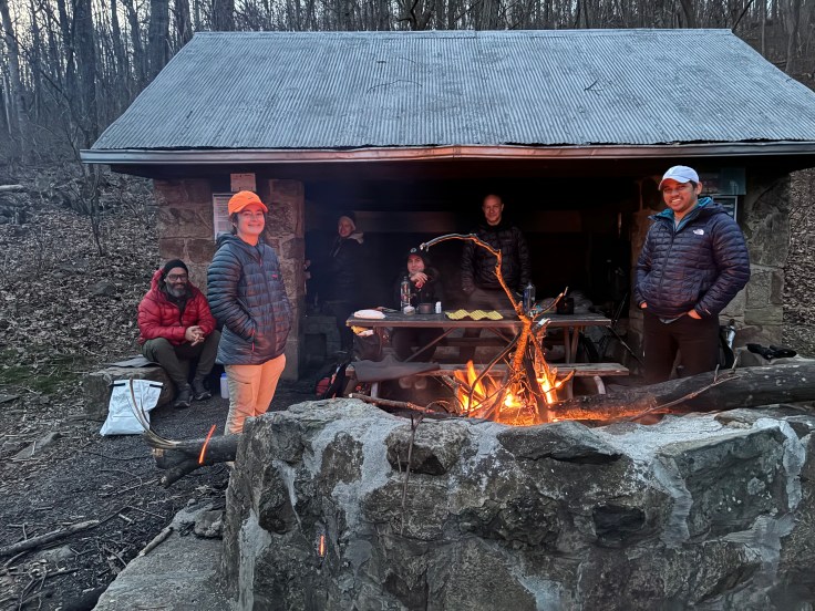
We arrived at the Gravel Springs Hut well before sunset. WB deeply desired a campfire, so she led us in collecting wood after setting up camp. Vinay, who previously impressed me with his pioneering skills chopping wood on the “What’s the Worst that Can Happen” trip to the nearby Doyles River Cabin, showed off his pyrotechnics skills in managing the fire along with WB. She was right. It was very nice to have the fire as the sun set and the temperatures dropped.
I made no wakeup call Sunday morning. Another backpacker was camping at the shelter area, and I didn’t want to wake him. People make fun of my wake-up calls. However, Logan will never do so again. He overslept. Amazingly, he broke camp and was on the trail in less than 15 minutes—albeit without having any breakfast.
We left the shelter area at different times, so many of us were hiking separately unlike the prior day where we mostly hiked as a group. It was nice warming up in the cold air. I enjoyed a “nature concert.” A quiet morning, I listened as my feet crushed the crisp leaves and twigs on the trail, as I walked. The sound was like the bass line of a song. I smiled when a couple of birds sang solos in time to the rhythm. James was hiking behind me. We were moving very fast on this slightly descending trail—just under a jog. When I reached a fallen tree across the trail waist high, I spotted a rock on the right side of the trail and, with my right foot jumped off the rock onto the top of the tree, landing on my left on the top, then jumping down to the other side in a fluid motion. Later, James told me he saw that and muttered “WTF” to himself as he more carefully stopped and shimmied his way up and over the obstruction as I disappeared down the trail.
Our route was to take the Keyser Run Road trail to the Pole Link Bridge trail to the Piney Branch trail to the Hull School trail to the Rocky Branch trail back to the AT. With so many junctions, we kept checking our GPS tracks.
On the long descent on the eastern side of the mountain chain, Logan and WB each made great time. They were the last to leave camp, but both caught up to James and me even though I thought we had been moving fast. The trail generally followed a stream with only a few crossings. The climb back to the top of the mountains on this side was even more backloaded than our Saturday route. Most of the climb occurred concentrated at the very end. Even with fewer miles and an “end-of-a-trip” lighter pack, I was getting tired. We eventually reached the AT and took it back to our cars at Thornton Gap. We took no breaks the entire 14 miles.
Back at the cars, we waited at a picnic table for everyone to collect from the trail. Emily broke out her stove and boiled water for coffee. Many of us went into the washrooms to change for the trip home—just as Mr. Rogers did at the beginning of every show when he arrived in his sport jacket and dress shoes only to immediately change on screen into a casual sweater and sneakers while singing, “won’t you be my neighbor?”
# # #
For any future trips, here is the Meetup trip description.
Since this is the SNP, one now needs to buy a permit for backcountry camping, available online here.
— David O. (“Spider-Man”)

Leave a comment