“We came all the way to Europe to hike the Tour du Mont Blanc trail, so why are we so focused on trying to avoid it?” Wasal (“WB”) asked. It was a good question. Six of us flew from Washington, D.C. to hike the Tour du Mont Blanc (“TMB”) trail in the Alps, but after a few days we had yet to hike a complete full section of the famous trail that circumnavigates the continent’s highest mountain while crossing the borders of France, Italy, and Switzerland. Instead, we had been taking “variants”—approved detours to higher elevation, more rugged hiking, and more dramatic scenery. The TMB is a very tough trail, but for DCUL, it was not tough enough! Yet, on our 5th day of the trek, a predicted thunderstorm made dangerous our planned variant. The Alps are consistently exposed without tree cover. So, lightning is a real concern. The prior day we climbed steeply up the toughest part of the day’s variant in bright sunshine and cloudless skies, only for storm clouds to rumble out from nowhere, chasing us back down to immediately forfeit our hard-earned elevation gain.
WB was right. Bypassing a variant due to a planned thunderstorm was not too disappointing when the “consolation prize” was hiking the very trail we all travelled 3,900 miles to hike—and the trail was spectacular.
We backpacked the TMB counterclockwise starting from Les Houches, France with a 9-day itinerary. Another group of 8 DCULers also started a TMB trek the same day with a 6-day itinerary. Our group camped out on the trail all but one night while the other group stayed exclusively in “refuges” in France and Switzerland and “rifugios” in Italy. Refuges/rifugios are staffed mountain dormitories, like the huts in the White Mountains of New Hampshire. Guests get a bed, dinner, breakfast, and a shower. Staying in refuges is the European style of hiking the TMB. It lets hikers complete the trail with lighter packs by excluding tents, stoves, food, and other camping essentials. By contrast, camping in the Alps is tightly regulated. One may not (legally) just camp anywhere. To plan our trek, we bought an invaluable guidebook from http://tmbtent.com which gave us a camping-focused gpx track, logistical suggestions, and 2-3 recommended camping spots for each night. Most of the campsites were at commercial campgrounds with access to showers, food, and cell phone charging stations, all for a small fee. Unlike such campgrounds in the USA, they were relatively peaceful. “Quiet time” in the early evening was uniformly observed and the few camping vehicles at some of the sites did not use noisy and smelly generators. Two of our nights were at authorized “wild” campsites without any services (or fee). Our group planned one night in a rifugio for the experience, and because a particular section in Italy is logistically challenging to score a good place to legally camp. (We learned that others were less fastidious than us on legal camping, but it is bad manners to intentionally break this law).
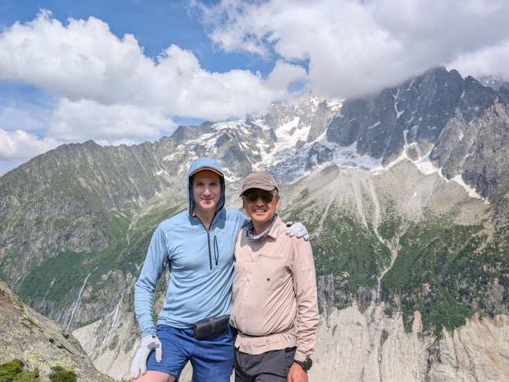
I called this trip the “What’s Up, Doc?” trip for obvious reasons. Mont Blanc was probably named after Mel Blanc, the voice behind Bugs Bunny. (Someone told me “Mont Blanc” means “white mountain” in French, but this doesn’t sound right). Iconically, Bugs Bunny would chew a carrot as he delivered his hilarious signature phrase, “what’s up, Doc?” For us on this trip, our “Doc” was Justus (“T-Jaw”). T-Jaw is either a pediatric cataract surgeon or a pediatric cardiac surgeon, depending on how one interprets his German accent. For a couple years he was doing medical research in Washington, D.C. and became an active backpacker with DCUL and a good friend. On this trip we would reunite with our favorite German doctor, this time on his continent, to say, “what’s up, Doc!” A strong hiker, he moves through mountains like Superman. Of course, we couldn’t give him the trail name “Superman” because we already have someone named as a superhero in DCUL—ahem, me. “Spider-Man.” We learned from him that his name “Justus” is not pronounced “Justice” as one would expect. Instead, he pronounces it “YOU-stus.” This is too hard for most Americans to say, so riffing off his Superman abilities and a name that should be pronounced “Justice,” he has the trail name “T-Jaw,” representing Superman’s slogan that included his name as Americans would pronounce it—“truth, justice, and the American way.”
T-Jaw and I planned the trip together, and it was very easy to plan. Essentially, just fly to Geneva, take a transfer van to Les Houches, and start walking. No reservations at campsites are needed (or possible). By contrast, staying at refuges necessitates advance planning—spots book up early in the year.
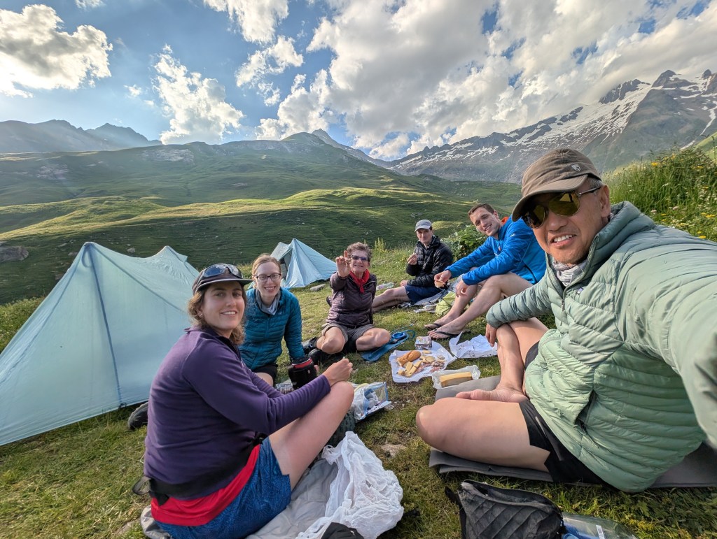
Both the camping group and the refuge group met for dinner in Les Houches the evening before the first day and toasted to the success of our trips.

The snow-covered peaks of the high, jagged mountains surrounding the Chamonix valley called to us, so it was an early evening. After dinner, the refuge group retreated to their hotel, the camping group to our campground, an open field on what is the finish line of a ski racing course in winter.

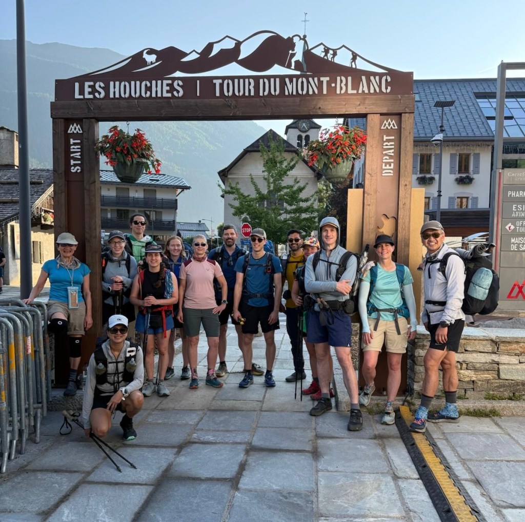
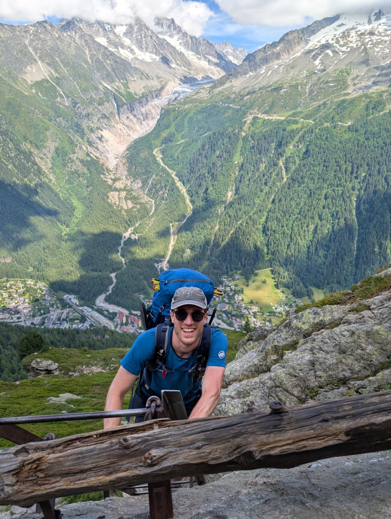
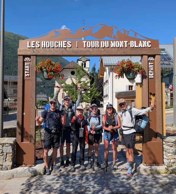
Friday morning, after a group photo under the arch of the official start of the TMB, we started hiking.
I was so excited, I forgot I wanted to stop at a bakery for breakfast. I regretted this omission as we hiked up a steep path along a ski run in direct sunlight. Only 2,000 feet of elevation gain, it was tiring to climb it in the heat and with an empty stomach. At the top, however, there was a café where we refilled water bottles, and some of us treated ourselves to pastries and coffee. Yes, this trip would be a different one than most backpacking trips in the US. On the TMB we constantly had opportunities for refreshment.
Actually, this trip had at least one similarity to typical DCUL trips. At the café, Parag of the refuge group was still seated at the café when we of the camping group arrived. He was the last of his group to leave the café before we arrived as he lingered over his cappuccino. When he saw us, he immediately got up and gave us the signature “DCUL FU greeting.” This is where tired hikers reach a companion at rest only for the resting hiker to use this as a cue to immediately say “hi” as he saddles up and hikes on. It is like when a southern woman tells you “bless your heart.” It sounds benign but really means something insulting. We waived him good luck and never saw him, or anyone else from the refuge-only group, for the remainder of the trip. Because of his genial good nature, we naturally did not hold anything against Parag. Bless his heart.
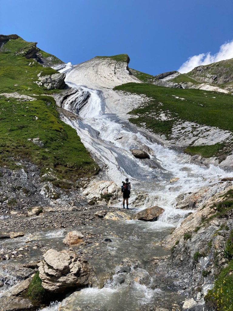
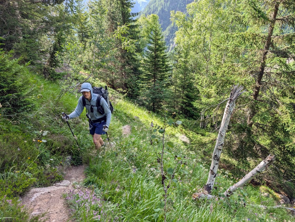
After our rest stop, and instead of continuing to hike the normal TMB, we took a variant that routed us up higher into the Alps rather than back down to the valley. We were glad we did! We crossed a roaring glacial river over a swinging bridge to climb to our first “col”—the Alpine term for a high mountain “pass”—this one called Col de Tricot. Because we had not before seen anything like this, we lingered. The opening scene of the musical, the Sound of Music, could have been filmed here. We stared at the snow patches around us that seemed out of place under the hot sun. We admired the green fields all around us, and the snowy peaks and long waterfalls in the distance that we knew we’d soon see at closer distance. Also, we were tired. Our first day required 5,000 feet of elevation gain and corresponding loss over only 15 miles. This terrain was steep! To put this in perspective, a few weeks before this trip I backpacked a section of the Allegheny Trail in West Virginia during the Memorial Day weekend. Over 4 days that trail contained a total of only 5,500 feet of elevation gain. We would soon learn that 4,000-7,000 foot days were normal for the TMB (with the variants we selected).


As we lazed on the col, James put on extra sunscreen. The high elevation and cool breezes off the snow patches had us forgetting how strong the sun was. James correctly pointed out that “it’s the same strong sun on the col as it was in the valley.” I joined him and bathed myself in sunscreen and retreated under my trekking umbrella for shade.
After our nice break, we took a long snake path down the mountain to lunch and then to our campground. Our group of six enjoyed the bonus of having Beth (“Girl with Big Backpack”) and James temporarily adopt us. Officially on the refuge trip, they did not sign up for the trip in time to get reservations at all the refuges, so they began the trail in a hybrid fashion by hiking with us and camping.
We woke the next day and chose to hike another variant along the route, because the prior day variant was so incredible. This time we hiked up and over Col du Fours.
Another steep climb would lead us over a higher pass. However, we first stopped to put on our micro spikes.


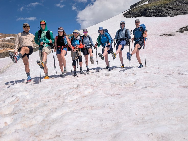
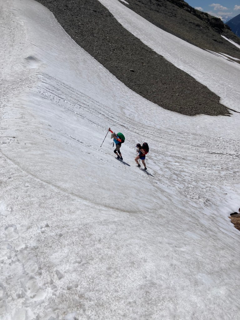
The col was covered with a thick wet blanket of snow. I expressed my concern about the safety of this, having never used micro spikes over a snow field this large. Eileen (“Come on Eileen”) said, “as long as we don’t wind up with a helicopter next to a concerned group of people we should be ok.” As it turned out, the spikes were not essential. However, they did make the trek easier and safer. T-Jaw climbed without spikes, although I saw his feet repeatedly lose traction. He then descended by glissading—“skiing” down the slope in only his trail runners. (Note: the TMB and its variants can be impassible without full mountaineering gear in colder, snowier years, due to snow and ice).


We descended into a valley where we watched a farmer who, with the help of two eager dogs, herded his cows from one field to another, their loud cowbells ringing a chaotic tune. A couple of French backpackers told us we could buy cheese the farmer made from those cows and linguistically helped us do so with the farmer who spoke no English. Our campsite for the evening was just a mile uphill from the farm, so after pitching our tents, we supplemented our dinners with the cheese we bought. Haigang (“Two Gangs”) set it out as part of a charcuterie board with cuts of dried meat and fresh bread he bought from a butcher and baker in a prior village.
We ate the deliciously strong cheese on the green grass with the cows who had given their milk for it ringing their bells in the distance. (The cow bells started out as charming but soon became cloying and annoying—especially when they rang all night. Don’t cows sleep? This part of the world is Christopher Walken’s dream location—more cowbells!) This was the first of our only two nights “wild” camping, and it was delightful.
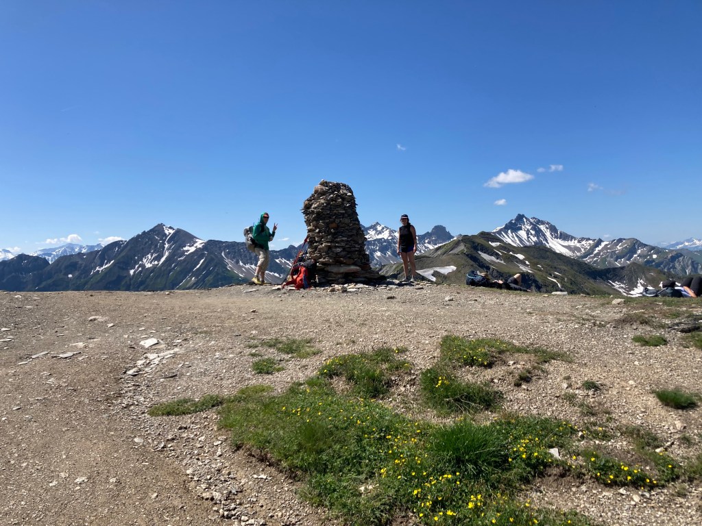
Sunday, we climbed to Col de la Seigne. Not only was this col particularly picturesque, it is the border between France and Italy.

Even though the border was on top of the same mountain pass, the sides of the mountain were totally different. As James observed, instead of Americans saying “bonjour” to each other as we passed one another on the French side, American started saying “buongiorno” to each other as we passed on the Italian side. I later learned the preferred Italian greeting was “ciao” (pronounced “chow”), but this information never reached my fellow American hikers.
We had a long, long descent into Courmeyeur, Italy’s largest town on the TMB. At this point, the days of long climbs in the hot sun made us a bit testy. Ashley (“Rise and Shine”) was frustrated that everything in town was closed on account of it being a Sunday. She was counting on this town for a resupply opportunity. WB was done with the “wake early” part of the DCUL slogan: “Travel Light. Wake Early. Walk Far.” We had been habitually waking very early to get as much climbing done before the sun rose above the mountain peaks. Two Gangs just wanted a siesta somewhere—anywhere. He took to pulling out his sleeping pad and lying down every time we paused, no matter how briefly. T-Jaw just got very quiet, as did I. Even Come on Eileen stopped being chatty and was concerned about leaving town without sunscreen. Sunscreen was truly necessary. (Happily, we found an open pharmacy that sold very expensive sunscreen. We eagerly snapped it up).
Feeding our mutual frustration was the lack of a campsite in this town. Rise and Shine took the initiative in figuring out how we could take a bus to a nearby village that had a campground. However, the return bus did not start running the next morning until 8:45 a.m., long after we normally started hiking and well into the “hot sun” time. It was important to WB not to skip or redo a part of the trail and us not taking the return bus would result in us doing both. Yes, this was our low point.
It is amazing the power of a good night sleep, though. With the campground’s help I was able to secure an early morning (albeit very expensive) taxi ride back into town. WB was such a good sport she went along with the early hour. In exchange, we did not miss an inch of the trail. Our good spirts were back.
Two Gangs, a professor in the real world, met a nice student on summer break at the campground and invited her to join our early morning taxi ride. When she introduced herself as “Sam” I shot Two Gangs a glance. He immediately knew what I was thinking and his return glance told me, “don’t!” Two Gangs has a dog he often brings backpacking on our trips, an adorable little dachshund. He didn’t bring his dog on the TMB, but regretted the omission when he saw a similar-looking one the prior afternoon. His dog’s name is Mocha. However, because Mocha hikes so often with us, the dog earned a trail name. Because trail names are descriptive in nature, and because Mocha’s real name is already a trail-name-style descriptive name, I long ago suggested that Mocha’s trail name be a conventional name, so his trail name is “Sam.” It was when I was about to tell Two Gang’s new acquaintance “Sam” that her trail name should be “Mocha” that Two Gangs shot me the “don’t!” look. I’m not sure student-Sam would have found this to be as funny as I did. However, to me, she will forever be “Mocha.”

Helping us transition from the prior afternoon funk was the fact that we pre-booked a rifugio to stay in that evening—our first and only overnight in one on this trip. We imagined the luxurious experience that our refuge-crew friends enjoyed every night. For Two Gangs and I, who hiked and camped in the Alps for two days prior to the start of the TMB, we especially looked forward to a real bed after six nights in a tent. I imagined turn-down service with a Swiss chocolate mint on my pillow, a long, lazy hot shower with massage head, and cool mountain breezes wafting through an open window. I pined for an easy sleep without managing tent condensation. Since our campsites were almost always in open fields near streams or waterfalls, morning condensation annoyingly soaked our tents.
We climbed steeply out of Courmeyeur. Even with our early morning taxi ride we did not hit the coolest part of the morning. We should have left even earlier than 6:00. Fortunately, much of the early climb part of the hike was in the shade of the trees. We reached a rifugio on the way to “our” rifugio and stopped for water. Most of us chose to continue hiking up the mountain on another TMB variant to Col Sapian. This was the variant where the weather turned after we completed the bulk of the climb mentioned at the beginning of this trip report.
Storm clouds appeared seemingly from nowhere. The clear blue sky turned angry. T-Jaw, Rise and Shine, and I caucused to consider our options. It started drizzling, but there was no thunder. T-Jaw suggested we press ahead for another mile to take a side trail down to the TMB near our evening rifugio. I suggested turning around and immediately descending the way we came. It was a close call, but in the mountains there is no time for extended debate. We all made the decision right for us. I turned around to descend, T-Jaw and Rise and Shine started hiking smartly onward. I quickly reached Two Gangs, who was still climbing and rapidly told him the options as I continued descending. He turned to follow me. I reached WB. She chose to hike up and follow T-Jaw. Two Gangs changed his mind and followed her.
When I reached the rifugio I backtracked to, I looked up to see blue sky peeking through the clouds. Happy for my friends, but disappointed that a weather-fake stymied my plan to hike the variant, I hiked toward our evening rifugio on the regular TMB. The salve to my disappointment was an enjoyable ridge walk variously in the open, through trees, and across crystal-clear streams.
Weather in the mountains is a funny thing. I experienced a short drizzle and heard no thunder. While I was descending, Come on Eileen was waiting out the storm in the rifugio 900 feet and less than a mile below me. She later reported a torrential rainstorm, not the short drizzle I experienced. WB who was with the group hiking one mile forward before taking the descending trail later reported hearing thunder that I never heard.
I arrived at our evening rifugio before noon. My other friends arrived soon afterward. “Let the pampering begin!” I announced as we waited for lunch service to begin. We were all smiling. Having only hiked a half day, and knowing it would be a long afternoon and evening at the rifugio, I commented to WB how it was nice to take an easy “zero” day like this to recharge. She smiled and said, “well . . . we—ahem—did just climb 4,500 feet this morning! That is a bit more than ‘zero.’” Rise and Shine gave me the more appropriate term for our day, it would be called a “near-o” day.
After lunch, we checked in—cash only. They gave us each a token to use in the shower. I presumed, to my minor disappointment, that this meant only one shower. I had planned both an afternoon then morning shower at this rifugio. This would be the least of my concerns. An inn-keeper showed us to our quarters. I’ve been a trial lawyer for over 20 years and have seen jails and prisons—all of which provided more privacy and room. We were in an attic filled with twin beds pushed up against each other to make one giant bed for approximately 25 people. I’ve slept in plenty of Appalachian Trail (“AT”) shelters when backpacking, so I have experience sleeping shoulder to shoulder with strangers when necessary. However, this isn’t my preference. I prefer the room and privacy my tent offers. Also, I can pitch my tent away from others so noises such as snoring won’t bother me. In AT shelters, and at this rifugio, that is not possible.
However, my biggest concern was a woman lying in the bed four spaces from me, next to what appeared to be two friends of hers petting her sympathetically. Well, I really need not write anything more than this: we assigned her the trail name, “Typhoid Mary.” As I was unpacking, she was coughing and sneezing, clearly suffering a bad cold. Come on Eileen asked me, “do you think we’ll catch that?” I imagined hiking the last part of the trail—or taking my returning transatlantic flight—with a sloppy, wet cold. (I later learned that many in the “refuge group” got sick after their trek).
I left the room to ask the innkeeper if I could set up my tent behind the rifugio. It seemed more comfortable, private, and disease-free than the rifugio bedroom. I promised to set up after dark when everyone was asleep and tear down before sunrise. Unfortunately, camping near a rifugio in Italy is prohibited and he told me that both I and the rifugio would be fined if caught. I next suggested doing the same thing on the floor of the dining room after everyone was asleep. I’ve done this before in a New Hampshire White Mountains hut. He rejected that option, too. He told me everything would be ok and that “nobody gets sick” at his rifugio. He went up to check on Typhoid Mary and came downstairs happy to declare that he asked her how she was feeling, and that she reported feeling fine. “Oh, she said that? Well, that solves the problem,” I thought sarcastically. I told the innkeeper that I would just hike onward after dinner if my only choice was to sleep next to Typhoid Mary.
He told me that would not be necessary and that he’d find a solution. To his credit, he did. He transferred some mountain guides from a designated mountain-guide room and let us sleep there. Not only was it seemingly disease-free, it was a series of bunk beds in a more open and airy room.
As for the shower, the token provided 6 minutes of hot water. None of our campgrounds had such a limitation. Worse, 6 minutes in European time is only 3 minutes in US time. (They do a similar thing to us with their “kilometers” and our miles). It was a shockingly short shower.
Dinner was delicious but was served community-style with everyone sitting shoulder to shoulder.

A formal meal, it had drinks, bread, a first course, an entrée, and a dessert. Appropriately, seeing as we were technically in Italy, they served Italian food. (Fun fact: in Italy, they call “Italian food” just “food”). They packed us at tables so tightly that no one could get up from the table without everyone getting up like a sliding puzzle. The waiters served the food by handing dishes to the person at the edge of the large table for us to pass down the long line. This must be why they call spaghetti “pass-ta” in Italy. In Europe they start dinner much later than the US and this dinner followed suit. The late, long meal made our group weary. We were accustomed to waking early every day and, correspondingly, going to bed early. At more than one point a couple of us wondered aloud, will this meal ever end?
Hiking away from the rifugio the next morning, most of us agreed that we were glad to have experienced a night in a rifugio, but that camping was much more comfortable.
Without a variant option that morning, we hiked the TMB up and over Grand Col Ferret, which is the border between Italy and Switzerland. Our group started a new hiking style to accommodate those who wanted to start very early to beat the heat, those who wanted to start later in the morning, and those who fell in between. We set the evening destination and agreed to just meet there. However, we wound up meeting up on the trail during the days anyway—usually at scenic spots or for lunch.
In this part of Switzerland, the people spoke French and not German. T-Jaw knew this but was disappointed anyway. In eastern Switzerland, the Swiss speak German. The biggest difference between Italy and Switzerland was the prices. Everything was markedly more expensive just across the border. But since French was the language of the land, everyone on the trail immediately returned to greeting each other with “bonjour” instead of the confusing “buongiorno/ciao” greeting.
On our descent from the col, a huge group of marmots ran alongside us to encourage us.

Actually, they could have cared less about us as they went about their marmot day doing marmot things. Rise and Shine mentioned, as we stopped to take photos of the adorable little rodents, that “marmots are cute, but some are bastards.” She recounted tales of marmots stealing food from backpackers on a prior trip of hers. We hiked onward.
Trip reports, such as this one, usually understate the effort of a backpacking trek. A summary statement that “we climbed up and over Grand Col Ferret,” reads much milder than the actual experience. The col was approximately 8500 feet high. We climbed there from a valley at 5800 feet. An elevation gain of almost 3,000 feet over a short distance in exposed, hot direct sunshine is exhausting.
The climbs were often straight up with limited switchbacks. I took to creating my own switchbacks by taking a couple steps to my right than a couple to my left as I ascended, as if skiing uphill. The climbs felt as if they would never end. One could only set a sustainable pace and power through. Breathing was as heavy as if running a race—but we were hiking all day. I would occasionally take short standing breaks to take a photo—really, just for the breaks. However, my fingers got so wet from sweat I couldn’t use my iPhone camera without first trying to dry them on my sweat-soaked shirt. I could have stared at the scenery all day—both for the break and because of its magnificence. I took a lot of photos. None accurately reflect the scale of what I saw. This trail has the world’s best scenery that one can only appreciate by hiking it.
At the start of the major part of the day’s climb, T-Jaw, WB, Two Gangs, and I took a short break in the shade of a tree only a valley could provide. Knowing these miles wouldn’t just hike themselves, T-Jaw set off to start the climb. I put on my pack to follow and took out my earphones, sighing at the imminent physical effort. I told WB I needed Lady Gaga’s help on this one and quoted the singer: “rah rah, ah-ah-ah, roma, roma-ma, gaga, ooh, la-la.” They don’t write lyrics like this anymore! WB smiled politely and said she’d wait to hike far behind me. She later said she couldn’t get the song out of her head. So, Lady Gaga was able to help both of us up that climb.

At lunch at a refuge in Switzerland, we met a small group of other hikers who met on the trail and befriended each other. This trail is very social like this. The group consisted of an American couple from Pennsylvania, two British guys—a father and son, an Australian, and two young women who had German accents. I asked if they were German and, upon confirming it, proudly announced that our group had a German, too, and introduced them to T-Jaw. The three of them enjoyed the comfort of speaking their native language. We would overlap with this group and others like them at various places on the trail. It created a very nice community feeling. However, this group seemed too serious for us. They discussed philosophical questions such as: if you could commit a crime such as robbery, but in doing so you would stop all future robberies in the world, would you do so?” None of us engaged in their query-game. We circled among ourselves to, instead, discuss the pros and cons of using Vanilla Ice’s song “Ice, Ice Baby” as an alarm.
At our campsite that evening, we planned our next day. There was no official variant, and we had been getting to our daily destinations much earlier than we wanted. Ours was a very strong, fast group and the regular TMB route was hard, but we were up to greater challenges. T-Jaw, studying the map, pointed out a side route we could take up to a high alpine glacier. We each joined him in examining the route. It would be a tough one. The glacier was at 9,200 feet and we’d have almost 6,000 feet of elevation gain and an equal loss over a relatively short distance. Also, we did not know if it was passable. The unseasonably hot weather in Europe made the high passes we crossed mostly ice-free so far. However, higher elevation and different positioning could make this a concern. T-Jaw called the remote refuge at the apex of our hike. When they confirmed that we’d cross snow fields but that hikers were doing it without crampons and ice-axes, we decided to take what we started calling the “T-Jaw variant.”
This turned out to be the highlight of the trip. We climbed steeply through a pine forest over tree line and continued upward into the sky lured by numerous “false peaks.”

These “false peaks” looked like the top of our climb but cruelly, upon reaching the “top,” the trail continued upward to another. Rise and Shine took the lead on the alpine part of the climb with a steady pace with few breaks. T-Jaw, Two Gangs, and I followed at a short distance. WB chose to take a later morning start, so we would not see her until we were at the glacier. Come on Eileen chose not to “come on” this made-up variant and, instead, hiked the pre-planned segment of the TMB. She later, accurately, pointed out that she was the only one of our group to truly thru-hike the TMB. The T-Jaw variant, while significantly more challenging than the TMB segment, was not the TMB.

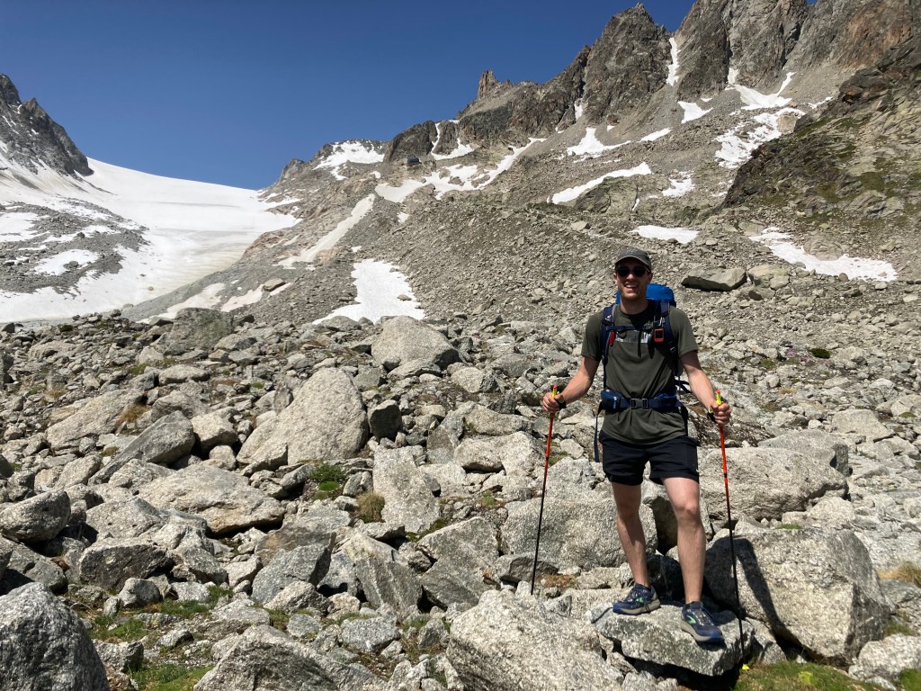
We reached the bottom of the glacier and saw a couple people hiking on it. The trail led to the refuge T-Jaw had called the prior evening. It looked like a short, easy hike on a knife-edge ridge along the glacier to the refuge. In the Alps, distance and terrain can be very deceptive. The ridge was a steep, strenuous climb to the refuge that never seemed to get closer no matter how long we were hiking toward it. It was like a mirage. The final push up to the refuge was a rock scramble. It was completely exhausting. Fortunately, this was Europe. The refuge was serving lunch. The hearty “roti” dish of hashbrown potatoes, fried egg, tomatoes, and strong raclette cheese was perfect. I ate it and then a giant Swiss chocolate bar before going back outside to view the glacier and adjacent blue lake. Staring up into the mountain above the glacier, we saw an avalanche of rock and ice. The innkeeper said this was common in that location

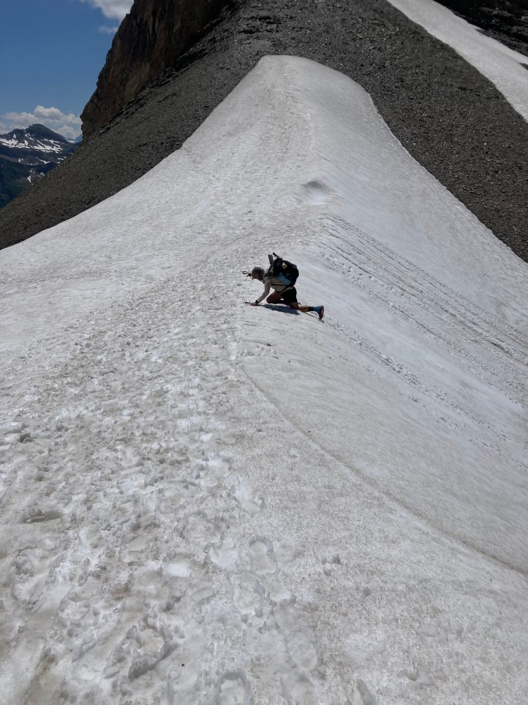
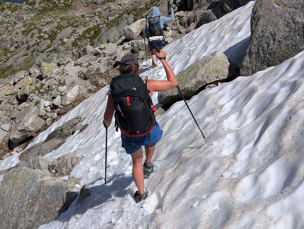
Eventually, WB arrived. We waited for her to rest and have lunch before we all began to descend as a group. Steep climbs are exhausting. Steep descents are challenging in a different way. One’s center of gravity when climbing is close to the mountain as one leans forward against the mountain walls. Descents are the opposite, leaving one less well-balanced and prone to falls. It was a very long, delicate descent over rocks. Twice, we had to stop to put on our micro-spikes to cross steep snow fields.
We did not take as many photos of this as we usually did because we were so focused on not falling. However, fall we did—all of us at various points. Rise and Shine had the worst of it. Her knees were bloody, and I was glad T-Jaw was a medical doctor. Falling was not the only cause of injury. The direct harsh sunlight eventually overwhelmed WB. She had the worst sunburn I had ever seen. It was bright red with blistering. Dr. T-Jaw was able to examine it. He told her it had reached second-degree burn stage and suggested covering it. Surprisingly, WB reported that it was not bothering her.
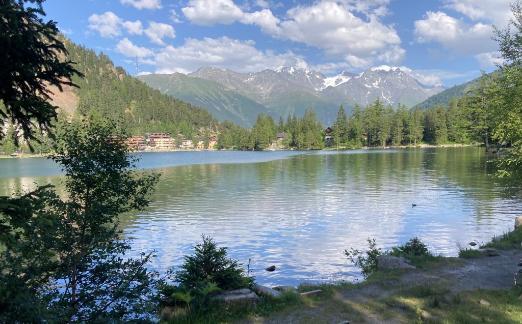
After a long day, we finally reached Champex-Lac, a small town around a pristine, clear glacial lake. We hiked around the lake to our campsite, collected Come on Elieen, and went out for dinner. Understandably, we slept very, very well that night at our campground.
On Thursday we woke to what we expected to be an easy day compared to the T-Jaw variant day we just completed. Other than an unexpectedly steep climb, it was much easier. We got to our campground in time for lunch. A cool intermittent drizzle settled into the valley. It was nice to wear a fleece and jacket after such long hot days, so the drizzle was not unwelcomed.
In the morning, we planned to hike to our second “wild camping” spot. In a national park, permits were necessary, and we had pulled them before the trip. The permit process required one to read the park rules and then pass an online test. (I got 100%). The campsite was along an alpine lake overlooking Mont Blanc. This would be the second trip highlight. But first, we had to get there.
The climb from Champex-Lac to the next col was surprisingly well-graded. We enjoyed the relative ease. This col is the border between Switzerland and France, returning us to the country in which we started. The refuge at the col appeared to be in France but it took payment in the more expensive Swiss francs. Grrrrr. We bought the expensive banana cake anyway.


As we set off to descend into France, Rise and Shine reached unsuccessfully for her trekking poles. They were gone. This alarmed her. One needed poles for the steep climbs and descents. And, like most of us, she used her trekking poles to set up her tent. Someone, probably by accident, took her poles thinking they were his or hers. There was an unclaimed pair not far from where we were sitting. After inquiring with everyone at the refuge if these orphaned poles were theirs, she took them. She was deeply disappointed. Her poles were lighter and had a grip she preferred. However, she just let it go and didn’t think of the matter further. Just kidding. She became a woman on a mission. She rushed down the mountain in the direction of a group of French guys who had been sitting near us. She thought one of them had her poles. Along the way, she would ask passerby if they had seen her poles. At the base of the mountain, she sat herself at a trail junction to inspect each person’s poles as they passed. She started posting flyers on trees with photos of her poles under the heading, “Have you Seen These Poles?” WB, who had been hiking behind us and who could not have possibly known Rise and Shine was missing her poles, asked about them when she saw us.
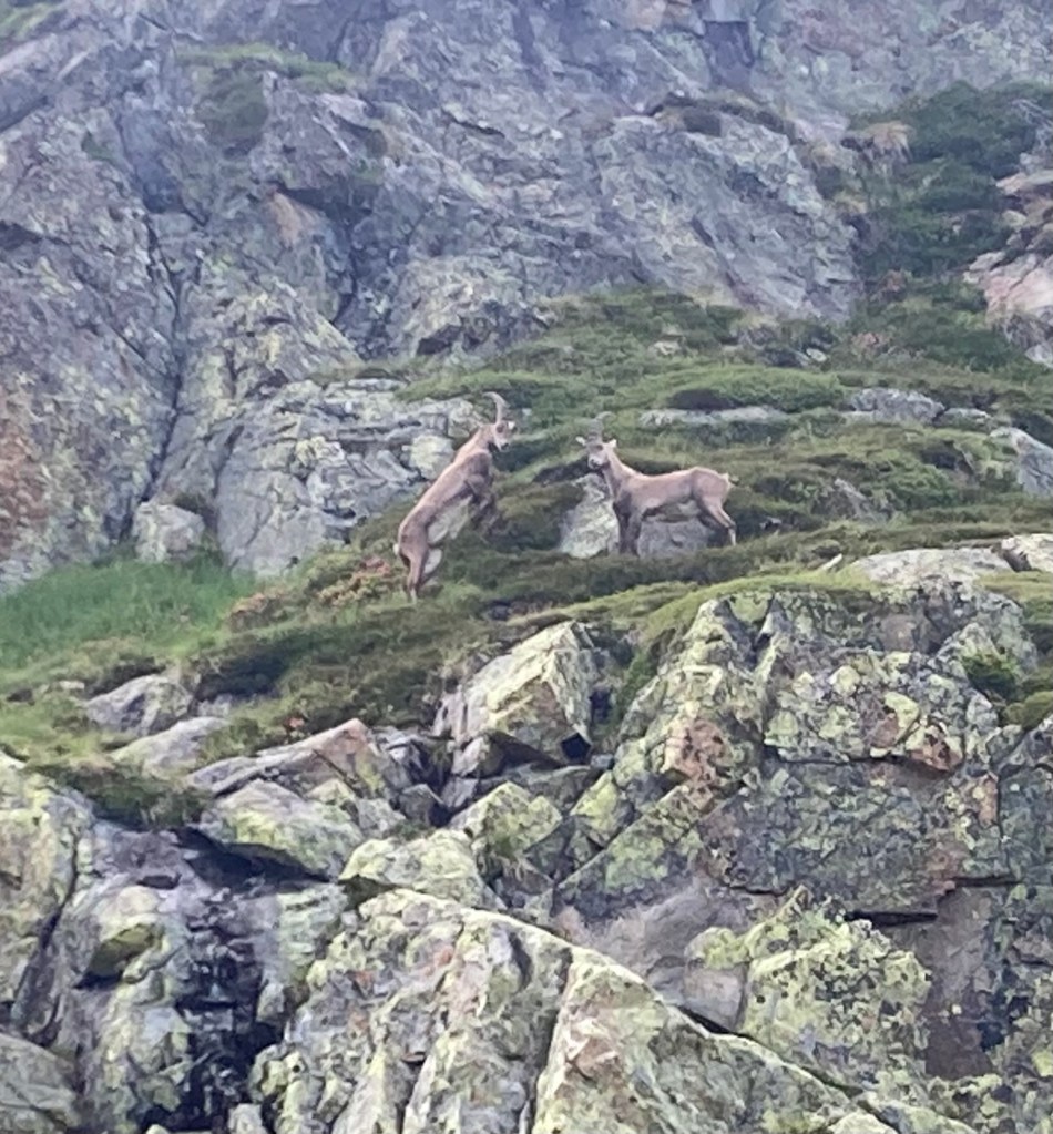
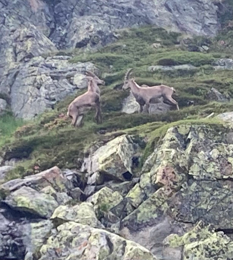
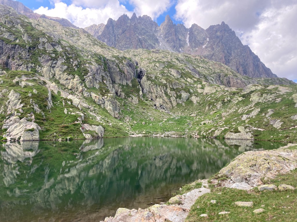
The climb after lunch was one of the most difficult of the trip. Another exposed steep climb in the heat of the day led to rock climbs requiring hands and feet. A series of ladders, metal rungs, and rock scrambles led us higher and higher. Eventually, we reached the top of our climb and the lake around which we’d set up camp. Per the permit, setting tents before 7:00 pm was prohibited, so we laid our packs on preferred camping spots and set off to walk around the lake, oogle at the high waterfall, and stalk ibex—a deer-like animal with huge, curved horns on its head.
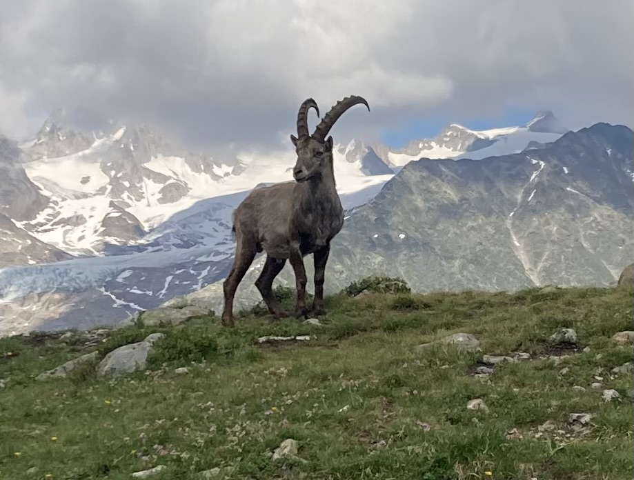
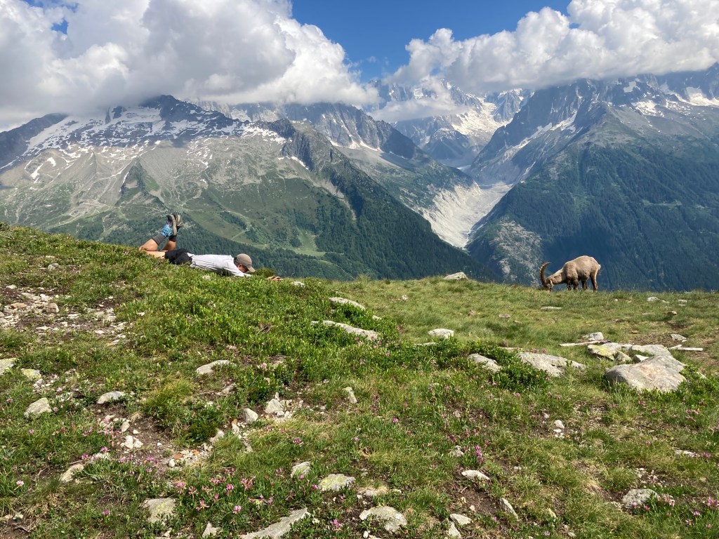
T-Jaw told us that seeing ibex in the Alps is a unique experience. He said some people go on expeditions with the hope of seeing just one in the distance. We found ourselves camping in a herd of them. They were walking all around us and even treated us to a World Wrestling Federation-style ibex fight! When they lock horns they do not do so figuratively.
At 7:00, we set up our tents, made our dinners, and stared at the changing colors on Mont Blanc as the sun was setting. This would be our last night on the TMB. I later mentioned that this was the best campsite of my life so far. Girl with a Big Backpack appreciated my “so far” optimism and the implication that there could someday be a better camping spot than that idyllic one. I’m always hopeful!

Our last day on the trail was a long one. After a nice high traverse overlooking the Chamonix valley that we rushed through to avoid marathon runners scheduled to race over that same section of the TMB later than morning, we had our final climb. The TMB did not disappoint. This final climb featured a “best of” experience, complete with stunning views, rock scrambles, ladder climbs, and snow field crossings.

And then, we had a never-ending descent back down to Les Houches—7,535 feet of almost continuous descent. In my mind I’m still walking down that mountain!
Back in Les Houches, we took a victory photo under the same arch under which we posed when we started the trek 9 days earlier.
We hiked 41,105 feet of elevation gain over 117 miles. Two Gangs and I, having hiked two bonus days before the official TMB trek, clocked in at 47,688 feet of elevation gain over 138 miles.
And then we dispersed. T-Jaw, who was driving back to Frankfurt, wanted to get a jump on traffic. He wanted to get out of Switzerland and their annoying “speed limits.” (On many German highways, there is no limit). Two Gangs wanted to greet a group of his hiking buddies from Ohio who came to start their hike of the TMB the next day. WB, Rise and Shine, and Come on Eileen, and I went out for a final dinner. Come on Eileen ordered a shot of Jägermeister and with a big smile started horrifying us with tales of her younger wild side as she bopped along in her seat at our table to 70s-era disco music playing loudly from the bar. Here is a sample quote: “Dance parties in the early 80s were the best; no AIDS and many were on coke.”
That night, in our final campsite prior to my flight back to the USA, I stared up at the Alps I had come to know so well. Maybe it was the shade in the rocky crevices rapidly changing in the light of an alpine sunset, but I thought I saw an image of the famous cartoon character voice-actor—and namesake of Europe’s highest mountain—Mel Blanc—himself. I could have sworn the mountain breezes whispered his character, Porky Pig’s, famous European farewell: “a thea, thea, thea, that’s all folks!”
— David O (“Spider-Man”)