
Everyone knows of the Black Forest Trail in north central Pennsylvania. Fewer people in the USA know of another “Black Forest” a lot further away—in Germany. Weirdly, the Germans call their Black Forest “Schwarzwald.” (I assume Pennsylvania beat Germany to the trademark rights to “Black Forest,” or Germany’s version is just a knockoff of Pennsylvania’s).
After I posted a DCUL backpacking trip to the Black Forest Trail, and after a friend told me of the German version of our famous trail, I decided to travel to Europe to investigate. I am now prepared to report on who does the Black Forest better—Pennsylvania or Germany. Having now hiked both, here is my report and verdict.
Geographic Size
The Black Forest Trail is a 42 mile loop in the Tiadaghton State Forest of Pennsylvania. According to the state’s website, the Iroquois tribe referred to “Pine Creek,” a major stream running through the woods, as “Tiadaghton.” So, I assume the word means “Pine Creek.” The website suggests the pronunciation “ty-a-dot-un.” (Had they just called it “Pine Creek” they would not have needed phonetics). The town of Slate Run anchors the trail. There is a restaurant and general store there, but not much more.
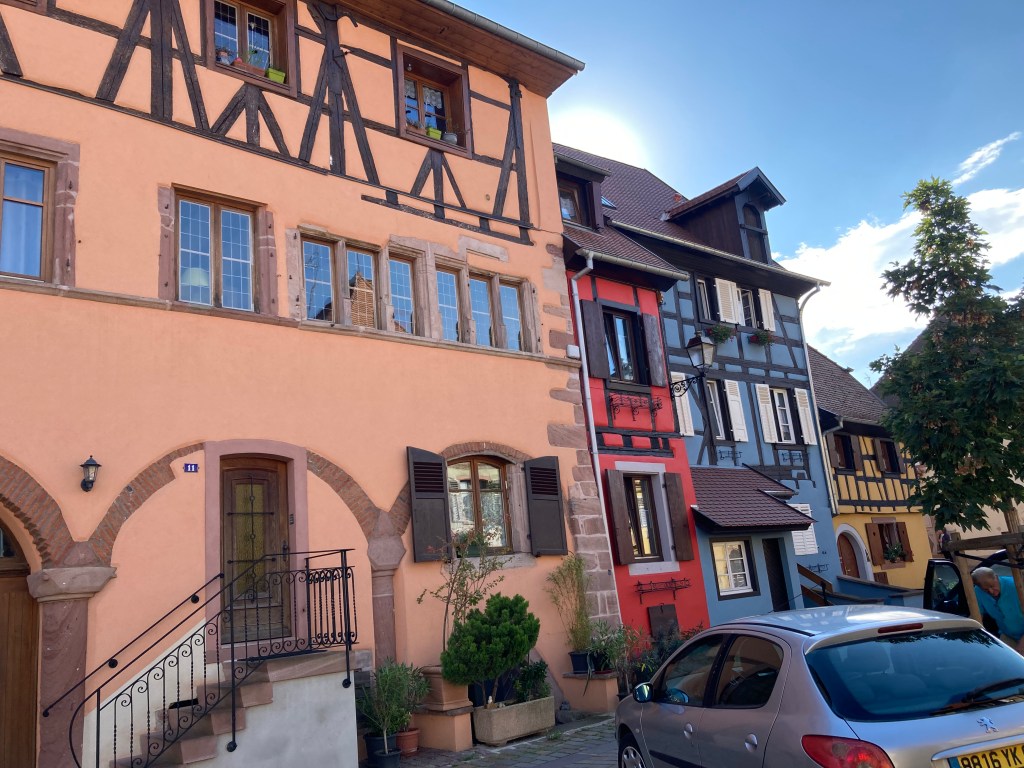
Schwarzwald is 2,300 square miles. To make it seem larger Germany brags about it being 6,000 “kilometers,” but they are not fooling anyone. It’s really 2,300 miles. Nonetheless, 2,300 is larger than 42. The portion of Schwarzwald I hiked was between the cities of Baden-Baden and Freiburg. These are bona fide cities. They were very cute, too. The houses looked like gingerbread houses and were so authentic you knew all the boys and girls who lived there were named Hansel or Gretel.

ADVANTAGE: Schwarzwald.
Accessibility from Washington, DC
The Black Forest Trail is a 5 hour drive from DC.
Schwarzwald is much further. It took me 6 hours to fly from Dulles Airport to Iceland, then 3.5 hours to fly from Iceland to Paris, then almost 2 hours to ride by train from Paris to Strasbourg, then almost an hour by car to Baden-Baden. Yes. That is 11.5 hours!
ADVANTAGE: Black Forest Trail.
The Experience
I hiked portions of Schwarzwald alone. It was kind of lonely, albeit peaceful. I met a few other hikers. They must have thought I was sneezing because they each said “guttentag” as they passed, which I assume means “God bless you.” Eventually, I started returning their greetings with the American version of well-wishes after someone sneezes—“gesundheit.” So, our exchanges consisted only of “guttentag”/“gesundheit.”

I hiked the Black Forest Trail with a terrific group of DCUL backpackers. We left DC in two waves at different times and met at a camp spot I designated 2 miles from the Rt. 44 trailhead, hiking counterclockwise on the loop. By 11:30 pm all 9 of us were in our tents sleeping or falling asleep.
With an “Octoberfest” theme, I roused our crew at 6:00 am Saturday morning with a traditional German drinking song:
“Ein prosit, ein prosit, der gemutlichkeit. Ein prosit, ein prooooosit, der gamut-lich-keitttttt. Eins, zwei, drei, GSUFFA! Ziggy zaggy, ziggy zaggy, hoy, hoy, hoy!”

(I learned this song at the Germany section of the Busch Gardens amusement park in Williamsburg, Virginia, so you know the song is authentic)! This got everyone in the mood. At least, it got everyone out of their tents. We began backpacking.
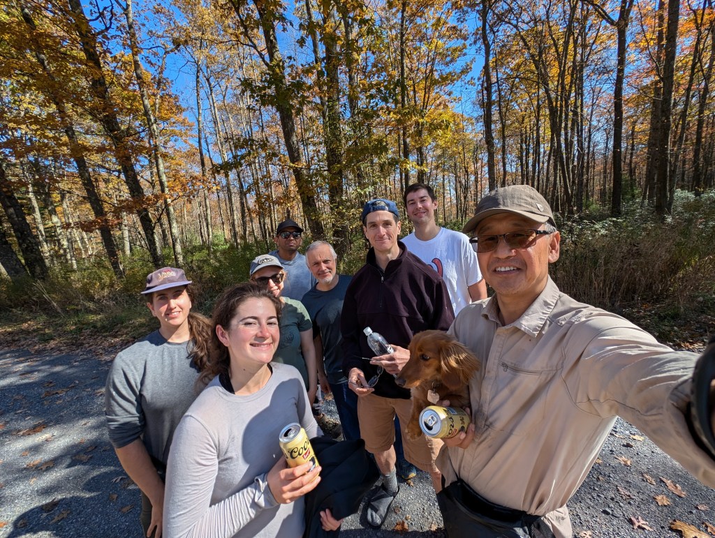
The Tiadaghton State Forest is part of the Great Allegheny Plateau and we started our trek from the top of the plateau. So, our morning consisted of starting above the valley before sunrise, hiking down into the valley at daybreak, and then climbing back to the plateau in sequence. It was very dramatic. On the top of the plateau it was bright, sunny, and very warm. We overlooked the fluffy whipped cream mist filling the valley. As we descended into the clouds it was dark, cold, and humid. Thus we constantly removed and added clothing layers to stay comfortable. At one point on the plateau I took a photo of Jake, Haigang (“Two Gangs”), his dog Mocha (“Sam”), Wassal (“WB”), Maddie, and Aneesh overlooking the cream filled valley.

The cool, dry Autumn weather felt delightful. We hiked fast. I expected we’d arrive at the town of Slate Run for a restaurant meal and beers by lunchtime, but we arrived closer to 2:00 pm. This puzzled me because I’ve previously hiked this trail and arrived at the town much earlier. I later realized that on the prior trip we started earlier in the morning, we didn’t linger for as many photographs, and no moron wasted our time with a poor rendition of a German drinking song.
Ashley (with the appropriate trail name, “Rise and Shine”) arrived first for lunch, having started her hike that day an hour earlier than the rest of the group. No one caught up to her. Dmitri (“Dying Siberian Wolf” or “DSW”) came close. DSW arrived with enough time to spread out his tent in the sun before others of us arrived.
Rise and Shine immediately ordered a crab cake sandwich and would become the last one to eat. Apparently, the highway signs near this part of Pennsylvania reflecting the close proximity to “Jersey Shore” does not mean the ocean. It took the restaurant a long time to fix her meal. She growled as everyone who ordered something other than seafood after her happily munched on their meals before her.
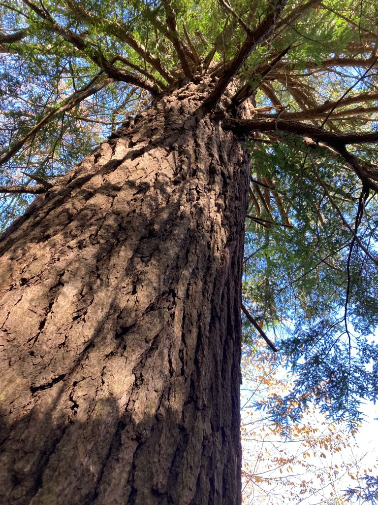
The trail was fun but physically tough. The climbs often ran straight up or straight down the mountains with little time on the plateau. We ultimately climbed 5,000 feet that day, losing the same amount in descents. It exhausted us! Two Gangs and his dog, Sam, compounded the difficulty by maintaining an unsustainable pace to “catch up” with us. Unfortunately for them, they passed the core group of us when we took a deviation off the trail to see one of the last old growth hemlock trees in the forest. So, they engaged in the impossible quest to catch up to hikers behind them!
After lunch we had yet another 1,500 foot climb and descent to our Saturday night camping spot along a swollen stream. The climb was memorable with mossy rock “bridges” to cross, and a solid rock wall to hike alongside. The descent featured a complicated, steep rock scramble that would have been more fun if we weren’t so tired at that point. We hiked 25 miles that day—a big day even without our 5,000 feet of ascents and descents.
We ate in the dark by the light of a campfire DSW kindled.

I ate a dehydrated meal I made of beans, rice, and spices. It was delicious, but did not look like one of the meals I ate in Schwarzwald.

Two Gangs and Sam ate alone outside his tent before going to bed. This was a big day for us bipeds. Sam hiked the trail with his four little legs. A small dog, he was too tired to do anything but eat some dog food and fall asleep in Two Gangs’ tent. Hopefully, Two Gangs ate something other than dog food, but I’ll never know.
There was no campsite along the stream large enough for all 9 of us to set up tents together. So, Two Gangs/Sam, WB, Aneesh, and I set our tents 3 blocks downstream from the others. Because we weren’t all together—and much to everyone’s disappointment—I couldn’t render the second of the two German drinking songs I remembered from Busch Gardens in the morning for a wake up call. So, we woke up on our own and started hiking Sunday at 6:30 am in the dark by headlamp.
Sunday was a much easier day featuring “only” 17 miles and 2,250 feet of elevation gain. At one point, DSW, WB, Aneesh, and I, hiking in a subgroup, realized we were in reach of scoring a “10 by 10”–ten miles by 10:00 am. We had already completed the first of two major climbs and were hiking fast through a valley floor featuring a meandering creek. We had to jump, rock hop, or deadfall-shimmy across 15 or so creek crossings. As the clock got closer to 10:00 am, our pace increased. At one point WB, in the lead, was doing a light jog to secure our quest with the taller three of us behind her fast-walking. As Mark (“Brightside”) would later describe it, we were “in the zone.” We were moving so fast there was no time to think how we’d make each water crossing. We just rushed onward hoping there would be a spot to land each foot as we progressed across the creek.

Aneesh, breathing heavily, reported we were comfortably on track and might not need to push so hard. We pushed anyway—until we hit the wall. We reached the penultimate climb of the day and this one was a doozy. It was straight up from the creek like it was a rungless ladder. WB, who was in the lead paused to decide whether a 10 by 10 was worth running up a cliff. DSW arrived next to her, having made the last creek crossing by balancing across a fallen tree he used as a bridge to stay dry. He looked up, too. Aneesh and I tried a final rock hop, with me missing a key rock and getting both feet soaking wet in the cold water. We paused next to WB and DSW and also looked up.
Then, wordlessly, I started running up toward the sky. The others followed. Like a high intensity workout, I became completely breathless. My breathing was close to or at hyperventilation. I put my trekking poles in one hand so I could grab my GPS. So close to 10:00 am; so close to 10 miles. However, maddeningly, the recorded distance did not seem to match reality. It felt like sitting in high school math class when I’d stare at the clock that stopped moving, or standing in the kitchen over a pot of pasta water that would never boil. Why wasn’t the GPS distance increasing along with my steps? I wondered if distance is measured by steps or by straight lines—meaning that it takes more steps to hike up a steep cliff than flat ground because you don’t cover as much distance due to the elevation. I suppose this will just be a mystery for all time, like time travel paradoxes.
I reached a short rock scramble at the lip of the plateau and recklessly jumped from rock to rock as I clambered toward the top. Once on the plateau, I looked again at the GPS. Damn! 9:59 am and 9.7 miles. Now on flat ground, I sprinted. At 10:00 am I took a screen shot of my GPS.

I almost got it.
I hiked the remaining 7 miles much more leisurely. The trail was mostly flat and stunning. After the blur of the last, rushed 10 miles, it was nice to calmly notice the small things. The crystal clear stream along the trail looked inviting. The soft pine needles on the ground soothed my tired feet. My lungs had the pleasant “burn” with each breath one enjoys after a good run. The only part I didn’t like was a grassy, boggy meadow I walked through that soaked my feet.
The last climb to our parked cars was particularly difficult. So tired, I would take frequent breaks to look up the hill, look at my GPS to confirm that I really was as close to finishing as I thought, and then venture a few more steps forward before I rechecked my position all over again. Eventually, I got to my car, shrugged off my pack, and took a long pull on my remaining water. What a rush! WB arrived only moments after I did. Aneesh and DSW were not far behind.
“That was so close!” I sighed. “I really wanted that 10 by 10.” Aneesh said, “I think you got it. The 10 mile mark was at at the lip of the plateau. I appreciated his cheer, and he might have been right, but I lacked the proof of a screen shot. However, I quickly set aside any disappointment. This was such a fun, challenging trail, with such good companions, I felt great! Brightside gushed that this trip on the Black Forest Trail might be his last. He had hiked this trail a few times previously and felt that this time his trek was “perfect.” We had great weather—as cool and crisp as a tart October apple. The Autumn leaves were at peak colors, there was no rain the entire weekend, and we hiked fast and strong. Our companions were bright, funny, and engaging.

The total mileage for our trip, including an excursion or two, was 44 miles.
All but one of us arrived after a short time and I sent everyone to lunch while I waited alone for our last friend. After all my solitary hiking in Schwarzwald, I was comfortable being alone for a time.
So, rating the “experience” between the Black Forest Trail and Schwarzwald, Pennsylvania does the Black Forest better. Sorry, Deutschland.
ADVANTAGE: Black Forest Trail.
—David O (“Spider-Man”)
Cover photo credit: Aneesh


Leave a comment