Early this year, as a natural next step after tackling the King’s Canyon High Basin Route last summer (and also perhaps as a momentary diversionary cure for the dark cold nights of the DC winter), a few DCUL members turned their gaze further north: towards Yosemite, and the high route there. As winter turned into spring and then summer, and as both the days and our PTO balances grew, the time finally came to once again visit the high sweeping granite landscapes of the Sierra.
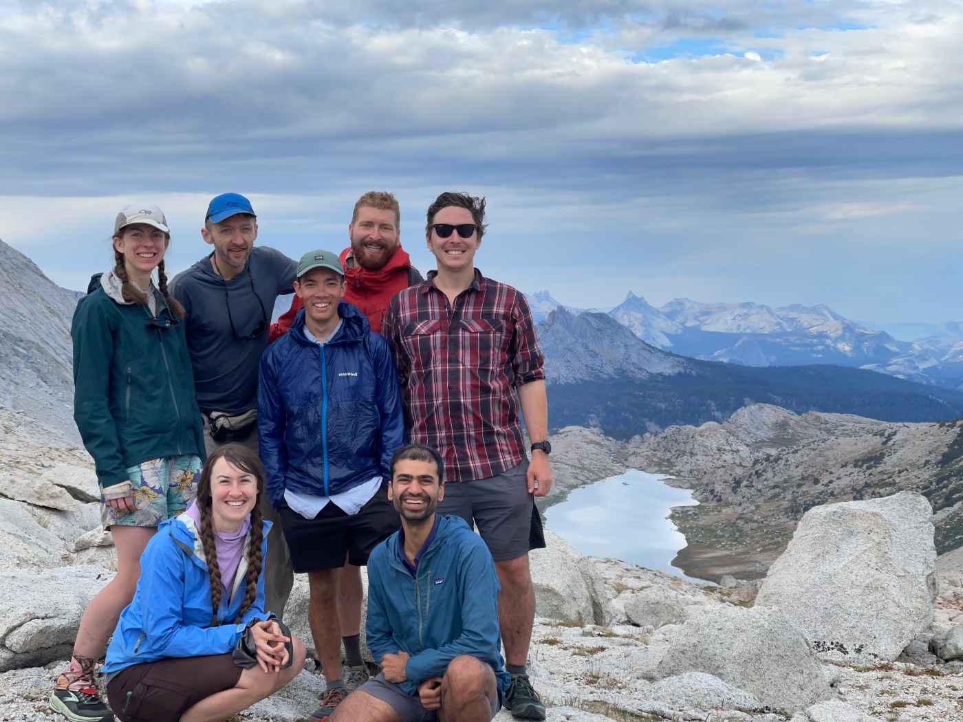
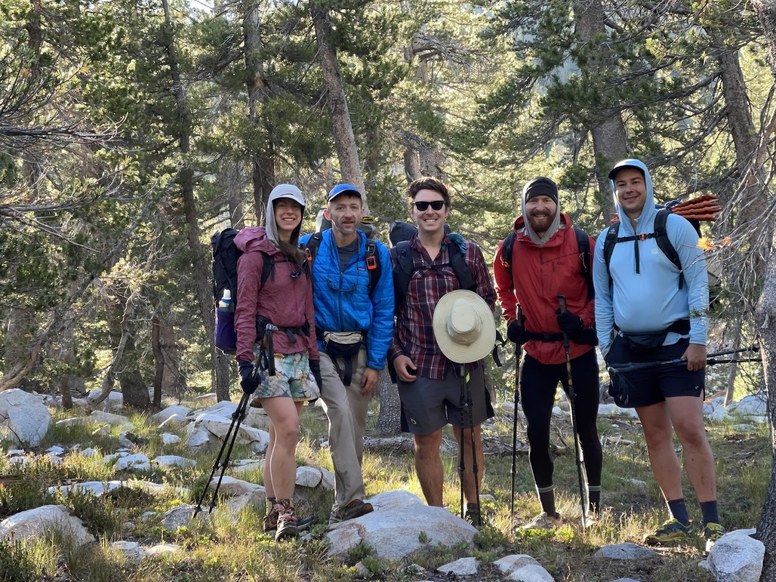
A group of 8 DCUL-ers traveled from DC, Colorado, and California to attempt the Yosemite High Route over 12 days in mid-August 2022. Our route was a big figure eight, starting at Tuolumne Meadows in the center. First, we headed north down the Grand Canyon of the Tuolumne, and then returning SOBO along the Core Route. We passed through Tuolumne for a resupply and continued south along Rafferty Creek until we reached the southern terminus, at which point we completed the Core Route NOBO back towards Tuolumne. Kudos to Mark for doing all the hard planning work in terms of logistics, permits, and caltopo-ing.

Chronological play-by-plays can be tough to follow if you weren’t there, so we’re giving you an alphabetical rundown of what happened instead:
A is for ALTITUDE. The YHR is relatively low for a high route, but pretty darn high if you’re coming from sea level. Our route ranged from 4360′ to 12216′, mostly hovering in the 9-11k’ range; the southern loop was generally higher up than the northern loop. Our approach from Tuolumne to the northern terminus was about 50 miles over 3 days, and this worked really well in lieu of a separate acclimatization hike for most folks. Alas, Mark was hit with the curse of the trip planner and got off trail on Day 5 after having some respiratory issues at higher elevations.
B is for BEARS (and other animals). Hard-sided bear cans are required in Yosemite National Park. That said, we saw one bear the whole trip (the first day). In general, there weren’t many animal sightings: a couple snakes (rattlesnake & water snakes), caddisfly larvae with natural debris casings, plenty of chipmunks and birds, some deer, and one awesome sighting of a falcon nearly catching a pika.
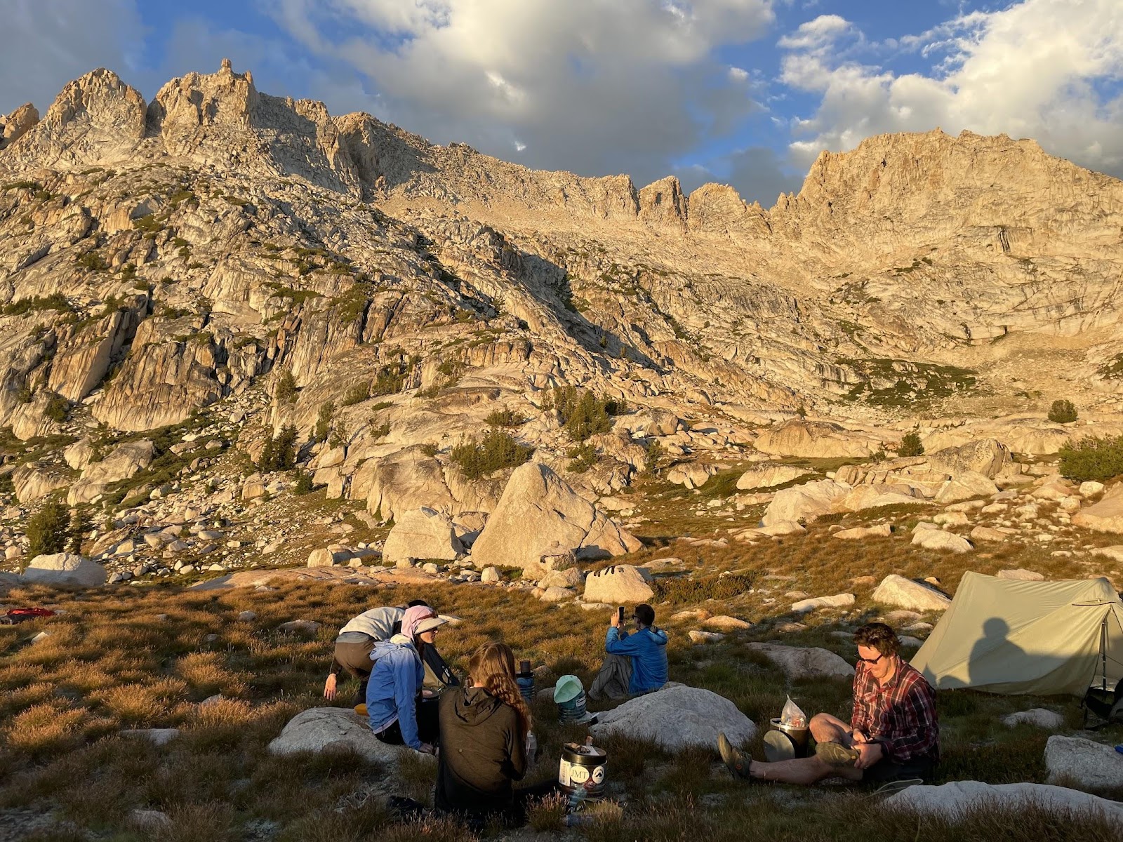
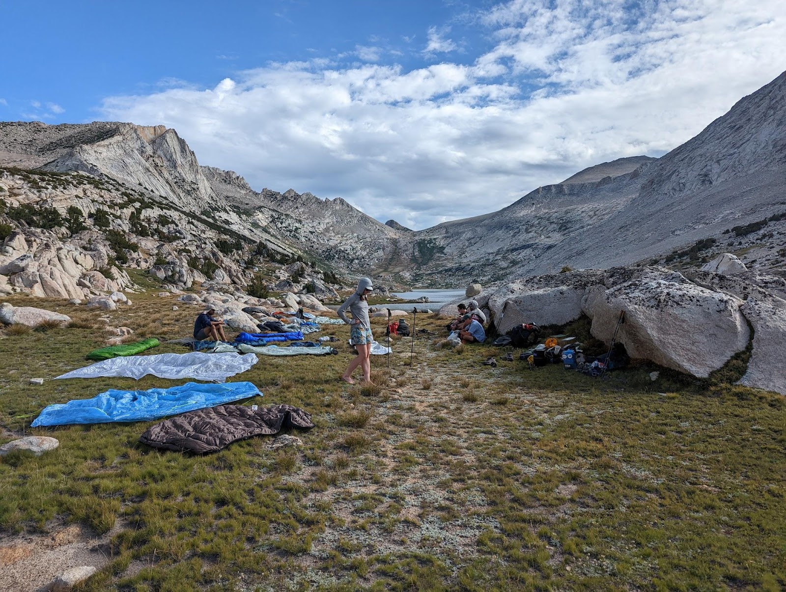
C is for CAMPSITES. It was easy to find sufficiently large campsites near water each night on our route, even with some in-the-moment schedule adjustments. Most people cowboy camped most nights, but we were never camped on slab where it would have been difficult to stake out a tent.
D is for DISTANCE, and E is for ELEVATION. In total, we hiked about 190 miles and 43k’ – spot on with what we expected. As with any off trail route, prepare for your daily mileage to exceed what Caltopo says (since your Caltopo line is probably a waypoint-to-waypoint suggestion rather than where you’ll actually have to walk). With this schedule, we typically maxxed out our effort for the day before we ran out of hours – it was great to be tired in camp each night but still have plenty of time for swimming holes and afternoon naps.
| Day | Distance | Elevation | Notes |
|---|---|---|---|
| 1 | 22.5 | 1290 | Descending 6k’ on the Grand Canyon of the Tuolumne |
| 2 | 16.1 | 5403 | Climbing up from Pleasant Valley to Bear Valley |
| 3 | 21.4 | 4339 | On the PCT! Going “across the grain” |
| 4 | 15.9 | 4900 | First day on the high route with 3 big passes |
| 5 | 18.1 | 4299 | No memorable passes but lots of smaller climbs |
| 6 | 13.2 | 3859 | Two big off trail passes and an afternoon thunderstorm |
| 7 | 17.2 | 3360 | One off trail pass and a leisurely resupply in Tuolumne |
| 8 | 21.3 | 3582 | On-trail approach to the southern terminus and starting the climb up Quartzite |
| 9 | 16.4 | 4710 | Quartzite Peak and two big passes (Lemonade and Sue) |
| 10 | 9.2 | 3204 | Took a “nero” after finishing 2 big passes before noon |
| 11 | 14.2 | 3827 | Last 2 passes and detoured to camp outside the park |
| 12 | 4.1 | 184 | Finished with an easy on-trail hike out! |
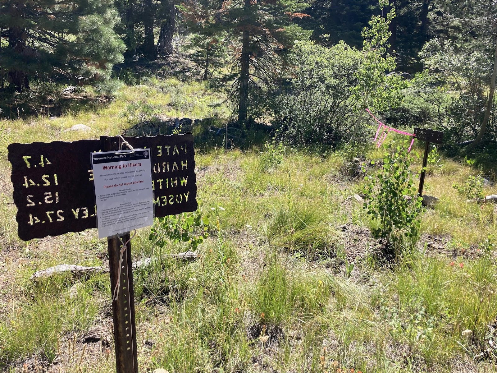
F is for FIRE. We got incredibly lucky with smoke and fires this year. There were a couple days where the smoke was unpleasant, but it never significantly interfered with our hiking (or even the views). We saw three active fires (no flames, just the smoke plumes) while we were out, but none were on our routes or grew dangerously large. We met a wildland firefighter on our second day who was keeping an eye on one fire in Rodgers Canyon, and he explained how they don’t do much active management in the national parks but there’s a group of firefighters on site to monitor the activity. Earlier that day, we’d seen a helicopter drop off 60 gallons of water to the people stationed up on the ridge (just for their own use).
G is for GEAR. We all packed pretty typical setups, with a few considerations specific to this trip (and/or high routes in general): hard-sided bear cans; sufficient gear for wet & and cold in case we hit storms (we were almost all too warm with what we’d brought, but it’s always hard to predict alpine weather); and more sun protection than you need on the east coast. The bug pressure wasn’t too bad, and people were happy with a variety of shelters ranging from fully enclosed, to tarps-only, to cowboy camping. Loaded packs with 7 days of food at the start were all around 28 lbs (without water), plus or minus. One big takeaway was that it’s really worth having new(ish) shoes with fresh tread for a technical route like this.
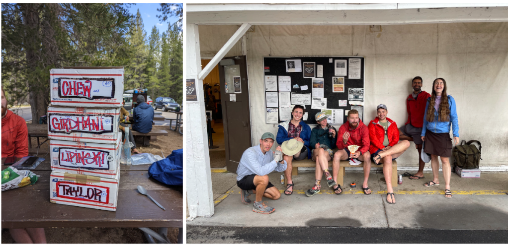
H is for HIKER HUNGER. In somewhat of a tradition by this point, we went to an Indian restaurant for our post-hike group dinner. We ordered what seemed like entirely too much food and demolished it all. Shenanigans did some truly heroic work finishing an extremely spicy butter chicken. Our favorite meals were at The Barn in Bridgeport (it could have been the post-hike hunger talking, since we went there first thing after finishing, but we all insisted that it truly was that good), and we also enjoyed a pre-hike stop at the June Lake Brewery.
I is for INREACH DEVICES. Almost everyone on the trip had a Garmin inReach, which was extremely helpful for coordination & communication on trail (and peace of mind when we inevitably got separated unexpectedly). They’re not great for real-time communication (there can be a long delay between sending & receiving), but very much a nice-to-have.
J is for JOKES. Jokes were a mainstay, and often came in the form of rap, Cher, or classic rock remixes with newly inserted terrain-related lyrics to help morale during sketchy descents and distract from lung-stinging climbs (to the willows, don’t fall!). Other times the laughs simply bubbled up as a result of collective slap-happiness after a long day with one too many climbs (can you ever have too many climbs?). We speculated often on the quality of each other’s mitochondria (don’t ask); squeezed in a couple quick innings of snowball-trekking pole-baseball when we found holdout snow up in the passes; decided that the cloud shading one of our climbs was a friendly Italian named Cloud-io; and delighted in a surprise celebrity cameo by YouTube sensation, Steve Climber.
K is for KARMA (trail). One of the biggest “things gone wrong” of the trip was when Greg’s resupply failed to show up at the Tuolumne Meadows post office. But where USPS takes, the trail provides. Between a well (albeit oddly) stocked hiker box, donations from other hikers who caught wind of the situation, leftovers from our own resupplies, and Greg’s own good humor, he successfully pieced together a fully 5-day resupply for the southern loop. In exchange, we packed out three mylar balloons, which doesn’t seem like quite enough trail karma to balance out.
L is for LOGISTICS. People flew into Reno/Tahoe, which is a small and easy-to-navigate airport. We rented a car from the airport and drove about 3 hours to June Lake (stopping at REI on the way for fuel cans), where we stayed in a frontcountry campground. The next morning, we entered Yosemite National Park and parked the car at one of the trailheads near Tuolumne, where we started the hike. Karan, Kylie, and Alex joined us several days later, starting from the Twin Lakes trailhead and hiking over Willow Pass to meet us in Thompson Canyon at the end of Day 4. We would have done a driver’s shuttle to get back to that car at the end, but Mark was able to drive it down to Tuolumne for us after he hiked out. At the end of the hike, we drove back to Reno and stayed in a hotel near the airport.
M is for MAPS, and N is for NAVIGATION. We heavily used Skurka’s guidebook and mapset; those waypoints and notes were sufficient to navigate the whole route. It wasn’t always obvious from a distance where we’d be going over a pass, so we often had to check and re-check as we got closer. Most folks used the Caltopo app on their phones, and several people also carried paper maps. At one point Cassie’s GPS stopped working and Kylie’s map layers wouldn’t display, which is a great reminder to always be comfortable with a non-digital navigation option.
O is for OTHER PEOPLE WE ENCOUNTERED. There were certainly clusters of dayhikers and campers on the popular & accessible trail sections (we saw one group out for a 75 mile loop on horseback!) but we hardly saw anyone off trail – just a single person up near Dead Horse Pass, and then a group of NPS glaciologists heading out to measure the movement of the Maclure Glacier by putting a stake in it, measuring its precise location, and then coming back to see where the stake is several months later. The glacial movement hadn’t been measured in ten years, and this year’s measurement happened almost exactly 150 years after John Muir first did that experiment. We loved hearing about their research, and it was a funny experience to have our permits checked so far off trail. Speaking of permits…
P is for PERMITS. We needed a backcountry permit for Yosemite National Park, which we picked up at the ranger station the morning of our first day after reserving it well in advance. There were restrictions on camping in some of the most popular areas and within a few miles of certain trailheads, but we were not restricted to camping at specific campsites. We also technically needed a National Parks pass to enter the park by car, but we didn’t need a timed entry reservation–the backcountry permit exempted us, and once we had checked in we were free to come and go from the park for the duration of the trip. Our permit got checked twice–once between Bear and Pleasant Valley by a ranger who seemed shocked to find us awake and ready to hike at 6:30am, and also just in that part of the park at all. The second check was by the geology team who proclaimed Alex’s photo of the Inyo NF permit as acceptable albeit “a bit fast and loose” considering it was unsigned.
Q is for QUICKSAND. There was no quicksand. Did you really think there’d be quicksand?
R is for RESUPPLY. We started with 6.5 days of food, with the first one carried outside the bear can (since it’d be eaten before the first night). By lunch on Day 7, we’d arrived at Tuolumne Meadows to stuff our faces at the store (the grill was closed) and leave with another 5 days of food. Most of us mailed our resupply boxes ahead of time, since we knew the car would be tight, but it’s also easy to leave stuff in the bear lockers at the parking lots.
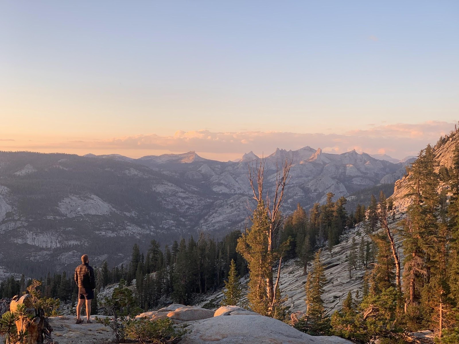
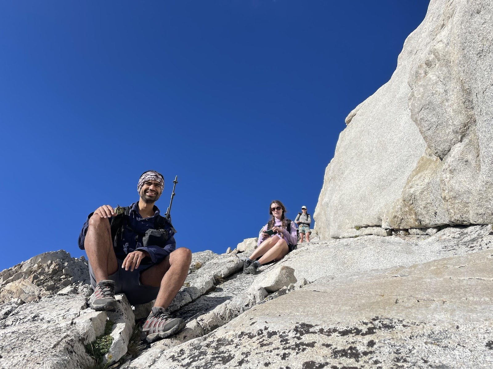
S is for SUNRISE and SUNSET. We were typically in our tents long before sunset, but a couple nights we stayed out past hiker-midnight (aka past 7:30pm) to watch the light fading across the mountains. On one of those nights, Alex and Greg talked the group into a sunrise ascent of Quartzite Peak, which meant leaving camp at 5:15am. It was a sweaty and challenging 800’ climb in the dark that morning, and unnecessarily early since the sun took so long to get above the mountain horizon. But the views more than paid off, and we spent the time perusing the trail register dating back to 1988.
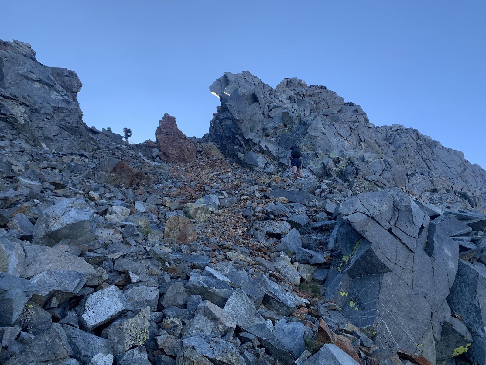
T is for TERRAIN. The YHR has a lot of forest, a lot of tundra, a decent bit of talus, and a delightfully low amount of scree. Rocks were generally pretty stable, but there were a number of Class 3 / Class 4 moments that required stowing the poles and climbing a bit. The sections that Skurka hyped up weren’t as heady as we’d expected, but some of the “stiff descents” surprised us. Our experience was that Stanton Pass (both up and down) and the ascent of Russell Pass were more technically challenging than we’d expected, but Russell (and possibly Stanton) may be less demanding earlier in the year with more snow covering the talus and scree.
UV is for UV INDEX. It’s sunny up high, and mid-August was hot! We often spent afternoons in the shade, finishing the last miles after 4pm when it had cooled down a bit. Once we got to higher elevations it wasn’t quite so hot, and we were all extremely thankful for the cloud cover on our afternoon climb up towards Quartzite Peak. Everyone wore long sleeved shirts and hats.
W is for WEATHER. We were so lucky with the weather on this trip. If anything, it was too hot – sweaty in the afternoons, and sweaty overnight in our ready-for-anything sleep systems. We had one thunderstorm on Day 6 that we rode out in our tents, digging trenches to divert the water that couldn’t soak into the dry ground fast enough, and it rained most of the afternoon that we spent at the Tuolumne general store.
XYZ is for COME ON, these letters really just shouldn’t exist when making complete alphabetical lists like this.

X is for excellence in writing entertaining and informative trip reports.
Y is for Yosemite — because it just is.
Z is for zebra. Because what else could it be for? You never know when you might see one.
LikeLike