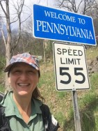
My final sections of the Mid State Trail (DCUL sections 1 and 2; MST sections 1 through 5) did not disappoint. Taking advantage of the flexibility of hiking solo, I started on Wednesday afternoon instead of Thursday morning, to give me extra time in case my ankle started acting up again. I made it to Pennsylvania in time to cover more than 10 miles, which seemed like a good way to ease back into 20-mile days. I had intended to park at the Rails-to-Trails parking lot in Williamsburg, as I had on a DCUL trip last year, but a new sign indicated that overnight parking was not permitted. Concerned that I might get towed, I decided to consult the handy-dandy MST group on Facebook. As usual, people responded quickly with suggestions. I was heading to one of the suggested places on foot when I happened to pass by a police officer who greeted me with a smile, so I asked his advice. That led me to the Williamsburg municipal building, where all I had to do was leave my car information, and I was told my car would be fine. (It was.)
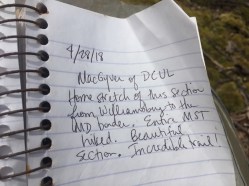
 I was on the trail by 4pm on Wednesday. The first few miles were on paved roads, but they were still scenic and pleasant. I was greeted on the way by Joe from the Williamsburg municipal building, who was heading home for the day and happened to live on a road right on MST. Shortly after reaching the ridge, I passed by a trail register with a brand new log book. The old book was there for me to peruse (and see previous DCUL entries), but I was the first one to sign the new book. A couple hours later I was setting up camp as the sun went down.
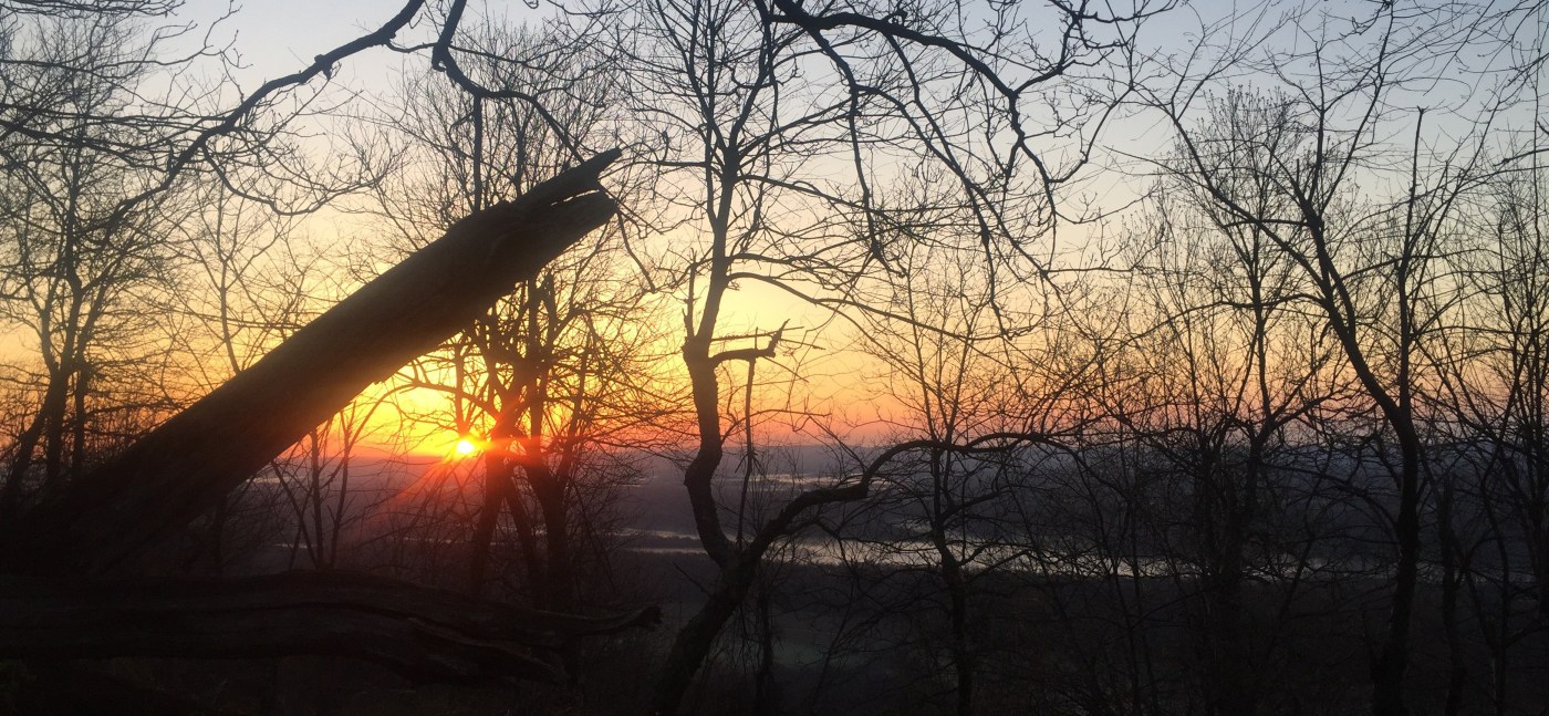
 Thursday started with a short climb up to the ridge and a fantastic view of Butler Knob. The terrain included some grassy woods roads along with the ridge walks, so it wasn’t particularly difficult, but for some reason my pace was still a bit slow. In the afternoon I dipped into Maple Run Valley, which was incredibly pleasant with all of the babbling sounds of water rushing by. A fisherman complained that the sun came out and scared all of the fish away. I expressed sympathy but added that his loss was my gain, as the warm sun and cool air made for delightful hiking weather. I had way too much food with me for the trip, so I passed by the New Frontier Restaurant without stopping, crossed the new bridge at Loysburg Gap, and proceeded to find a place to camp for the night.
On Friday I expected to wake up in the rain, and I was pleased to be able to pack up with only a light sprinkle. The wet rock scrambles that followed made for very slow going, but ridges are fun regardless. The rain stopped completely for the middle of the day as I traversed some more difficult ridge walks, passed through rough briar patches, and descended into Everett Borough. It was a long time to be walking on or near roads, but I certainly didn’t mind the egg sandwich and hot coffee at Sheetz before moving on toward Rainsburg for the rest of the afternoon. Late in the day, the rain started coming down hard. I was thankful for my umbrella, which I almost didn’t bring, but I wanted to travel with a pack list as close as possible to what I plan to use on the Pacific Crest Trail starting next month. (I’ll be using the umbrella more for sun than rain, but it’s handy for both.) I kept hiking until the rain stopped and then started looking for a place to camp for the night. The options were limited, but I settled in after dark at a spot almost all the way to Rainsburg Gap. I covered more miles than I expected on Friday, so I figured I would finish mid-afternoon Saturday. Not long after I set up my tent, the rain came back unexpectedly. I had a signal, so I checked the forecast only to find that there was another line of thunderstorms coming through, including an advisory to those at campsites to “seek sturdy shelter.” Ha!
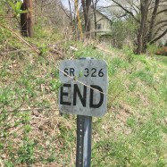
I got moving shortly after sunrise on Saturday and thoroughly enjoyed my walk through the Buchanan State Forest, which included pleasant, water-filled valleys and grassy roads that double as cross-country ski trails in the winter. My feet had been wet all day and I was starting to feel some hot spots, so I decided to enjoy the last few miles walking through cold water puddles in my Bedrock sandals. Boy did that feel great at the end of a 76-mile trek. Before exiting the State Forest, I signed the last trail register, pausing to reflect on how lucky we are to have the Mid State Trail. Thanks to DCUL for starting the trend and to Evan for getting me hooked.
Splits were roughly 11-22-26-17 = 76 miles.
Previous MST section trip reports:
- DCUL Section 3 – June/July 2017 (MST book sections 6 through 8.5)
- DCUL Sections 4-6 – March 2018 (MST book sections 8.5 through 16)
- DCUL Section 7 – August/September 2017 (MST book sections 17 through 20)
I recommend using the MST maps and book. The 12th edition of the book (2012) is out of print, but the next version should be available soon.

Leave a comment