
Santa Catalina Island is located just off the coast of greater Los Angeles and features a gem of a trail called the Trans Catalina Trail or “TCT” for short. You may have heard of Santa Catalina Island from the movie Step Brothers (queue the Catalina Wine Mixer memes). With the weather on the island usually in the 50s/60s even in December, I felt it was the perfect place to spend some time I had off between Christmas and New Years. Thanks to Steve (trail name “Baconator”) for joining me on this trek.
Link to Meetup event: https://www.meetup.com/dc-ul-backpacking/events/303202353
The trail map: https://catalinaconservancy.org/wp-content/uploads/2024/04/trail-map.pdf
Day 1 – Avalon to Little Harbor (~19 miles, 4,075 ft ascent, 4,052 ft descent)
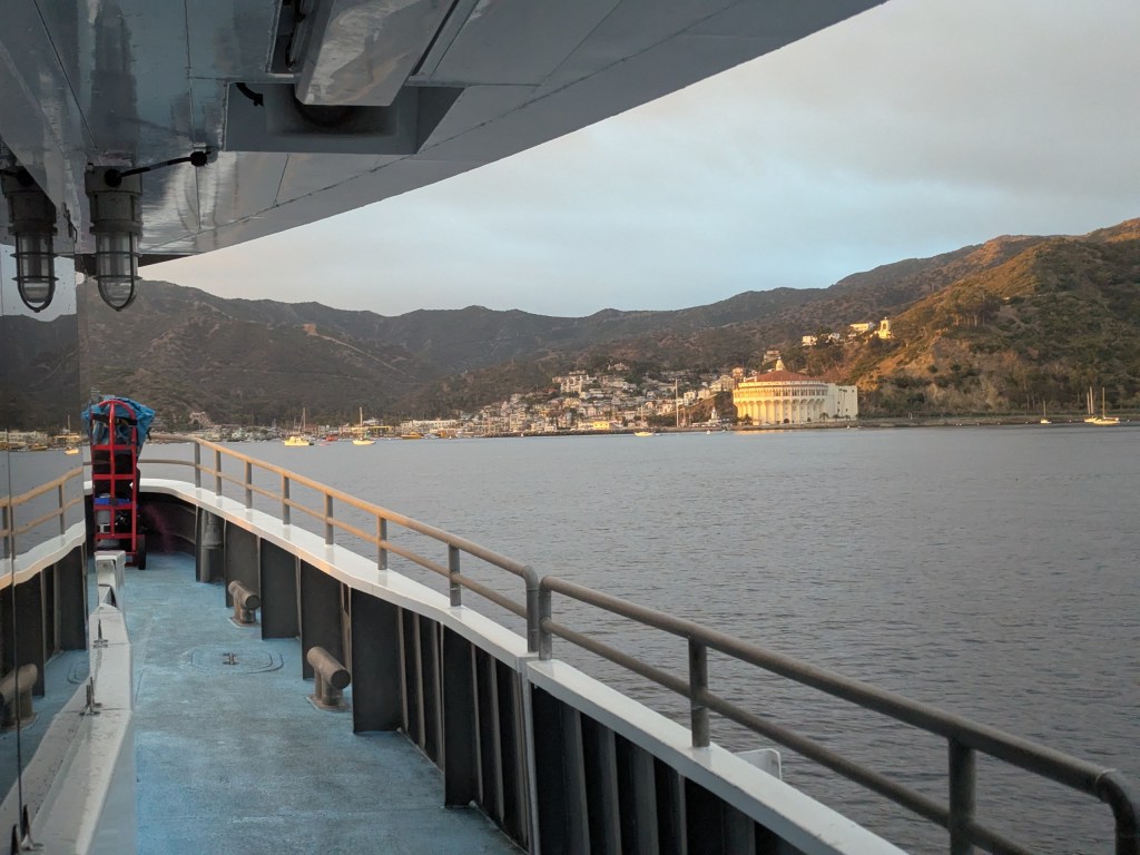
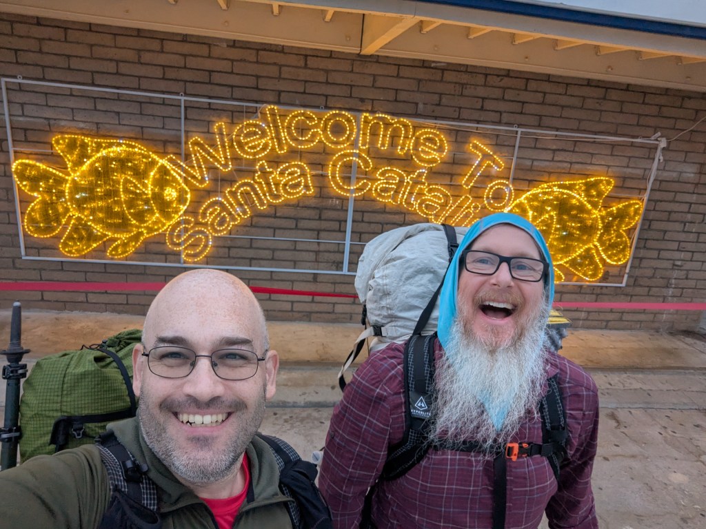
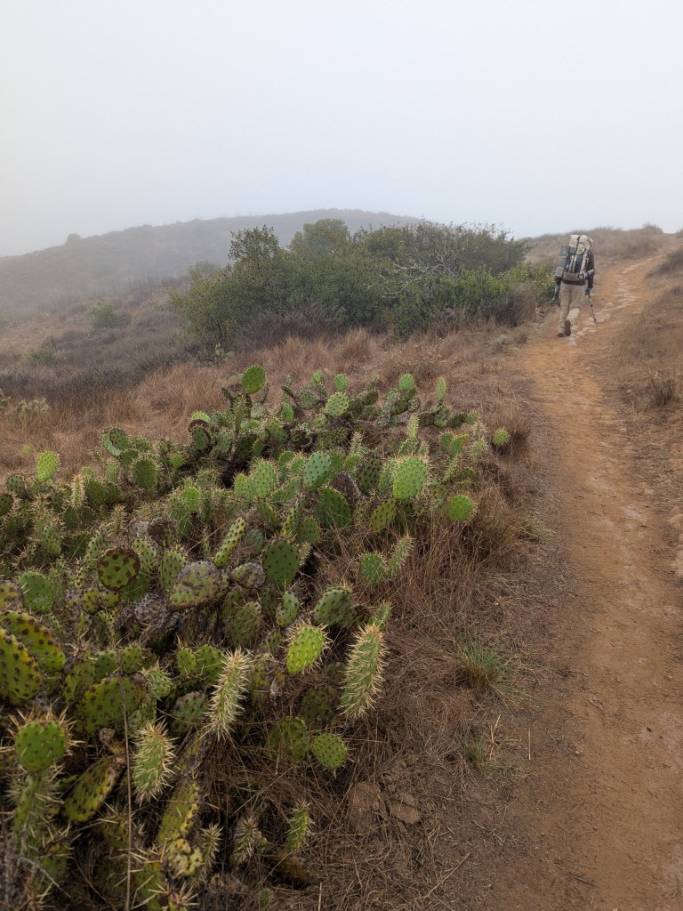
Day 1 had us grabbing the 6am ferry from Long Beach to Catalina Island and hiking from Avalon to Little Harbor campground. Steve and I toured Avalon a little bit; killing time until 8am when we could grab fuel at Chet’s Hardware. Once we had fuel, we began the ascent up from town on the ridgeline. Catalina Island’s trail was quite different from the mid-Atlantic trails I’m used to in that there were pervasive cactuses, wide open areas with virtually no tree cover, and lots more dirt than rocks on the trail.
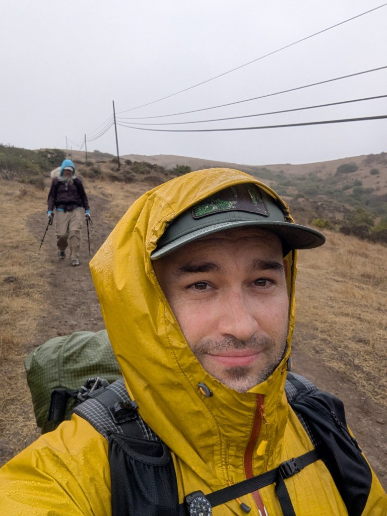
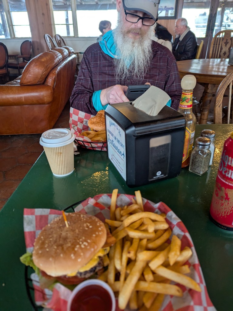
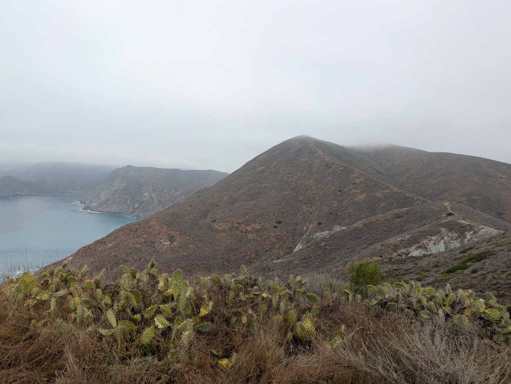
Unfortunately, not long after we were out of town, Steve and I found that we were pretty socked in without much line of sight. Although the weather forecast called for virtually no precipitation, we hiked for hours through persistent mist that slowly dampened our clothes. I decided to throw on my rain jacket to shield myself from the occasional gust. As Steve and I hiked, the trail’s loose dirt accumulated as heavy mud on the bottom of our trail runners making me feel like I was wearing clogs. Around 12 miles into the trek Steve and I arrived at Catalina Island’s “Airport in the Sky Restaurant” where we warmed up while enjoying cheeseburgers and fries. Reenergized, Steve and I finished the remaining miles towards our campsite. As we got a few miles out, the clouds started to thin and we began to be able to see the island’s beauty much better. Eventually we descended down to our campsite, the Shark Harbor section of Little Harbor campground. Shark Harbor was an incredible beach-side camping spot that I hope to visit again some day. As fair warning to future TCT hikers, although I had nothing but positive experiences there, Steve and another adjacent camper encountered some pesky flies.


Day 2 – Little Harbor (~12 miles, 3533 ft ascent, 3510 descent)
Day 2 we didn’t have many miles to go and took a more leisurely pace getting from campground to campground. As Steve and I left our campsite and began to gain some elevation we had a much more clear day and could see significantly farther. It was a delight to hike on the ridgeline and to be able to see the ocean in either direction. In the far distance we could even see the peaks of some of the California mainland.
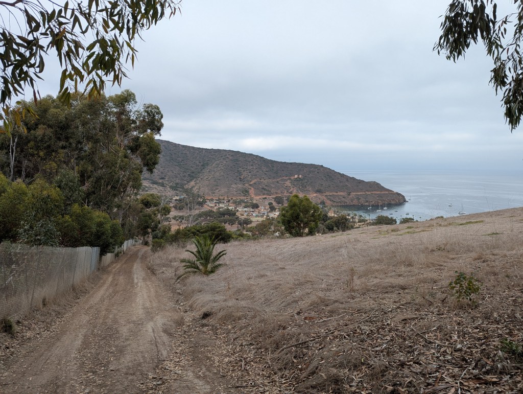
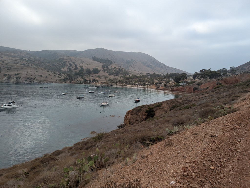
We arrived at the small town of Two Harbors mid-morning. There we checked in at the visitor center to get the code to the locker at the night’s campground (with water and firewood). Unfortunately, because it was the off season, the restaurant at Two Harbors was closed and the only option was the General Store. The general store’s prices were understandably pretty high so Steve and I grabbed only a few treats before hitting the trail again. We’d be back at Two Harbors the next morning to grab the ferry back to the mainland.
Although I’d seen piles of scatological evidence of bison on the trail the day before, we finally began to see some of the animals themselves on our second day. The bison are not native to the island but are one of the iconic animals so I was glad we could spot some. Steve pointed out that with how little we could see on day 1, we might have passed some and not known it.
I had heard that the Trans-Catalina Trail had some serious elevation change. The ascent out of Two Harbors was a prolonged upward march of about 1,700 ft gained in 2.5 miles. Once at the top we went down some of the steepest terrain I’ve encountered, losing around 1,100 ft in just over a mile.
The day’s hike ended with another beach-side campsite. This time, our campsite faced North in the direction of the mainland. We retrieved some water and firewood from the locker at the entryway to the campsite. Steve and I both enjoyed the sights and sounds of the beach as we made our dinners. We could see a fishing boat (“Gail force”) anchor nearby, attracting hopeful birds. Following a colorful sunset, the darkness revealed city lights on the mainland across the water. Steve and I lucked out again to have picked a great campsite, but be aware it sounded like site 7 was exposed to the sea water at high tide (those hikers’ tent were camped somewhere completely different when I went to bed vs. when I woke up).


Day 3 – Parson Landing back to Two Harbors (~8 miles, 869 ft ascent, 915 ft descent)
Day 3 Steve and I needed to make the hike back to Two Harbors where we’d catch the 11:45am shuttle to San Pedro. We got up early and began hiking to make sure we got to town with plenty of time. Day 3 had good weather and easy hiking without a lot of miles. In between Steve and I talking about his upcoming adventures, we took in the views of pod after pod of dolphins swimming in the water below.
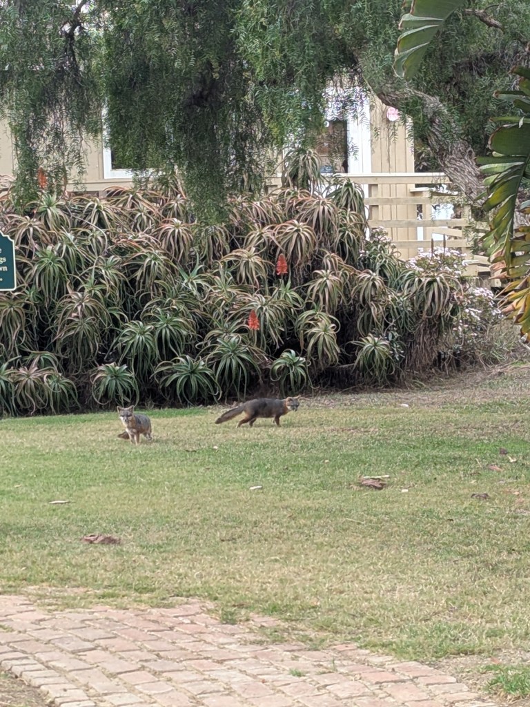
We were back in Two Harbors waiting for the ferry when I spotted some of the Catalina Island foxes, a diminutive breed of fox native to the island. It was a great way to finish up the backpacking trip.


Leave a comment