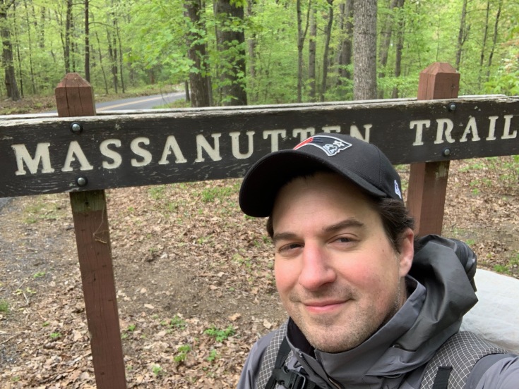
: A COVID-19 Era Hike of the Massanutten Trail")
by Evan McCarthy
March came and went. April came and went. No backpacking. Not so much as a quick overnight adventure in Shenandoah National Park, let alone DC UL Backpacking’s annual rite of spring group hike of the 70+ mile Massanutten trail. I hunkered down with the rest of humanity. I worked from home. I wore my mask out to my once every two-week trip to the grocery store. I went for a few walks and upped my running game slightly. By May, however, as the United States discussed a gradual reopening plan, I began to plot a solo return to the woods. My mind immediately went to the wild wonders of Pennsylvania. But prudence called for something in Virginia that I could safely reach and return on one tank of gas. That pretty much left me with the Massanutten trail – and within days of the ten-year anniversary of its very first DC UL thru hike. Though this trip would not be an official DC UL Backpacking event, I’m sharing it here so that you can follow along too. I couldn’t be more excited about the prospect of getting back on the trail with the team. This hobby lends itself well to social distancing.
Heading into the weekend, I prepped my clothing with tick-fighting Permethrin, reacquainted with my gear setup in front of my apartment building, and prepared for some unseasonably cool May weather. In fact, with night time lows in the 20s and highs fluctuating between the 40s and 60s, it was as if the weather gods were transporting me back to March. Better yet, the full green of spring would already be here (yay leaves) but without the heat that typically threatens in mid-May. For new toys, I finally invested in a Garmin GPS to act as emergency device, tracking mechanism, and communication system with family. Also, at the last minute, I tossed a 15 oz. REI camp chair in my pack thanks to a little extra space/weight.
I finished work on Friday and drove through torrential rain to park in a forest road turnoff buried in the woods near Edinburgh Gap. My plan was a counter-clockwise hike, which would be only my second time in that direction (and the first was a grueling, 48-hour version of the trip Max, Mark, and I pulled off in 2012). There, I met up with an imaginary hiking friend, who all the same kept his appropriate 6 ft or more of social distance. I figured this imaginary friend should be fit and faster than me to help keep my pace up, able to drink and contribute libations to the cause, and, oh, should have a cool backstory like the son of a tugboat captain from Boston who also works at the State Department so he can talk some shop too. For the heck of it, we’ll call him “Kyle” in honor of my middle name. And so we set off up the ridge for a few miles, the rain stopping as we started to ascend and the clouds providing some misty twilight backdrop. We camped at a lovely little fire ring that had two convenient tarp spots for us. “Kyle” shared a few beers from his car that we enjoyed in the dark as the temperature plummeted. It felt great to be in the woods again. The trials of the real world began to fade away.
Though the Massanutten trail is often devoid of other backpackers, it does have its share of mixed-use outdoorspeople. We encountered our first at 3:30 a.m. when the sound of footsteps woke me to an ultramarathoner rolling through. Later in the morning, I passed two shotgun-toting hunters on the lookout for turkeys and several badass mountain bikers cruising over rocks I would have thought impossible for tires. I carefully slipped my mask on in advance and waited off trail in the woods more than six feet away as they passed. Seemed safe and sound, shotguns notwithstanding. I also saw plenty of sign of horses on the trail but never had the pleasure of running into one.
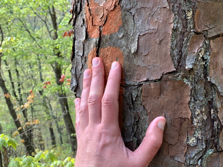
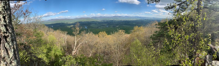
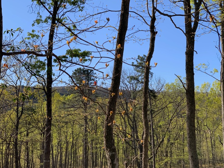
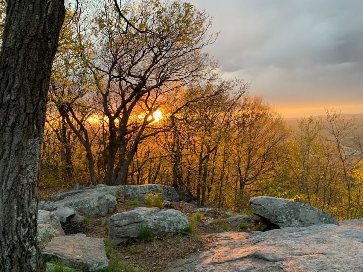
The morning ridge walk was divine even in the chilly breeze. With the leaves out, I enjoyed identifying the different species with an awareness I lacked over my previous outings. Mighty chestnut oaks and Table Mountain pines dominated the rocky and exposed ridge areas. A variety of mature oak, maple, birch, and ash filling out the forests at lower and moister zones – but with some tulip poplars, sassafras, and mulberry fighting their way into the understory too. “Kyle” raced forward on the trail, leaving me to my own adventure. I enjoyed the day, particularly intrigued by the new route through a recently logged area that was resplendent with colorful birds. I tried to figure out the loggers’ methodology of which trees were chosen to be spared. Overall, I was impressed with their work.
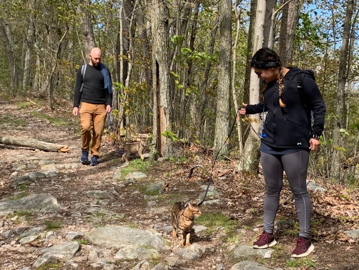
Going down (not up) steep Waterfall mountain was a treat as well. I was surprised by the number of hikers congregating around the turnoff for Strickler Knob but kept my distance, received a “Go Pats!” from a fellow hiker, and went about my hike in the solitude of the rest of the trail. Duncan Hollow was pleasant as always and a crowd again appeared near Kennedy Peak, where hordes of cars were parked in Edith Gap for a popular two-mile hike to the top. I put my mask on and stepped safely off trail a good dozen times to keep the order of the day, though I couldn’t help interacting briefly (from a safe distance) with a couple out hiking their cats.
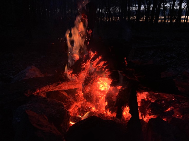
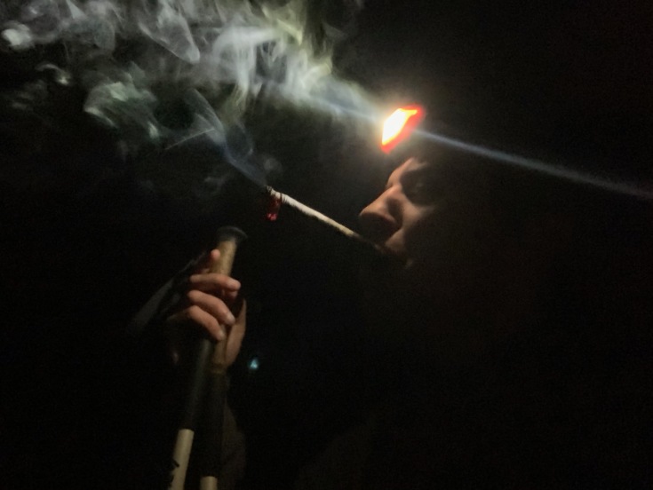
At about 24 miles for the day, I was greeted by a perfect little campsite right before the Stephens Trail intersection. “Kyle” had a fire going already. We enjoyed whiskey and cigars, as well as the pleasure of watching decaying wood burn slowly. I showed off my little camping chair. It was the first time I had ever brought it on a trip. Pack space permitting, I may do so again. I cowboy-camped underneath a clear, starry sky.
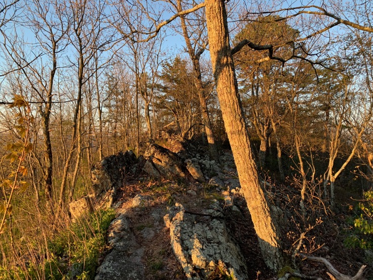
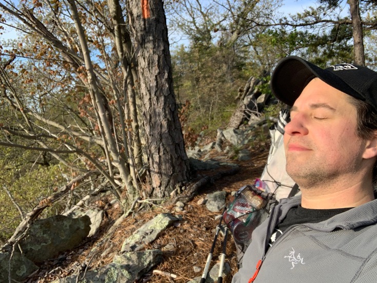
Sunday morning brought warmer weather and near constant sun, though still at temps usually consistent with early April. “Kyle” took off across the valley to hike back to his car, and arranged with me to leave a couple beers stashed near the Signal Knob parking lot. I carried on and enjoyed the rocky outcroppings and pines of the eastern ridge thoroughly (my favorite part of the trail).
Once I descended into Veach Gap to get some water near the shelter’s spring, I crossed paths with another Massanutten thru-hiker who was on his fourth and final day, ending at Signal Knob parking. We kept our distance but enjoyed chatting with each other over his final miles. He’s a local DMV guy with lots of long trails under his belt. Who knows, maybe he’ll join DC UL? Though decidedly feeling odd to simply roll through the parking lot I had begun and ended my seven other Massanutten hikes, I shrugged and kept on going – including actually using the trail connector in the woods behind the parking area. My newfound trail buddy finished his hike and I discovered my hidden “Kyle” beers.
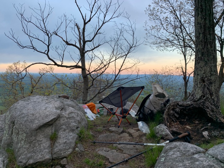
At first, I encountered a few hikers coming down the final stretch from Signal Knob and was concerned about potential crowding. I had timed it right for my evening ascent, however, and had the trail to myself after a mile. Once at the top, I set my little chair up, made dinner, watched sunset, and enjoyed my beers. Life was pretty good. But my mind wandered to a somewhat lengthy final day and I got the urge to keep on going in the dark. Since the next few miles were forest road, I didn’t have to worry much about stumbling on rocks or losing the trail. I certainly didn’t need to worry about a camping spot bigger than all I needed for my tarp. I even pulled out a cigar to enhance the evening stroll. After about 28 miles for the day, I set up camp in the woods in Mudhole Gap, right before the trail ascended back up the western ridge. It rained some in the night but let up by 5:00 a.m., when I jumped up and hit the trail again.
The western ridge, bereft of many viewpoints and typically raced or slogged through on a clockwise hike, proved more pleasant than in trips past. The temp was cool and breezy, with enough sun around to take the edge off a cloudy day. I enjoyed the trees and miles without too much rush thanks to my evening head start to this section. I savored coming down Waonaze Peak, which presented a thick mountain laurel forest slightly different than elsewhere in the Massanuttens, and great views of the valley to the east and south. I even scared off three tremendously large turkeys that could fly remarkably better than I would have thought possible.
Just like that, my 70-mile trip was over. The final stretch was an uneventful return to the forest road in Edinburgh Gap – not quite as epic as the usual descent down Signal Knob. But for COVID-19 May 2020, it would certainly do. My wife enjoyed following along with my trek from the safety of home thanks to my new Garmin toy. I think it’s a keeper. If day hikers and bikers can hit the woods, backpackers should certainly be a part of the mix too. It’s not hard to distance and is arguably safer overall since we’re equipped with gear for most possibilities. My verdict is that I look forward to more conscientious trips mindful of recommended distancing norms. DC UL Backpacking is considering its first trip soon and has taken measures into account to allow for a safe approach forward, which includes not using carpooling or car shuttles so that folks can keep the appropriate distance en route, as well as in the woods.

Love the sound of this trek. Sounds like an awesome challenge! Greetings from London.
LikeLike